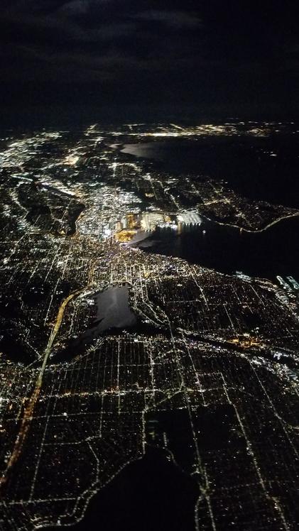
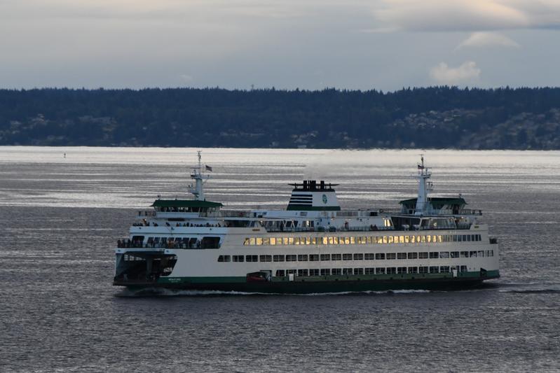
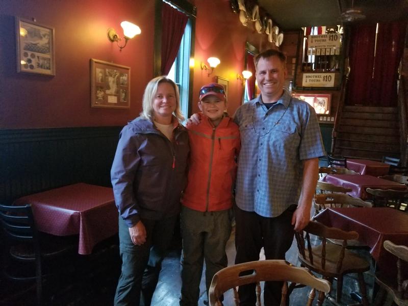
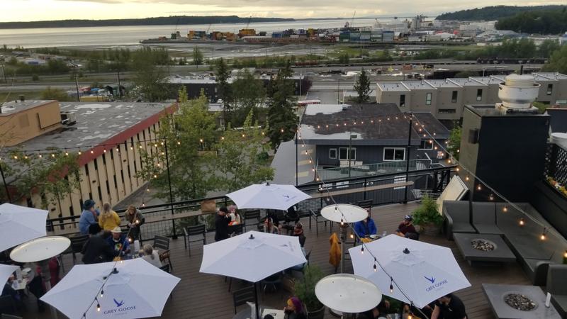
Seattle at night!
|
ALCAN and Alaska Tour - July 14 - August 12, 2022 [Join AlpineHippo facebook group to share your hikes! ] |
|
Quick Links: Seattle prepare and GO! Drive Seattle to Dawson Creek ALCAN Drive - Dawson Creek to Whitehorse Skagway Glacier Air Tour ALCAN Drive - Whitehorse to Fairbanks Fairbanks Denali Denali Backpack Talkeetna and Anchorage |
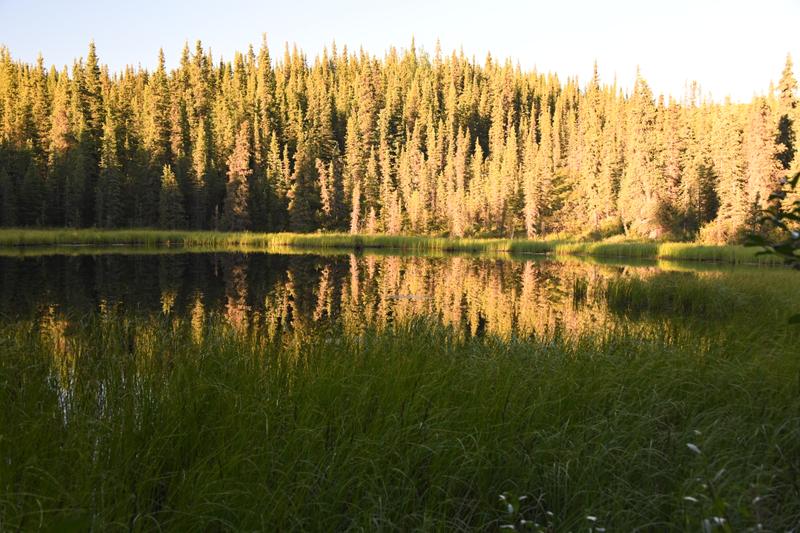
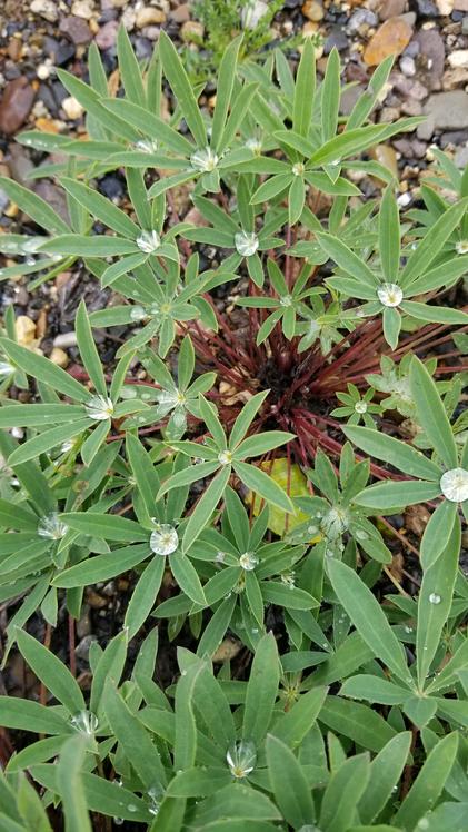
Hiking Log: Ancient Trees and Viking Ridge, Prince George, BC - 6 miles (3,000 ft) Miles Canyon, Whitehorse, YT - 2 miles (200 ft) Bryant Lake, Fraser, BC - 2 miles (300 ft) Chilkoot Pass, Skagway, AK - 6.3 miles (500 ft) Eagle Trail Overlook and Nature Trail, Tok, AK - 3.7 miles (850 ft) Castner Glacier Ice Cave, Delta Range, AK - 3.3 miles (250 ft) Angel Rocks, Fairbanks, AK - 4 miles (900 ft) Panchromatic Pass and Mountain, Denali National Park - 5 miles (900 ft) Miri Glacier Backpack, Denali National Park - 24 miles (3,100 ft) Horseshoe Lake, Denali National Park - 4 miles (700 ft) Total: 60.3 miles (96.5 km) (10,700 ft) |
|
Gas bill so far: $1,916.23 from Bothell, WA to Anchorage, AK with 2,746.4 miles total for the RV. |
|
|
|
Day -1 (July 14, 2020) I woke up early because I had just arrived the night before from France. We went to the orthodontist, since there would not be another chance for 5 weeks! We finished packing and jumped on the plane. |
|
Seattle at night! |
|
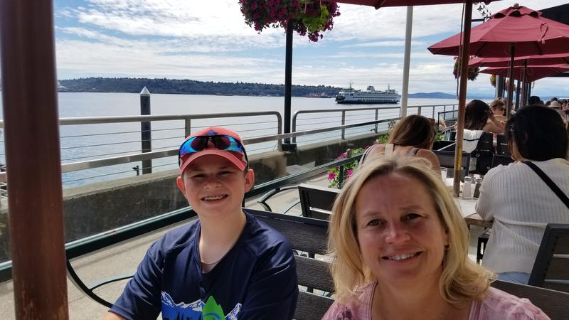
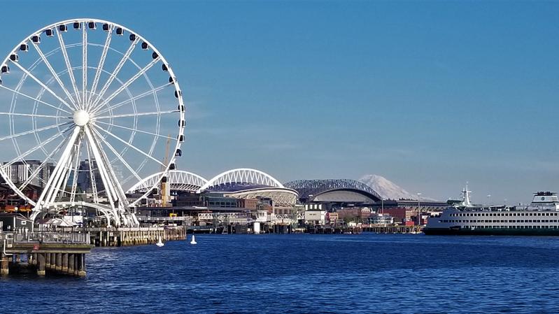
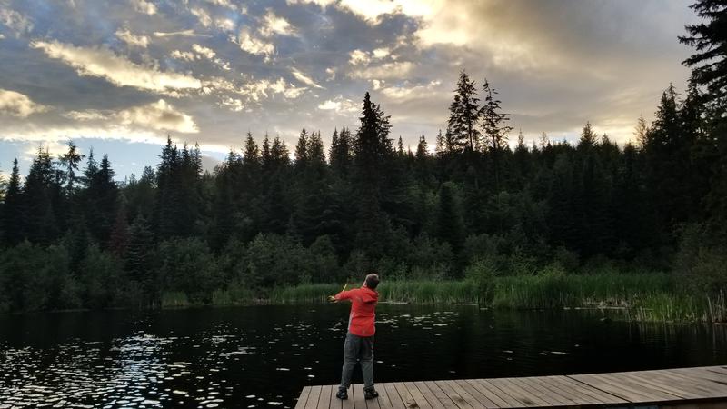
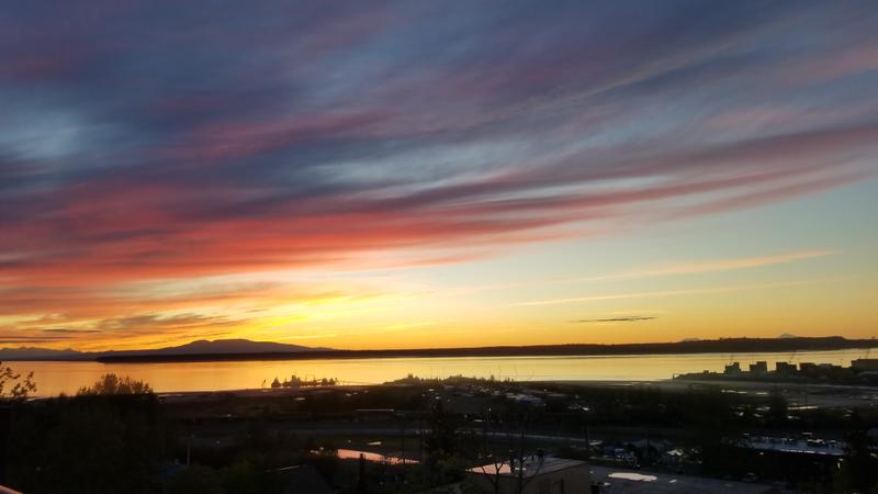
Day 0 (July 15, 2022) We had an awesome day in Seattle! We started with some RV organization and prep fueled by Starbucks. Then, headed off to Ballard to see the locks. Since I was still on some other time zone, we grabbed some Dick's burgers on the way and enjoyed them while watching the boats. There were seals chasing salmon in the large lock. Last fall, we donated to help renovate the fish ladder viewing room, which had been improved with better acoustics and lighting. A metal salmon with 'Save Wild Salmon - Hair Family' hung on the wall. We had a quick stop at Fremont brewery, then headed in to downtown. We had lunch at Elliot's where I had some scallops and clam chowder. Next, we went to the top of the Space Needle! It was a beautiful day, and the view was amazing! It was my first time up, and my first time up in a tower in a city. The glass floor was really cool. We headed back downtown, walked for a bit, and had dinner at Cutter's Crabhouse. Papa had a smoked cocktail and seared and smoked king salmon. Sunset was beautiful! |
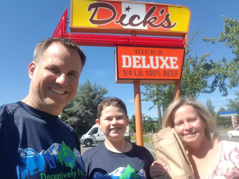 A bag of Dick's burgers. |
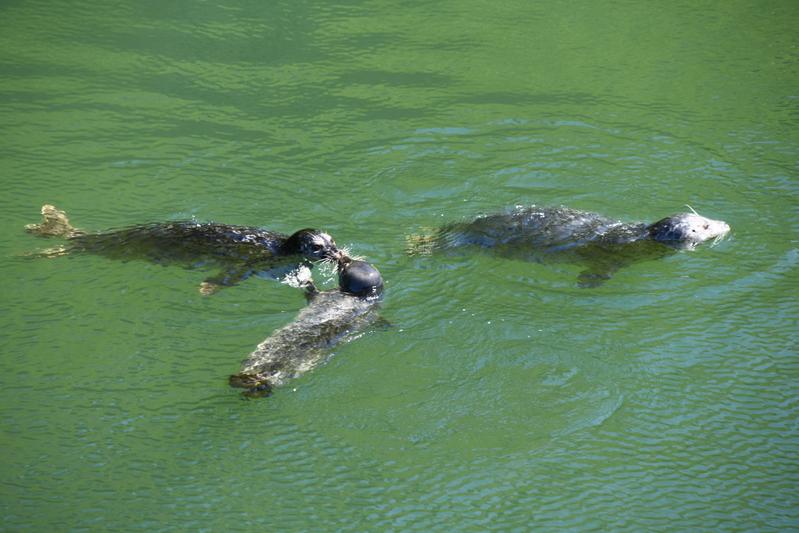 Seals, mama and babies, hunting for salmon. |
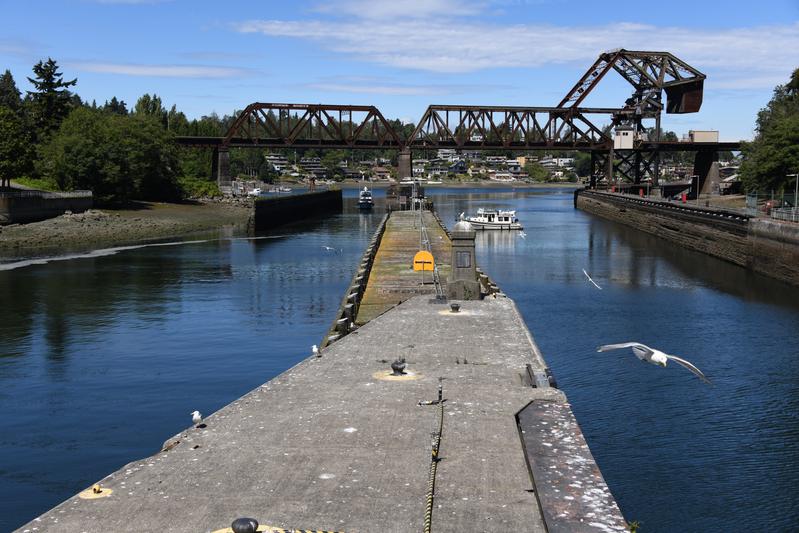 End of the locks. |
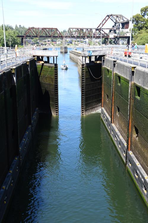 Sailboat made its way through. |
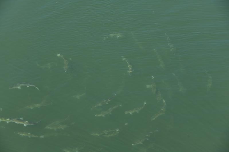 Salmon ready for the ladder. |
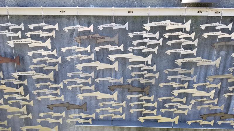 The fish wall above the fish ladder. |
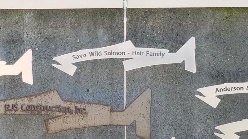 Our fish. |
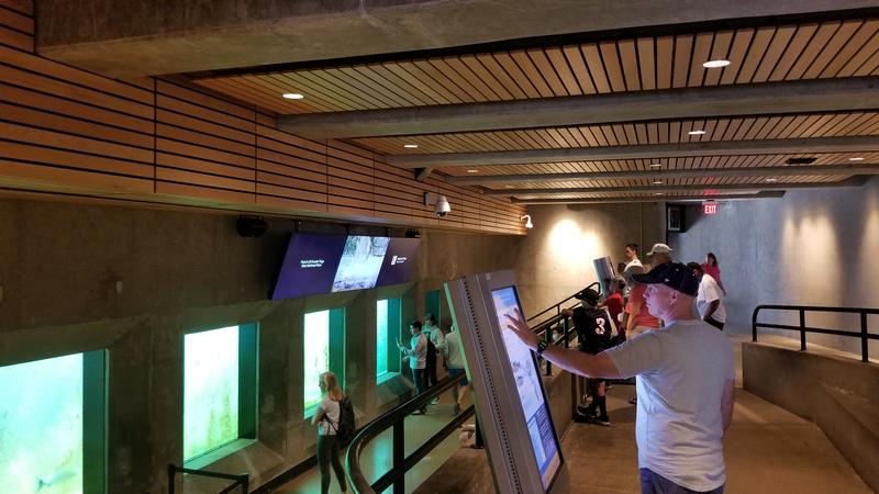 Viewing area with new ceiling and lights. |
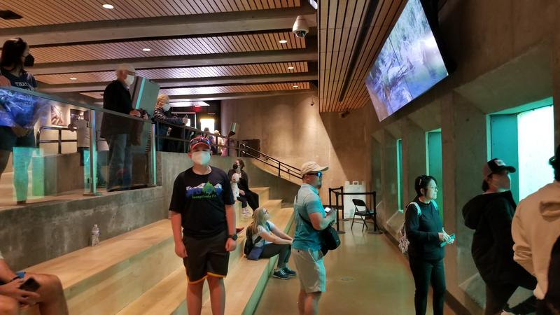 New benches, floor, and leak-free walls. |
 Lunch at Elliots. The chowder is still the best. |
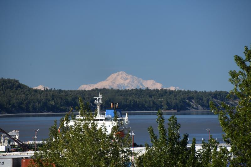
 Ferry coming in to the terminal with Mt. Rainier watching in the background. |
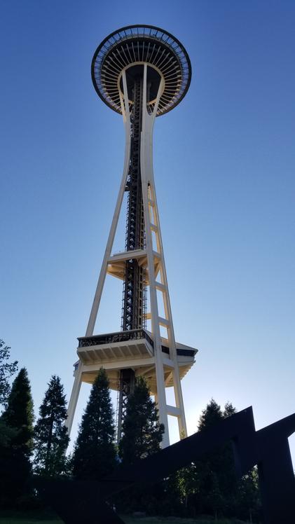 Space Needle. |
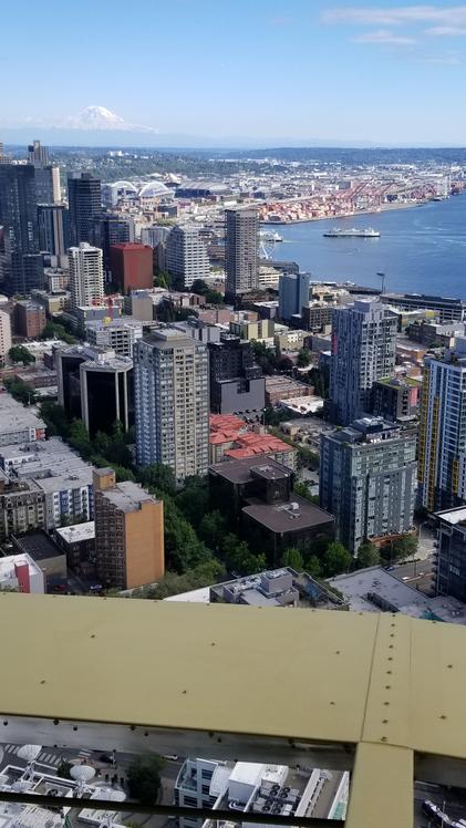 First view from the Space Needle observation deck. |
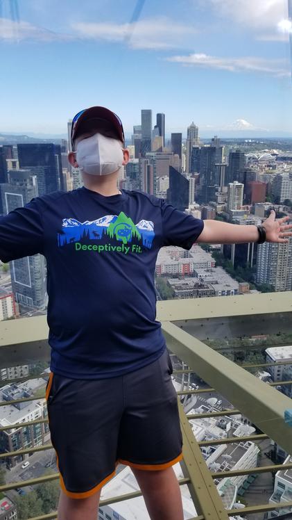 Trying not to fall. |
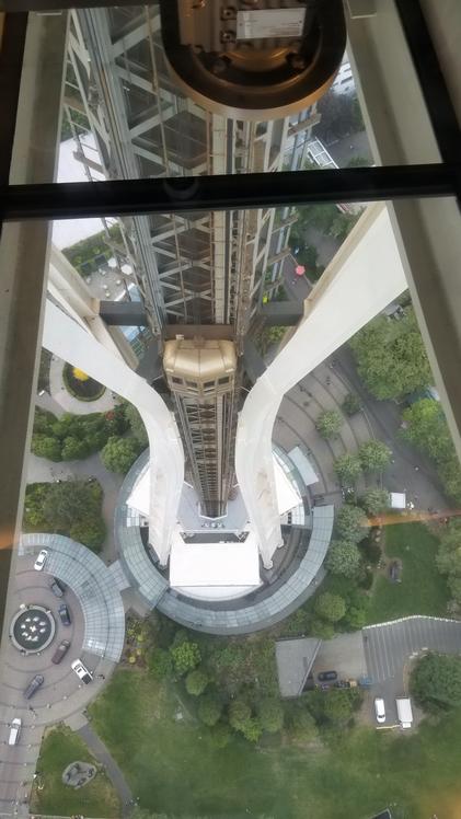 Glass floor in the original restaurant deck. |
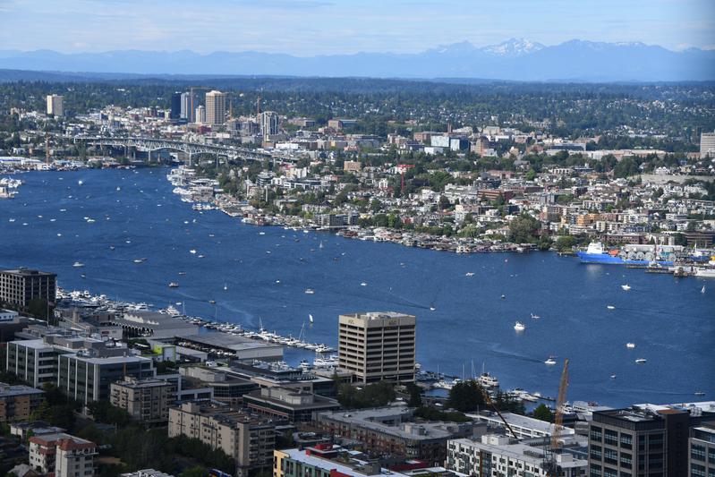 Union Bay. |
 Elliot Bay, upper Puget Sound, and the Olympic Mountains. |
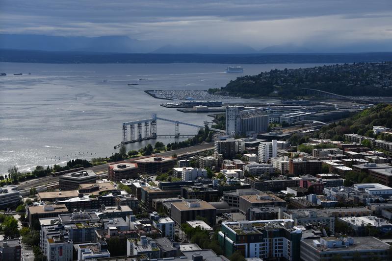
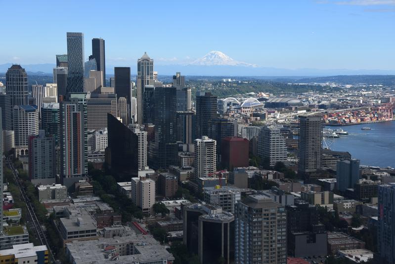 Downtown with the ferries and Mt. Rainier. |
 Close view of downtown and the mountain. |
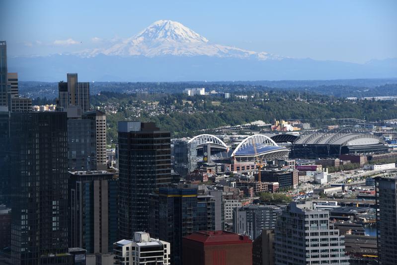
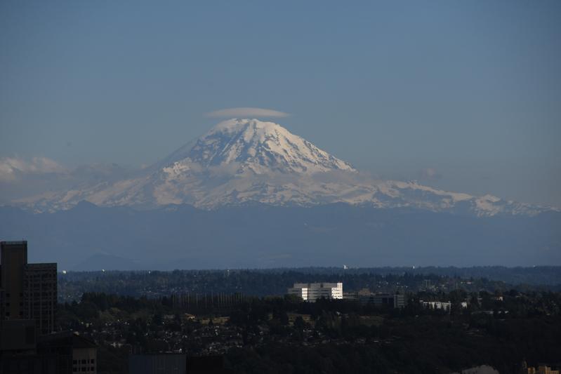 Lenticular cloud over Mt. Rainier. |
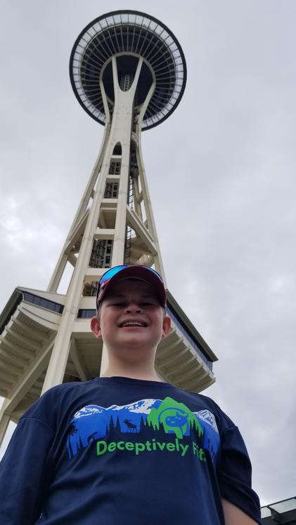 The space needle is so cool! |
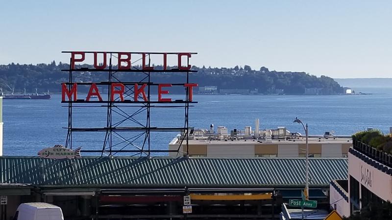 Pikes Place Market. |
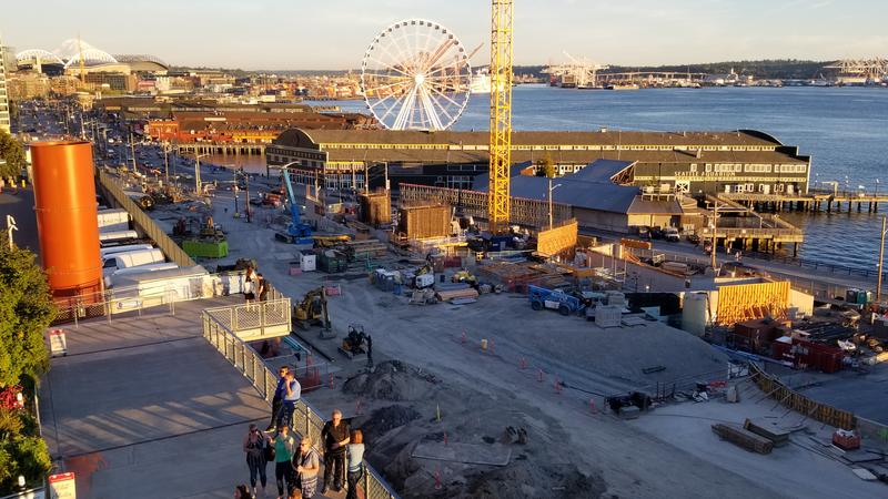 View of the waterfront without the viaduct. |
 Ferry in the low sun. |
|
Day 1 (July 16, 2022) First offical day of the road trip! We finished preping the RV and buying supplies. We drove to Bellingham to get a jump start on the drive across the boarder. We had a simple evening, eating at a greek restaurant, and made ready for the long trip. |
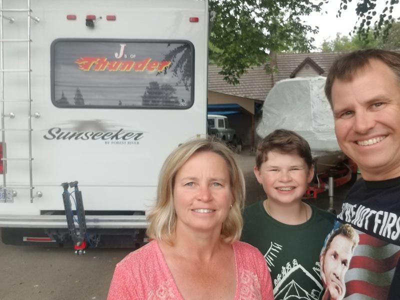 RV ready to go at the Story's. Jake, Stacy, Allannah, and Josh were very nice to allow us to stay at their house to help get started with the trip! |
|
|
|
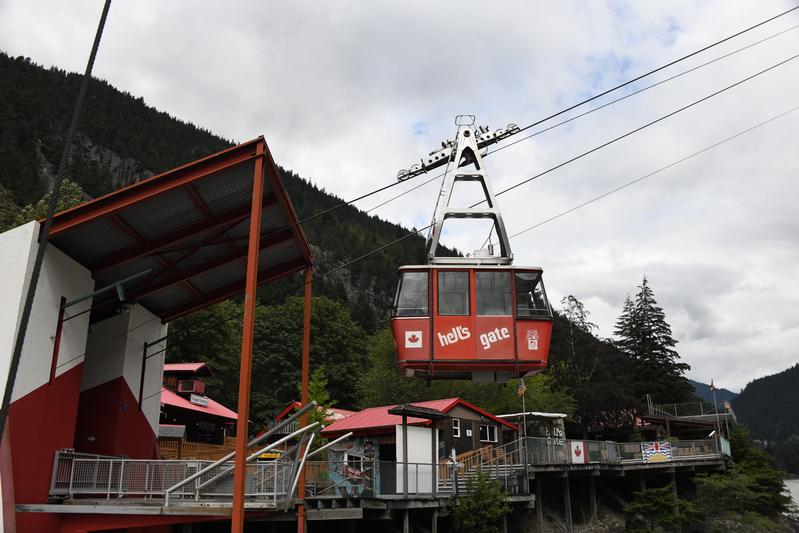
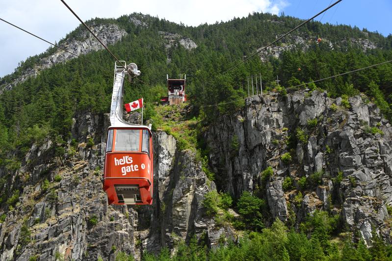
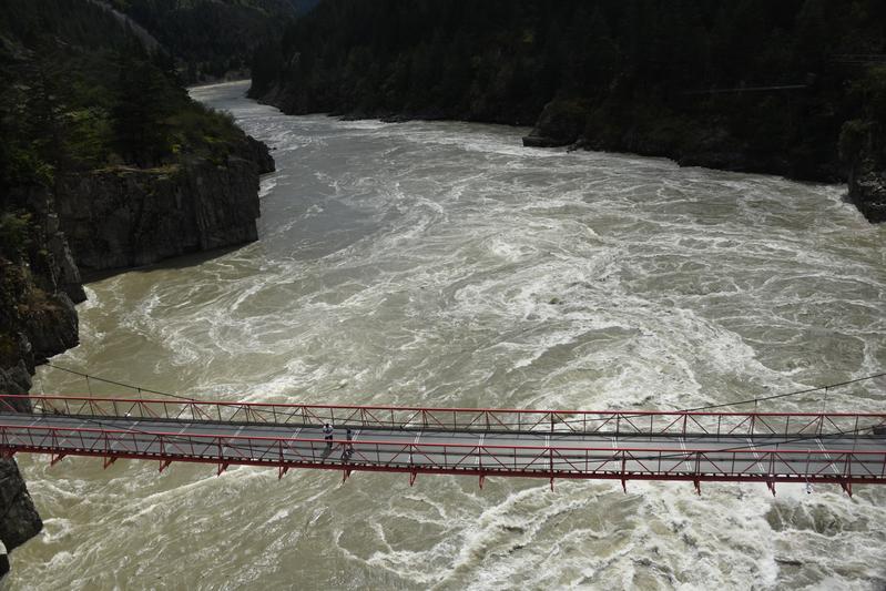
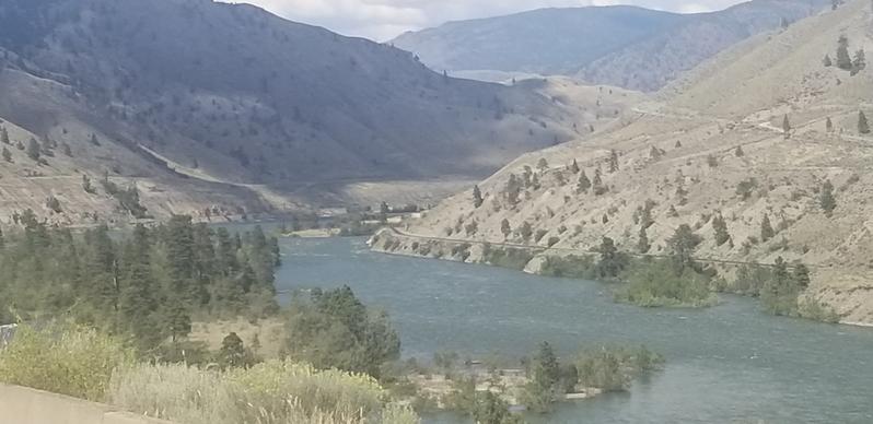
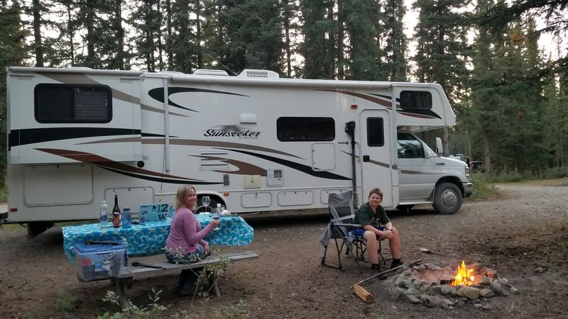
Day 2 (July 17, 2022) It was time to leave Bellingham and head north in to British Columbia, Canada. Papa and Juju woke up early as I slept untill we headed out. We heard of some delays and inspections happening at the boarder, so we were a little worried. All of the motorhomes and large vehicles ahead of us were pulled asside for inspection. However, we went through easily and only had to throw out our eggs. We crossed the border and got into Canada! It was about another 2 hour drive to Hell's Gate, which is a narrow canyon on the Fraser river. On the drive there we started to watch Tallegadea Nights, because, if you're not first, you're last! Once we got to Hell's Gate we took a cool cable car down to the bottom. We learned that it is called Hell's Gate because the first people said that when they first tried to go through it. Around 200 million gallons of water pass through every minute, which is more than twice the Niagra Falls volume. Once at the bottom, we went on a suspension bridge to watch the rushing water swirl. The water flowed up the eddys amost as fast as going down the river. For lunch, I had some Poutine while Papa and Juju got salmon burgers. We watched a short movie on how the sockeye salmon go up the river to start the lifecycle again. We panned gold from river dredging and for we found some real gold just like the gold rush miners in 1858! We slowly headed back up to the top. We got back on the road and started heading to our campsite, near Lac La Hache. We passed through a desert climate, back in to a alpine meadow environment. I slept for a couple hours on the road. We stopped at a roadside attraction called Cariboo Sam. When we arrived at our campsite, we set up and had a little cheese snack. There was a refreshing pool, where we played around with a toy football. Once it got wet, it gained 10 pounds and turned into a rock. When we got to the RV we started to cook some Halibut and we we steamed some Dungenous crab. As the Halibut cooked we ate the crab. It was super rich in flavor and really good. The Halibut was really moist and tasted amazing. After that, I chopped some wood and started a fire. The store in the campground had some marshmellows, so we got to roast some. There were good with the Snoqualamie Ice Cream we bought near Seattle. We were about 360 miles from The Story's in Bothell, WA. |
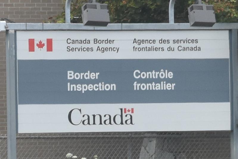 At the Canadian boarder. |
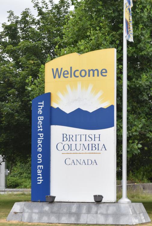 They let us in! Welcome to B.C.! |
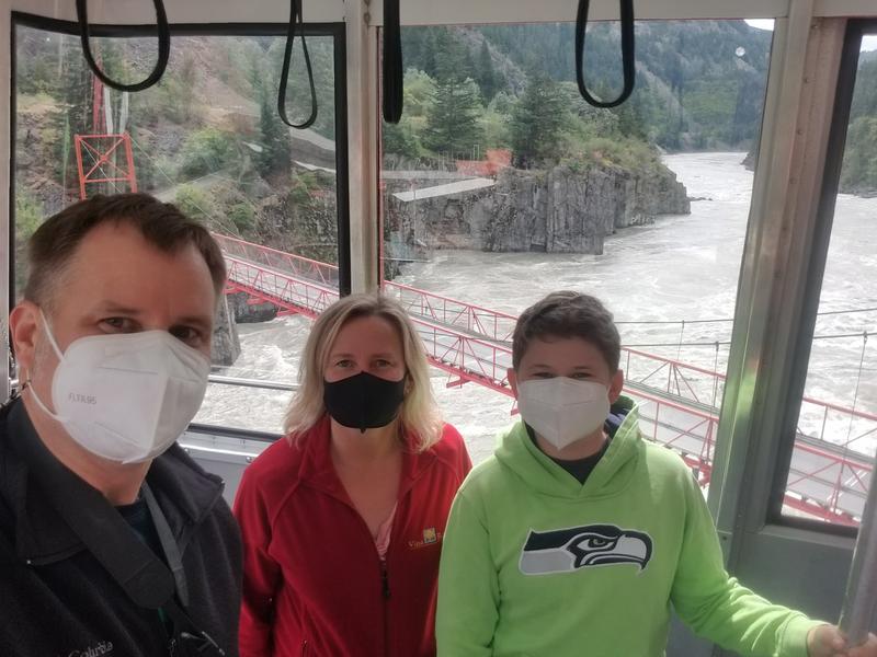 Riding down in to the Hells Gate canyon on a cable car. |
 So scary! |
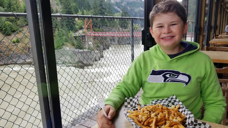 Can't go to Canada without some poutine! |
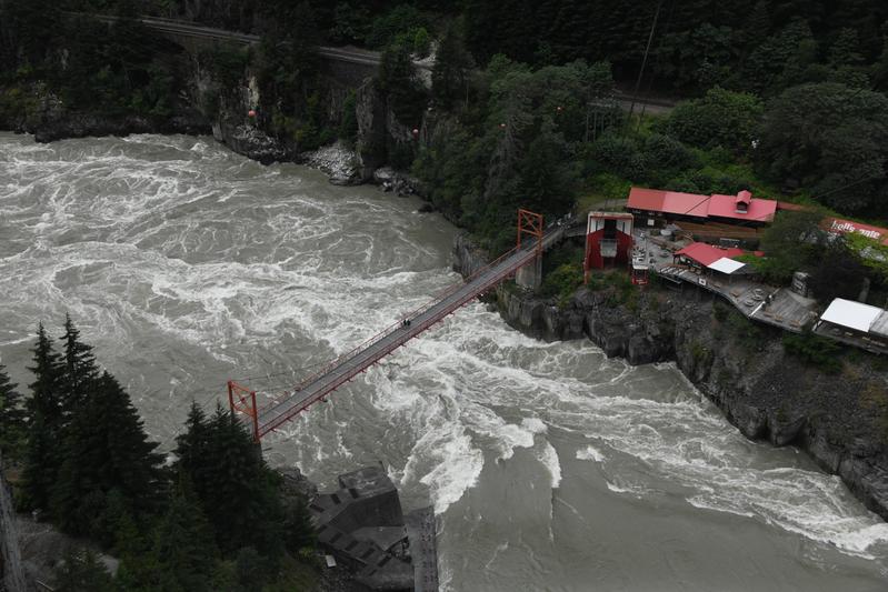 Hells Gate of the Fraser River from above. More than twice the amount of water as Niagra falls goes through here. The water was at a high level of 174 feet deep! |
 Little lodge at the bottom. |
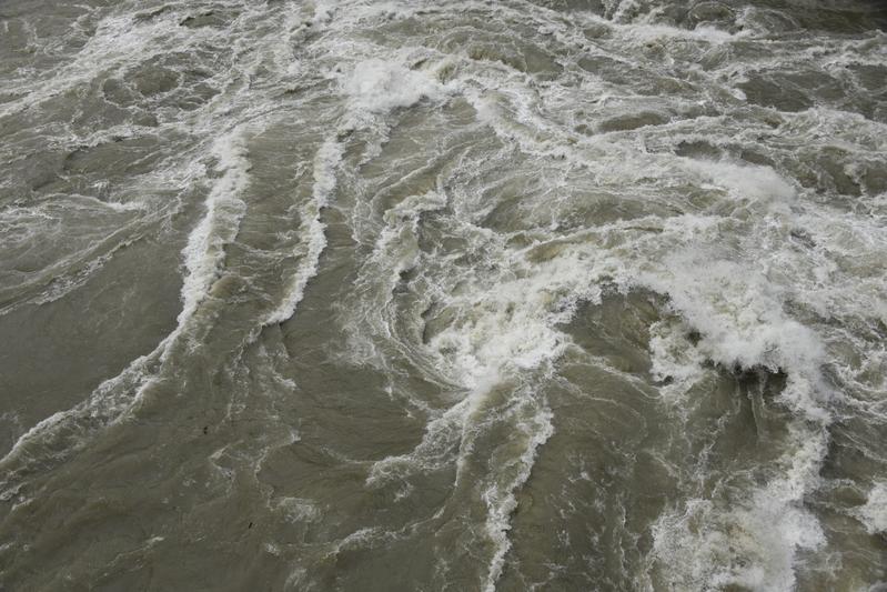 Water was swirling in to whirlpools. |
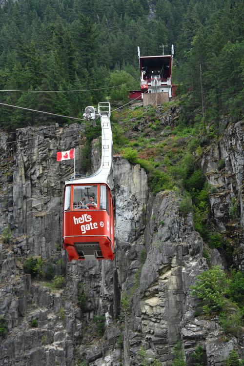 Cable car dropped 577 ft. |
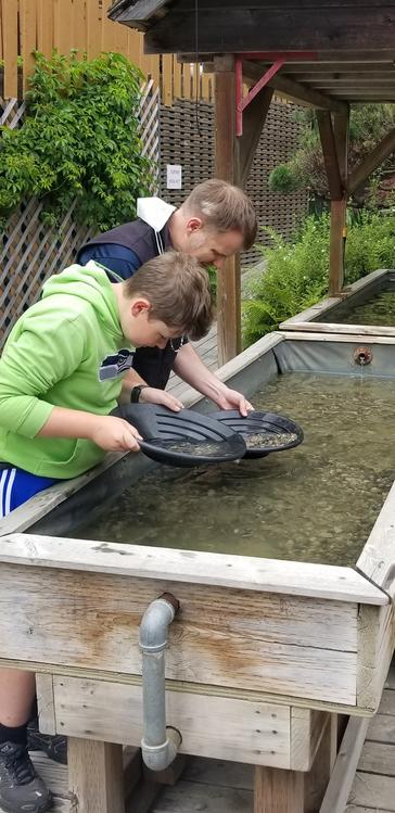 Panning for gold! |
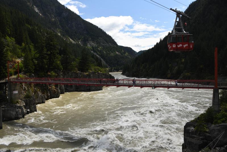 Suspension bridge over the torrent. |
 Sun came out for a bit. |
 |
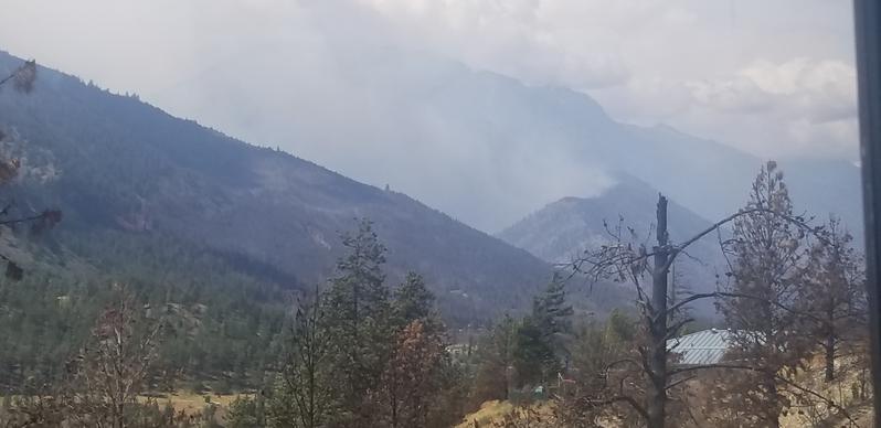 There was a large forest fire farther up the road. |
 As climbed further in to the cascade mountains, we were in a desert climate. |
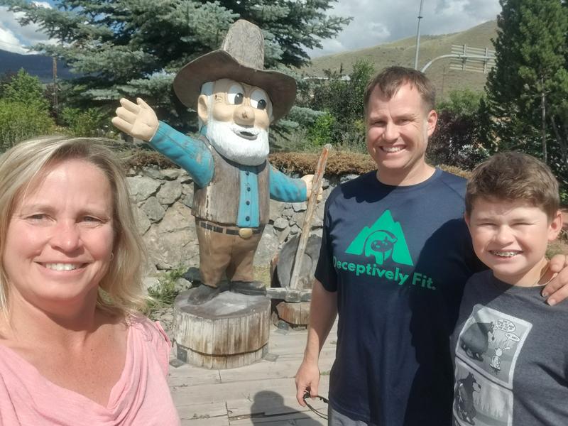 Cariboo Sam showing us the way! |
 We crossed in to lush mountain meadow climate. |
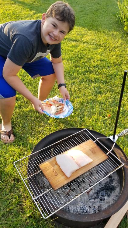 We got to do some real camping! Cedar planked Halibut and Dungenous crab! |
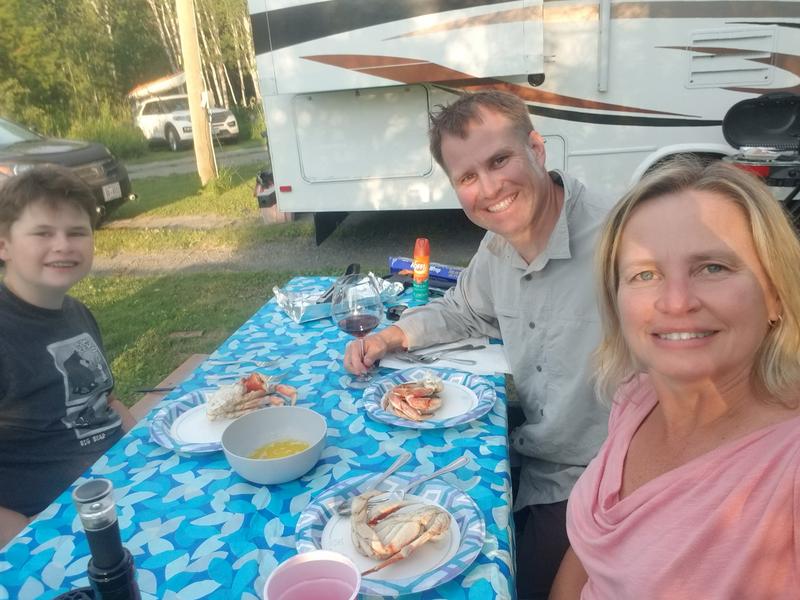 First camping meal. |
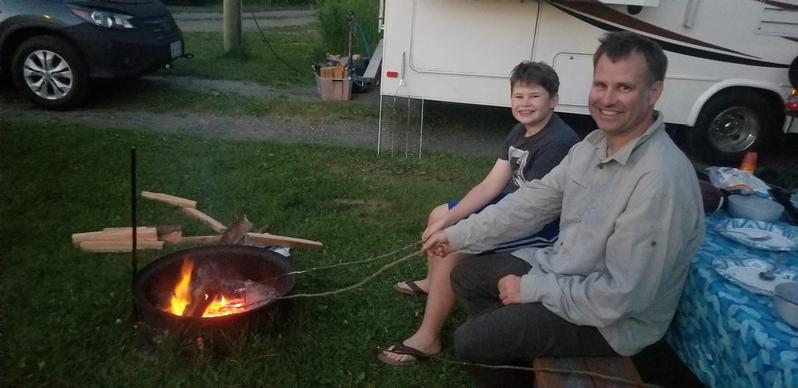 Since this might be one of our only fires due to the fire danger, we roasted some marshmellows. |
|
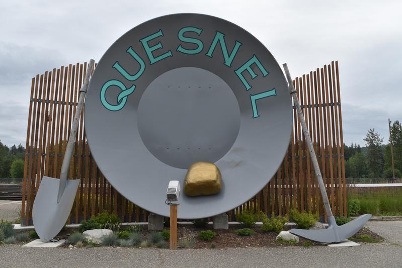
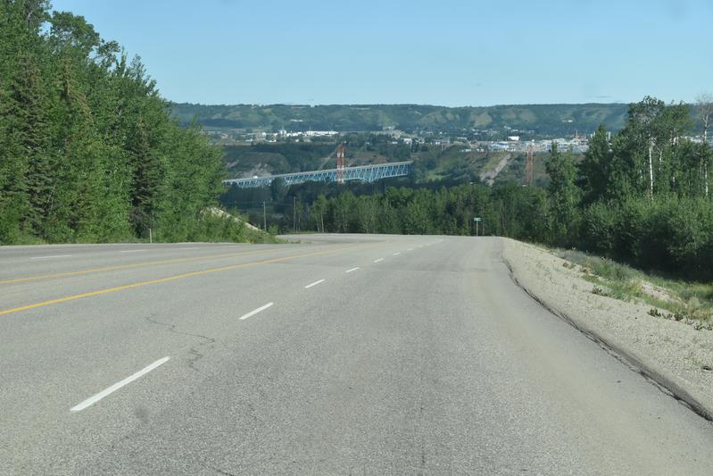
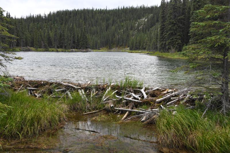
Day 3 (July 18, 2022) We drove from Lac La Hache area to Prince George, taking us 560 miles from the start. We grabbed some pastries for the road. In town, we found a fishing supply store and got some local advice on lures and places to fish nearby. We went up to Ferguson Lake to try our luck before dinner. We were swarmed by mosquitoes as soon as we opened the car door and it was raining lightly, but that did not slow us down. I had a few good nibbles, but no fish on. Dinner was at a wine bistro at the northernmost winery in Canada. The wines were made with fruit juice, too, but Papa said they went well with smokey cheese. The views of the swollen and fast-moving Nechako river were nice. We went up to Shane lake to try some more fishing. It was late, but not really dusk yet. No nibbles with the spinner here, but as dusk approached, the beavers came out! One crawled up on land next to us and started eating some wood it had stashed there. It was my first wild beaver sighting! |
 World's largest gold pan, though Guinness would not certify it because how can you confirm it is a gold pan?! |
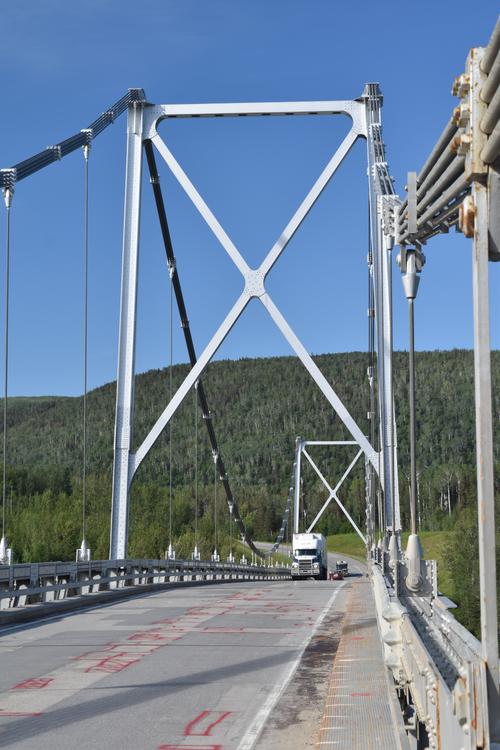
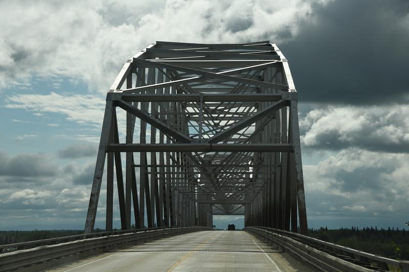
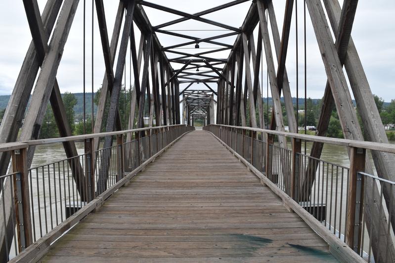 Longest wooden truss bridge in the world. Built in 1929. Crosses the Fraser river. |
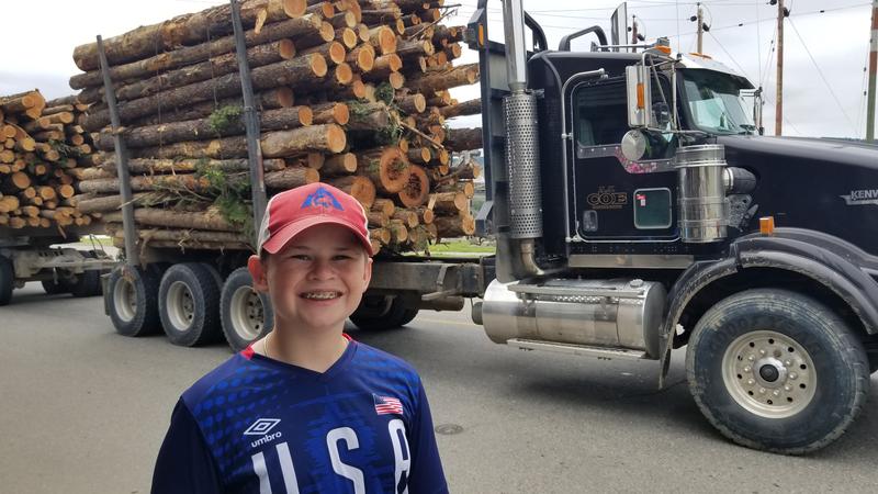 Logging truck. One of many we have seen so far. |
 Fishing at Ferguson lake near Prince George. |
 Wine bistro on the river. |
 Fishing with a rainbow at Shane Lake. |
 Casting with a spinner. |
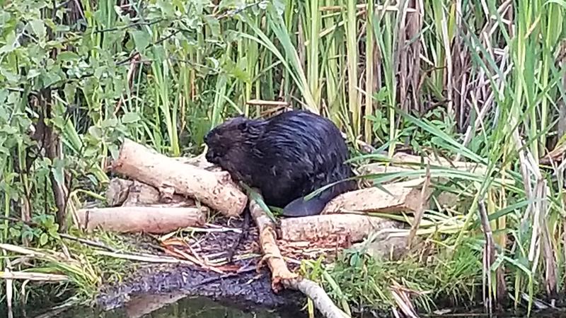 Beaver! It was actually eating the wood. |
|
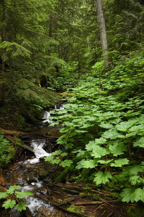
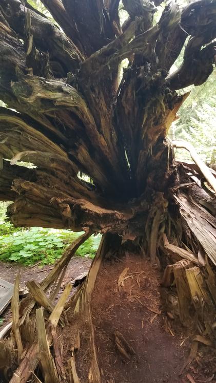
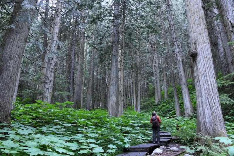
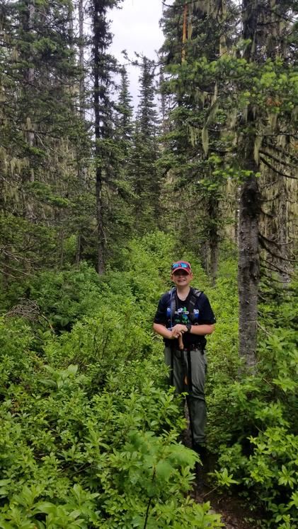
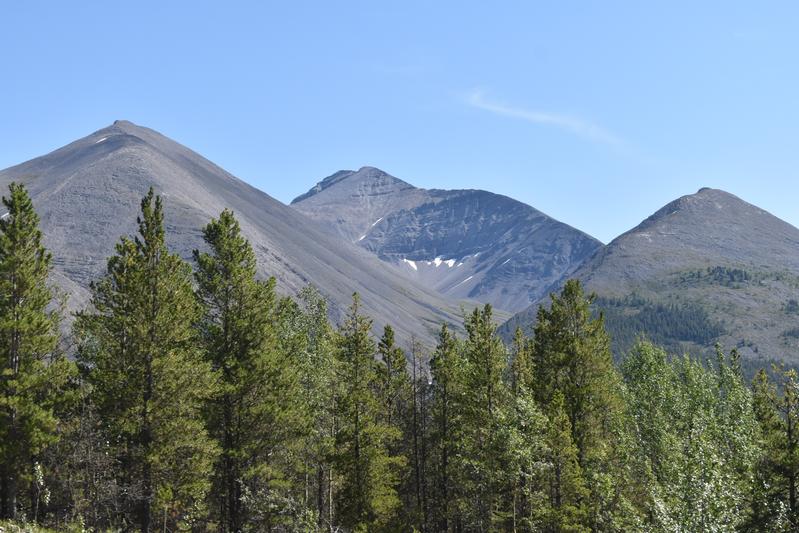
Day 4 (July 19, 2022) We had a day off of driving to explore around Prince George. We started the day early to do some hikes. There is a local area that is the only inland temparate rainforest that is home to an old-growth western red cedars. Some of them are more than 2,000 years old! Papa remembered some of the rainforest plants from western Washington, including skunk cabage, ewwww. It was damp and quiet in the forest and nice to walk with the big trees. The next hike was to be a bit more challenging, a Papa special. 2,200 ft in 2 miles. I had not done much hiking in a while, so I complained a little. Some parts were thick with wild grape and blueberry plants. Juju was soaked from brushing off the rainwater. We stopped at a meadow and turned back. On the way back to town, we stopped at Pruden lake to relax on some piers and fish. Papa hooked a nice 10" rainbow trout, but it came off right as we tried to bring it on the dock. In town, we had a steak dinner at a casual steak restaurant before heading back to Shane lake for some fishing. A nice guy at the lake talked to us about lure options and gave us some gear, including a fly larve fly that he was using to catch fish after fish. Osprey were flying around the other end of the lake, then a Bald Eagle circled the lake and landed on a branch to watch us. The beaver were active again, swimming and diving, but we did not get to see one out of the water again. |
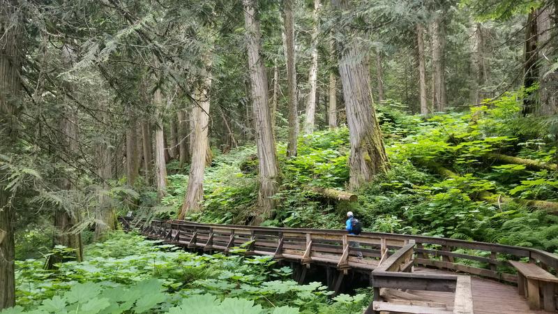 Boardwalk through the rainforest. |
 Lush Devils Club were everywhere. |
 Fallen giant. |
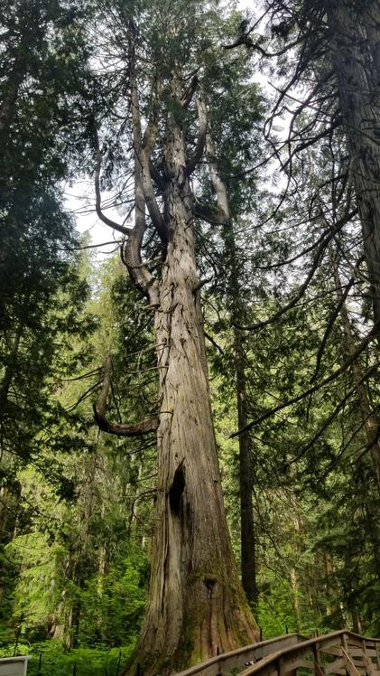 Treebeard. At least 1,000 years old. |
 |
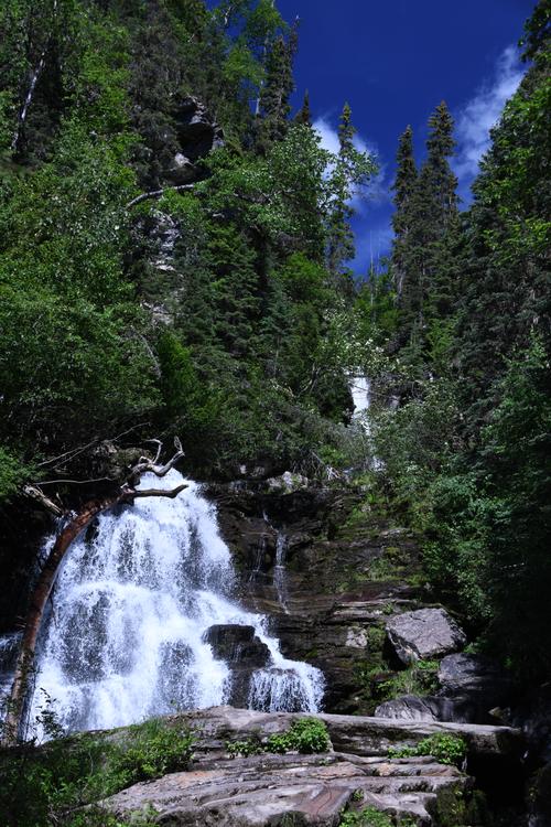
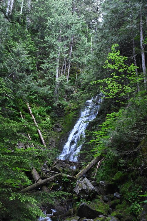 Nice waterfall. |
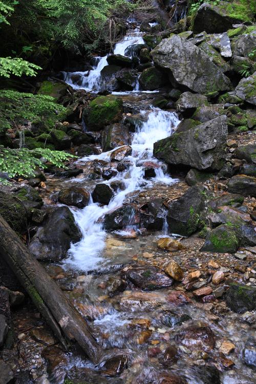 Babbling brook. |
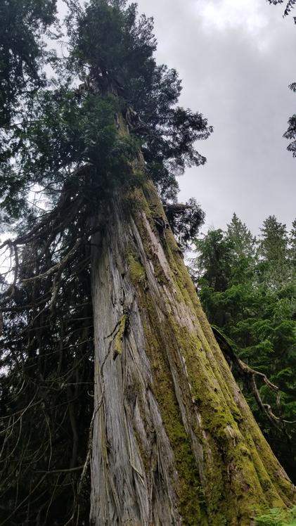 The oldest of the giants were around 2,000 years old. |
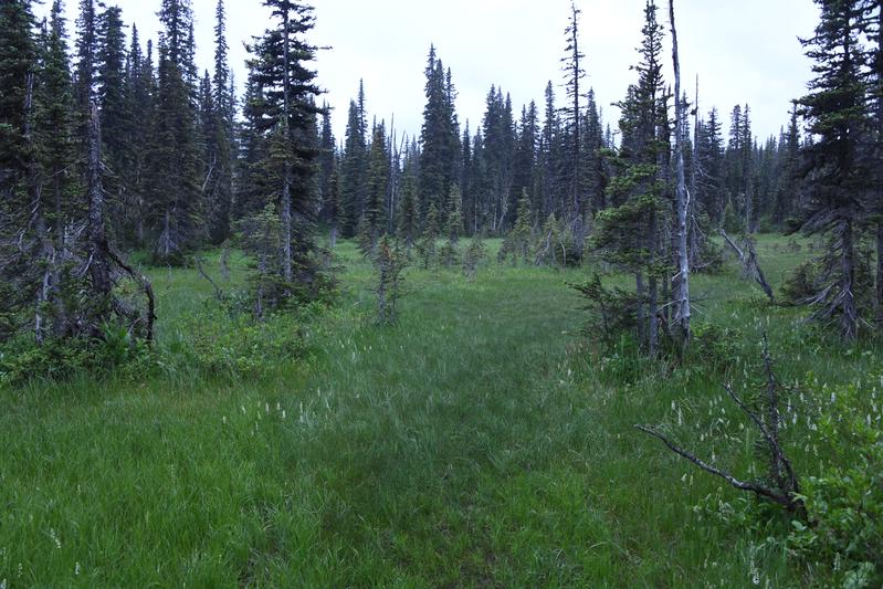 Meadow at the highest point of our hike up Viking Ridge. |
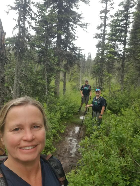 AlpineHippos with the meadow. |
 Lush undergrowth. |
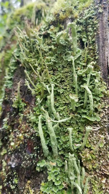 Rare lichen. |
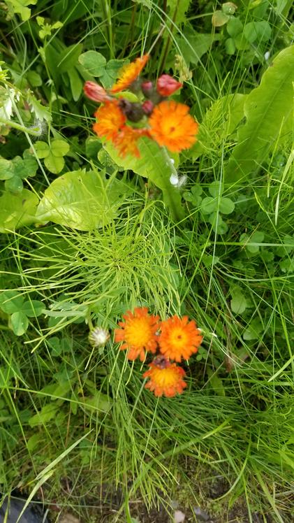 There were many wild flowers along the way. |
 Fishing in Pruden lake. |
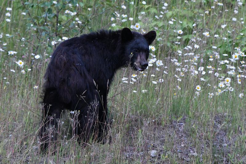 Black bear looking for some grubs. |
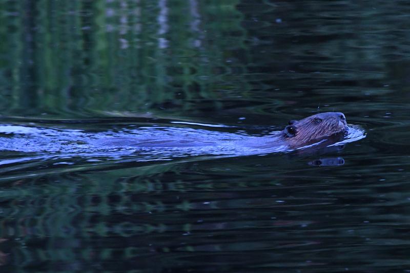 Beaver swimming in Shane Lake. |
|
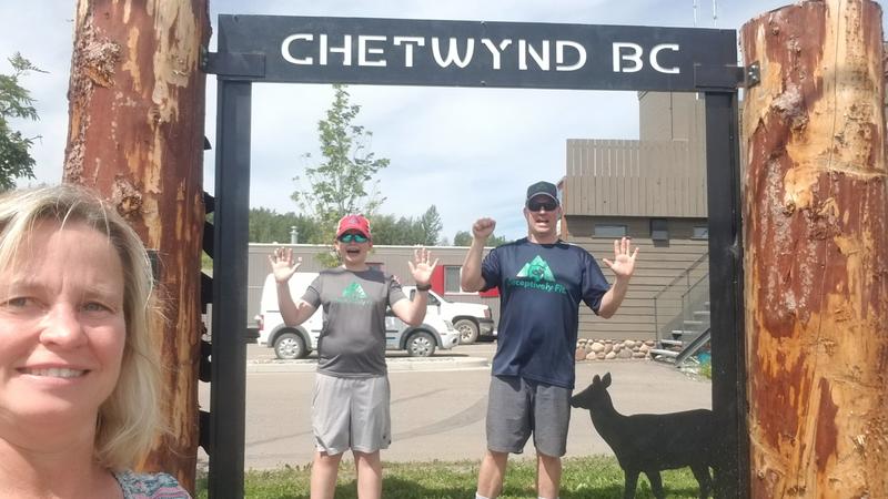
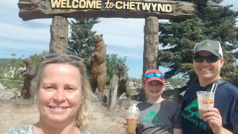
Day 5 (July 20, 2022) We had a bit of a slow start, but had a full breakfast before hitting the road from Prince George to Dawson Creek. We continued in the lush forest that gave way to rugged and rocky mountains as we rounded the top end of the Rocky Mountains. We now entered a plains area, similar to the Dakotas that extends well in to Alberta. It was national weiner day, so we had highway weiners while driving through the mountains. Chetwynd, BC is home to an international chainsaw wood carving contest, so we stopped to check out some of the carvings. In Dawson Creek, we checked out 'downtown' and the historical mile markers. We are now 817 miles from the start and it is 888 miles to Whitehorse, YT, the next big town. Diner was at a nice brew pub, then, it was off to another lake to try some more fishing. |
 Prince George man waves us on. |
 Bijou falls as we cross the Rockies. |
 Highway weiners for national weiner day! |
 We are trapped behind the glass! |
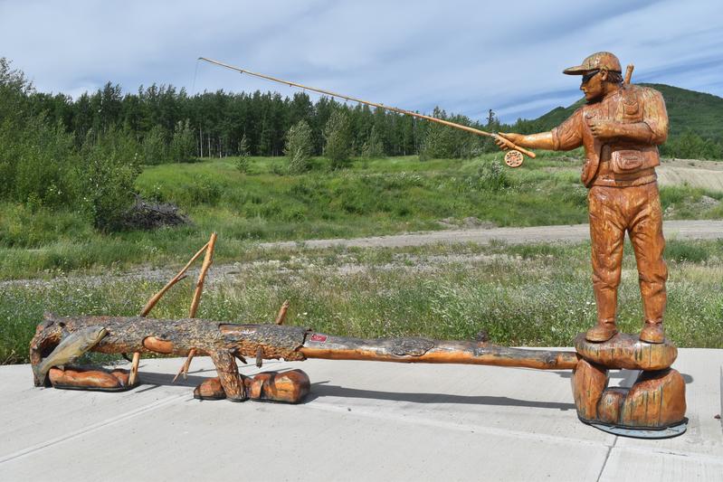 Chetwynd is the home to a chainsaw wood carving contest. |
 My first rootbeer float. |
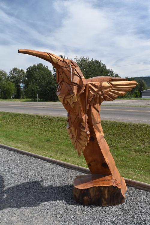 Hummingbird |
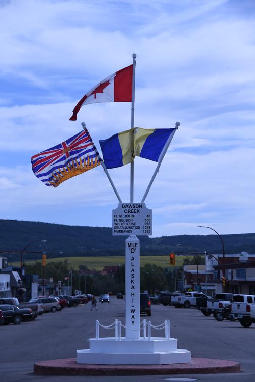 We made it to Dawson Creek, the start of the Alaska Highway. |
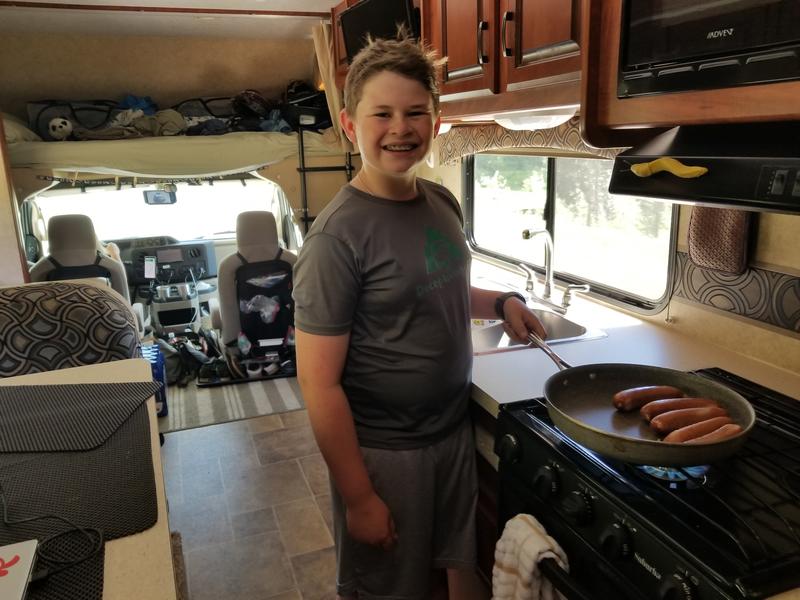
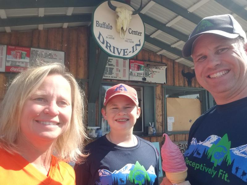
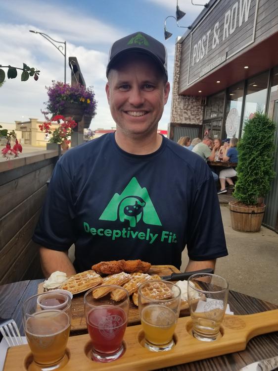 Is that a deceptively healthy meal? |
 We swung through Alberta on the way to a lake for more fishing. |
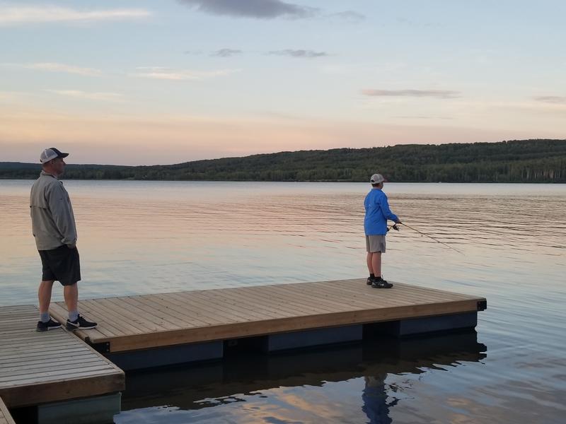 Fishing at Swan Lake. |
|
|
|
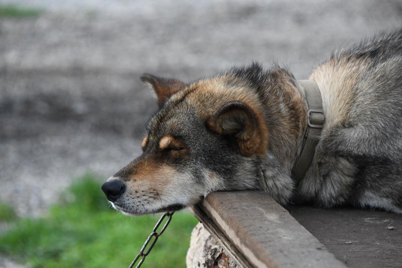
Day 6 (July 21, 2022) We started our journey up the Alaska Highway! We started at the official mile zero with a team photo with the sign. On our way up the highway Papa and I made Highway Pancakes! They taste better at 65mph! As we drove further the terrain went from prairie farmland to the Boreal forest. We finally arrived at our campsite in Fort Nelson, which has a population of 3,500. We were 300 miles up the ALCAN, 1,093 miles from Bothell, WA. We headed to the Fort Nelson historical museum. It had 4 buildings and many things outside. There were good examples of engines so my Papa could explain how they worked. My favorite building, however, was a garage full of old cars. I could have spent the whole day there, but my favorite car was a Model T from 1924. The other buildings had communication devices, the old Hudson bay house, and an exhibit on a lot of old items, including examples of many of the local wild animals. We had dinner at a restaurant that was at our campground. As an appetizer we got some deep fried pickles, they where so good! After dinner we had to do laundry, so while Juju went to the laundromat, Papa and I went to a little lake (Parker Lake) to try some fishing. we didn't catch anything. We came back to camp and I got started on cutting some wood and I started a fire. As the fired died down, we got out the marshmellows and made s'mores. After the goey goodness, I went to bed. |
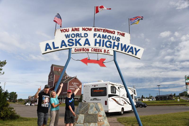 |
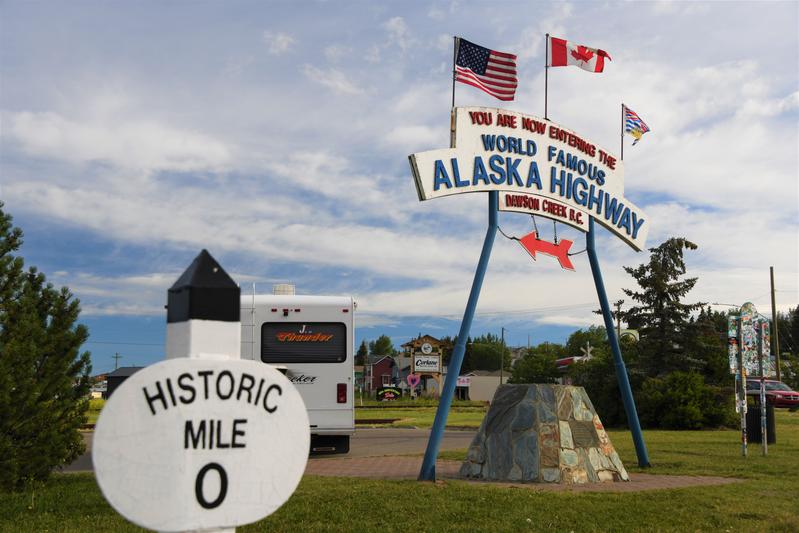 Official mile zero of the Alaska Highway (ALCAN) in Dawson Creek, BC. |
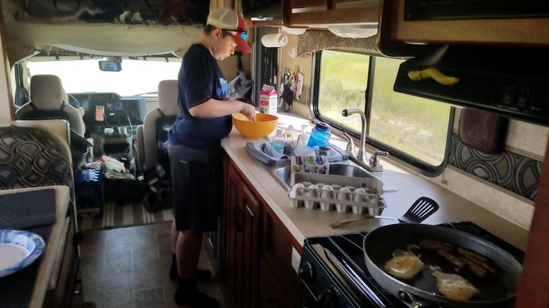 Highway eggs and pancakes! |
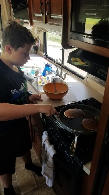 Got to stay balanced while flipping. |
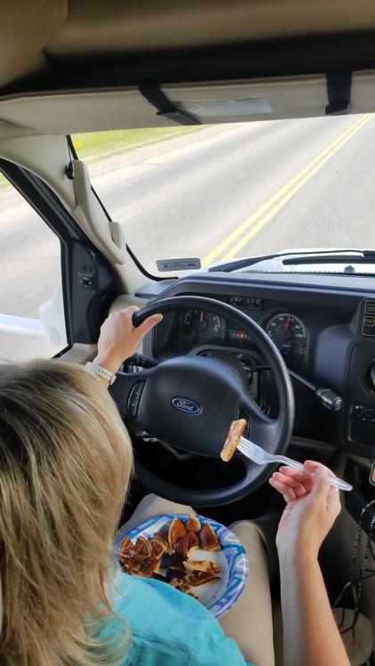 Yummy! |
 Bridge across the Peace River. |
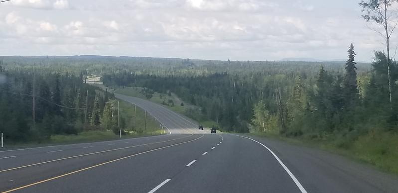
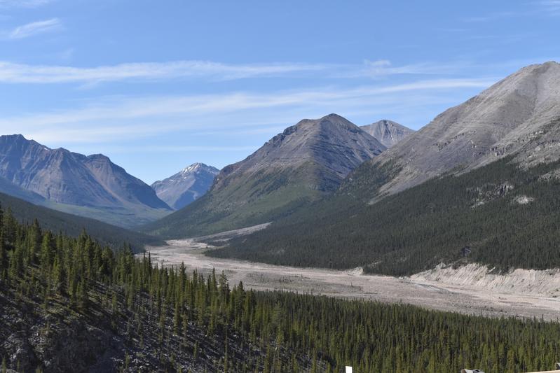
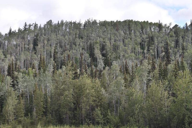
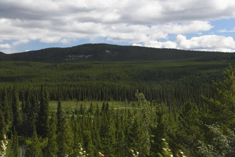
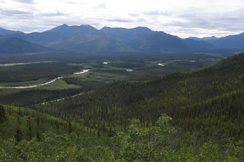
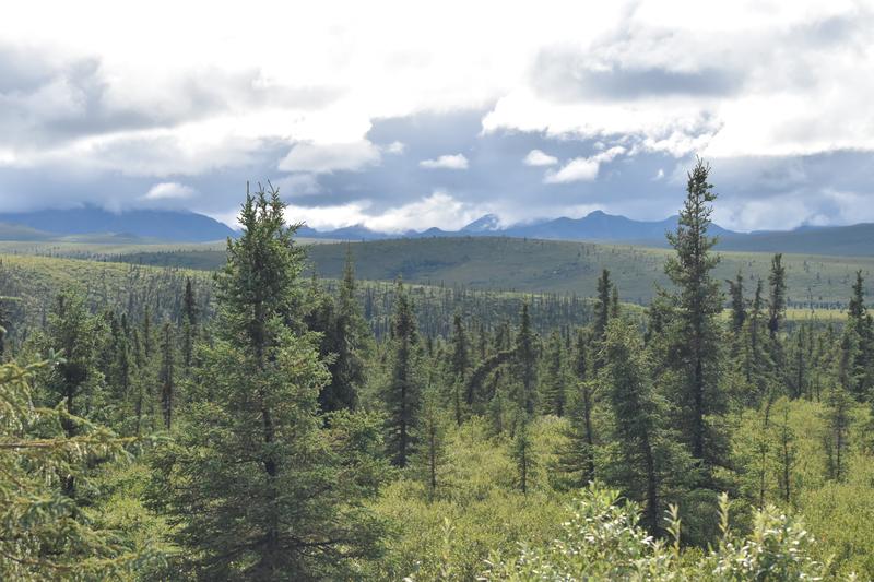
 View of the road with Boreal Forest, approaching the Northern Rockies |
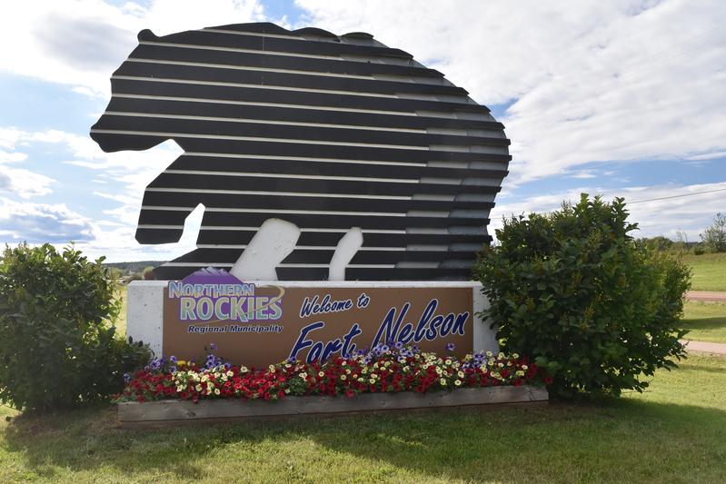 Fort Nelson, historic mile marker 300. |
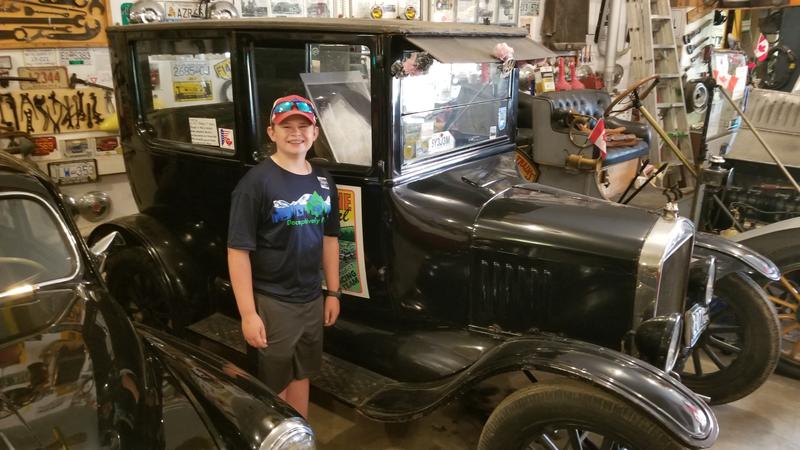 1924 Model T Ford |
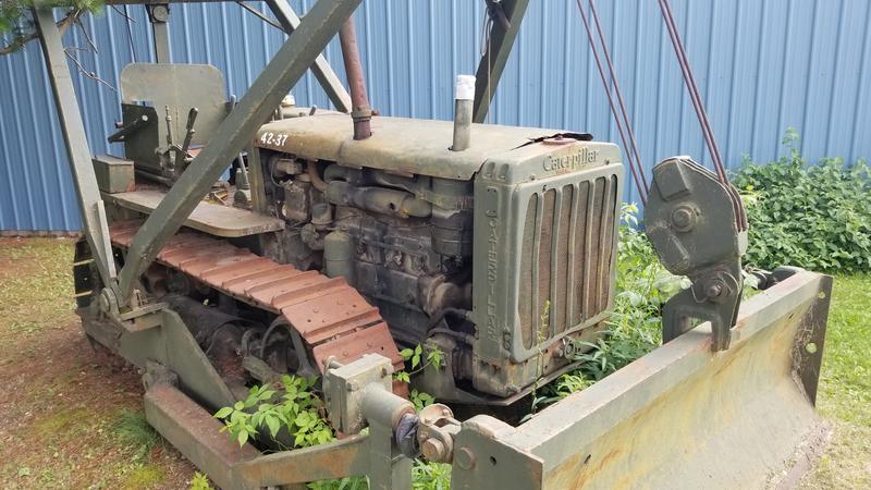 Caterpillar D4 that helped build the ALCAN. |
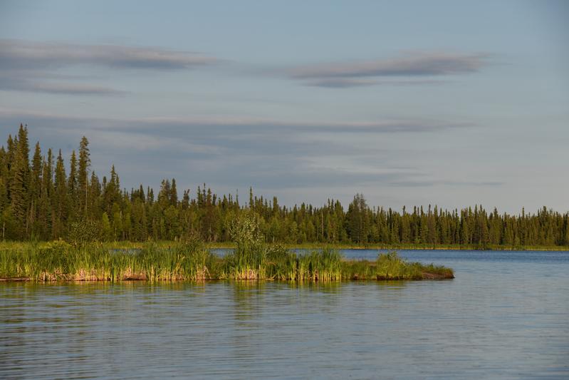 Parker lake, surrounded by Boreal Forest. |
|
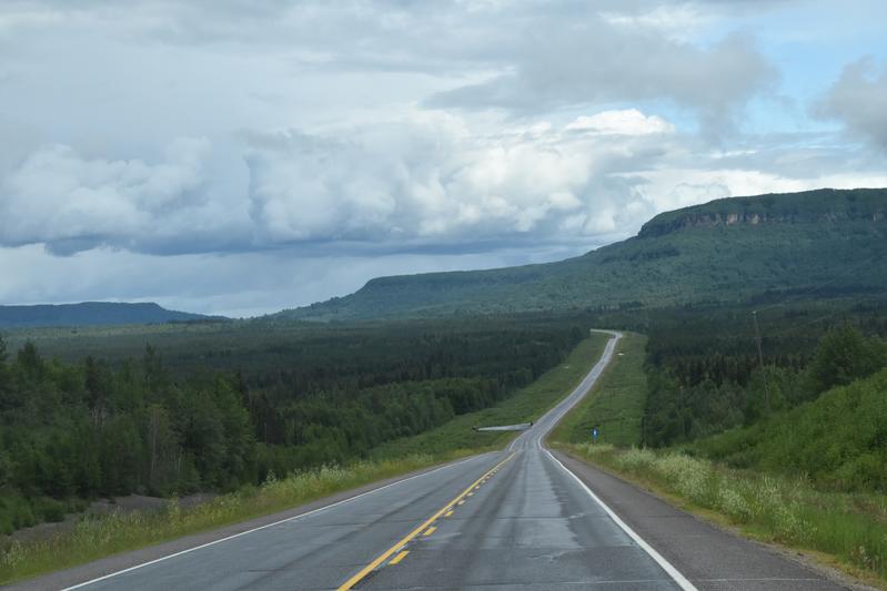
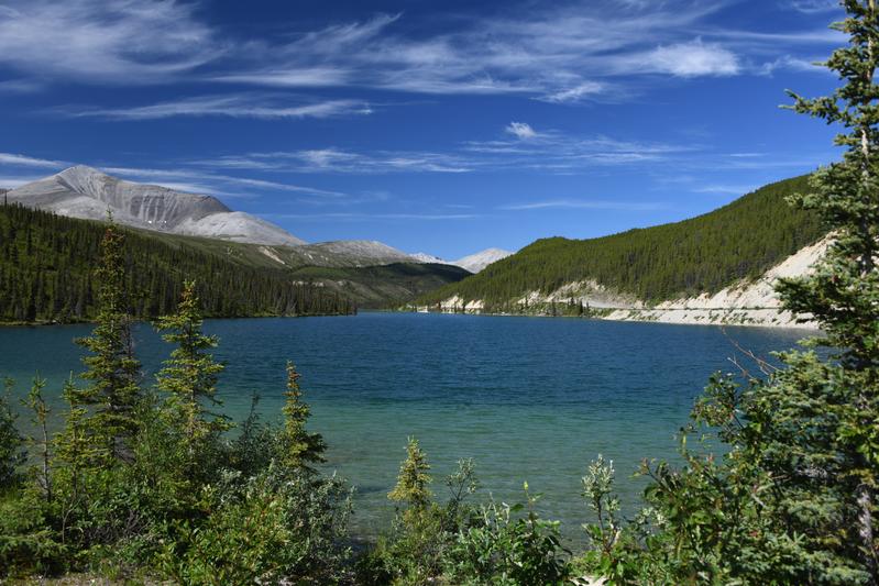
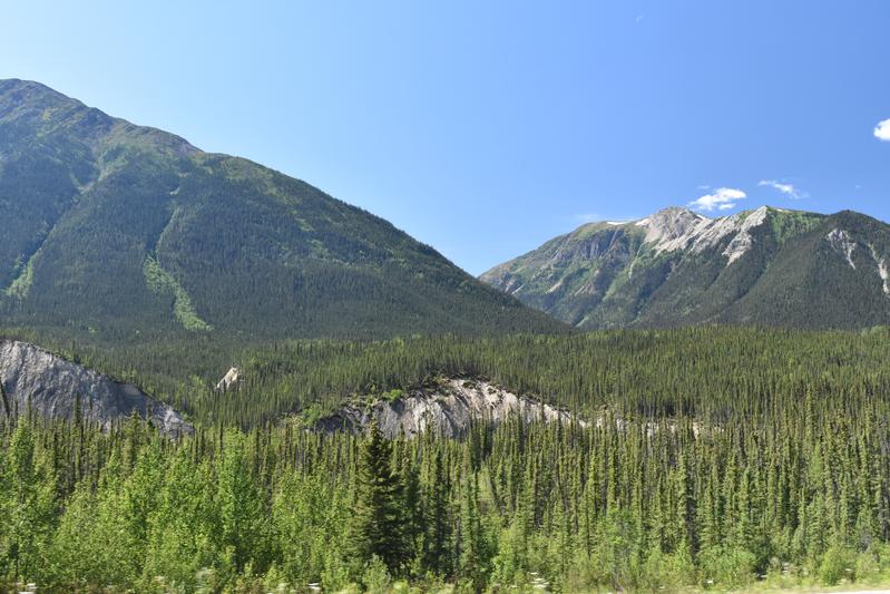
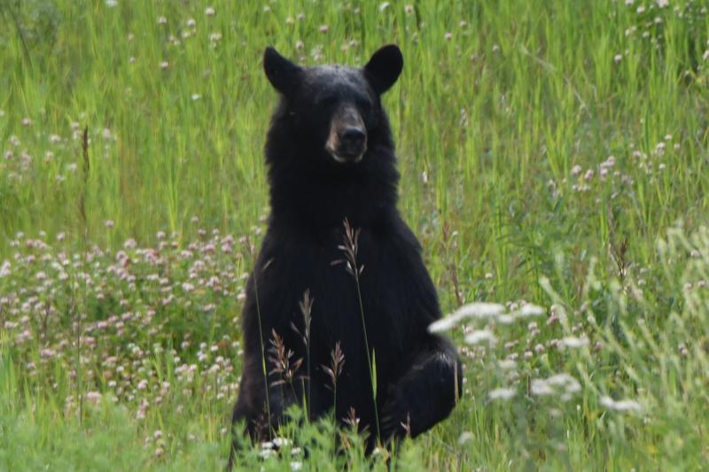
Day 7 (July 22, 2022) 1,283 miles from the start. We started to drive to a little cinnamon bun shack at Testa river, which is famous for its tasty treats. We took the buns to a little lake called summit lake, which is the highest point on the Alcan highway. We did some fishing but didn't catch anything, so we just sat and enjoyed the yummy cinnamon buns by the beautiful lake. Driving over the pass along a stark cliff offered great views of mountians rising from the valley. We saw a bear along the side of the road. He was eating flowers while keeping an eye on us. We then drove to another lake called Muncho lake. We tried some fishing and I almost caught a , but it didnt hook on. Along our whole drive we saw 2 Bears, 1 young moose, multiple long horn sheep, and a lot of bison. Then we got to our campsite. The water in the area was not potable, so we did not want to put any in the RV. We went to the hot springs where we soaked for a couple hours. The water was so warm and so cold in some areas. It got hotter the more you went to toward the source. At the surface, the water would burn your hand. Lower down there was this liitle jungle. It looked like a disney ride! We even saw little fish! We needed to shower but we had no water, so we used Papa's pop-up shower with hanging water bag outside, it was cold!. For dinner, we had some Canadian ribeye steaks. The mosquitoes were so thick, Papa had to wear a headnet and long clothes to cook our steaks. The steaks tasted so good! We had some potatoes and broccoli. After dinner we watched the movie RV. It was so funny! |
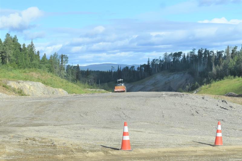
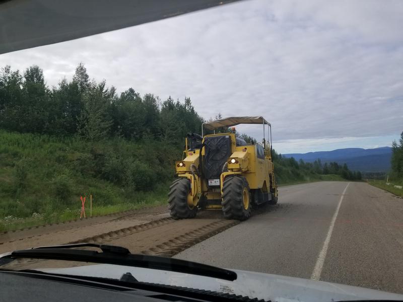 Road muncher starts the process of repaving. |
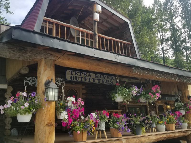 We stopped for some famous cinnamon roles at the Testa Lodge. |
 Summit lake, at the highest point of the ALCAN. I tried some fishing. |
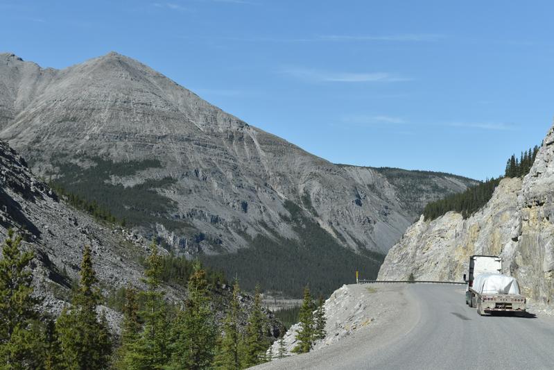 Road winding across the pass. |
 Mountains rising above the valley. |
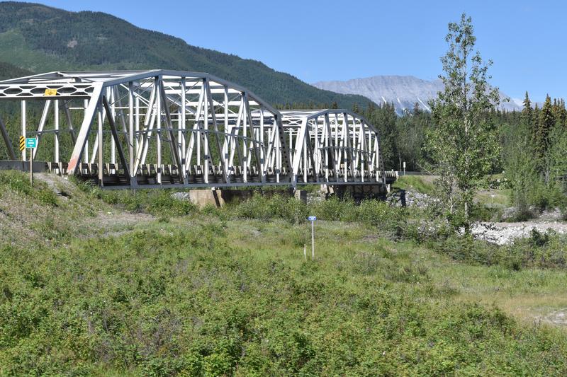 We crossed a number of tressel bridges. |
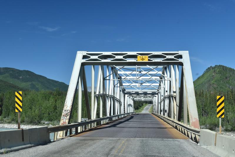 With expanded metal decks. |
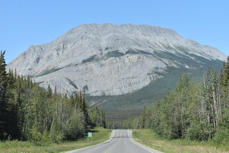 Much deformation as the rocks pushed up. |
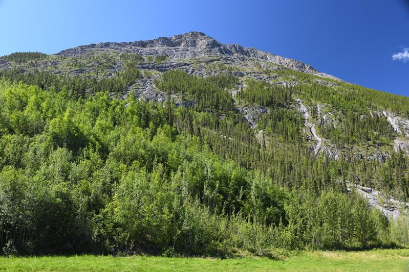
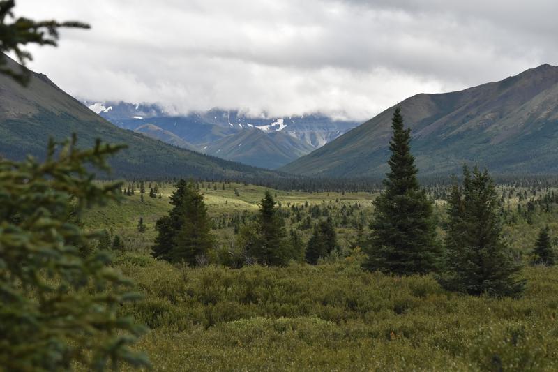
 Nice mountain views along the drive. |
 Muncho lake. |
 Muncho lake and surrounding forest. |
 More views along the road. |
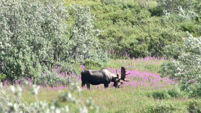
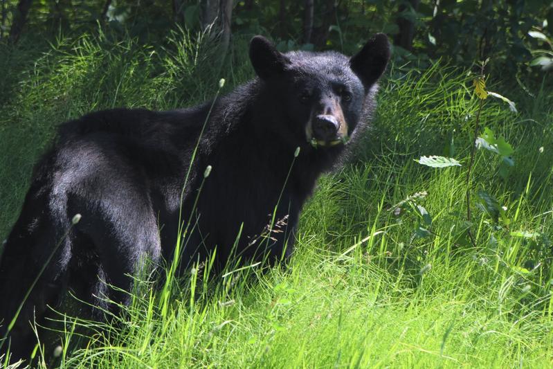 Black bear munching some flowers. |
 Cool mountain. |
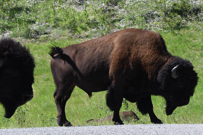 Tatanka! Up here? These are Wood Bison and are endangered. |
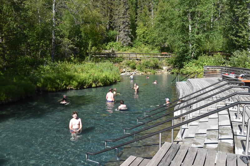 Liard River hot springs! The water was so hot at the surface in some sections, it hurt to touch. |
 Narrow section of the pool through the muskeg. |
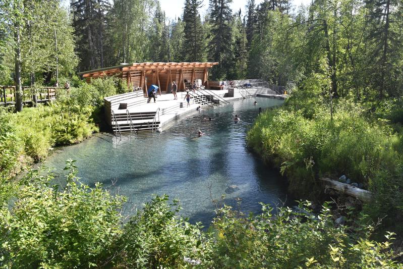 Nice pavilion at the hot spring. |
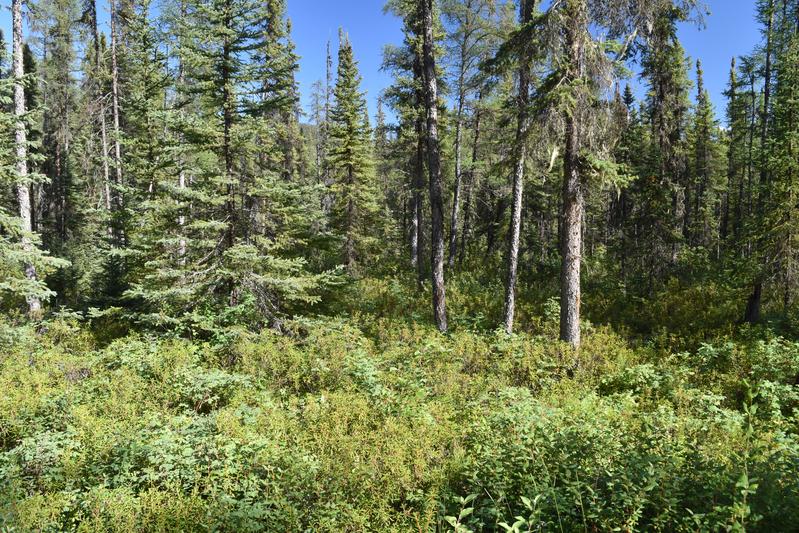 Good example of the Boreal forest. |
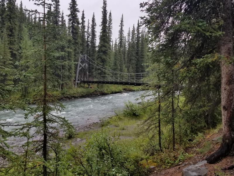
 Suspension bridge over the Liard river. |
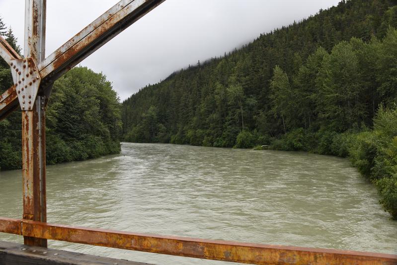
 Liard river. |
 Shower after the hot spring. |
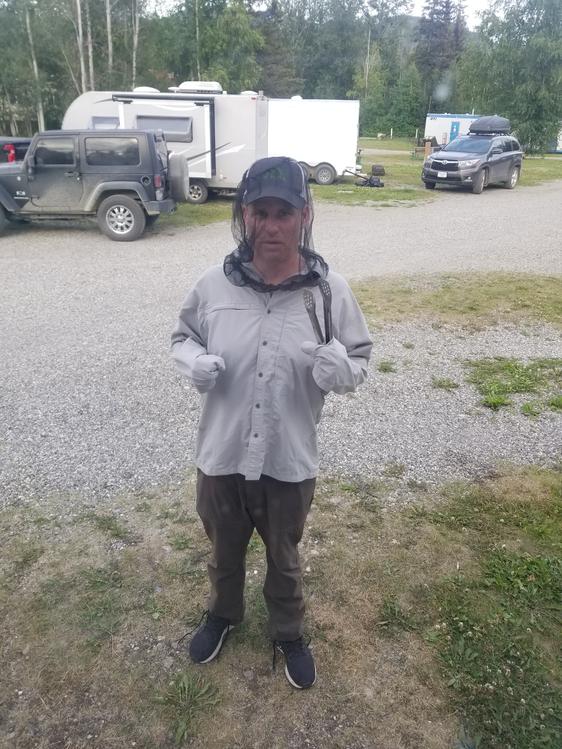 Grilling steaks with the skeeters. |
|
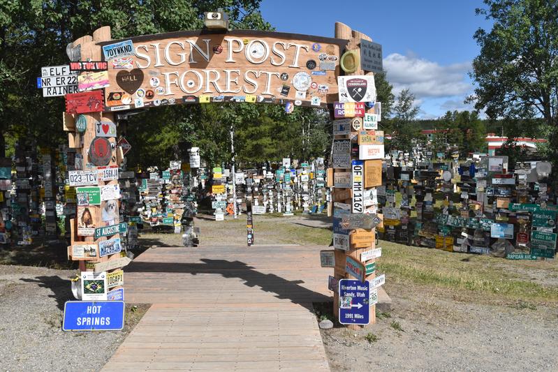
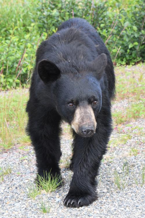
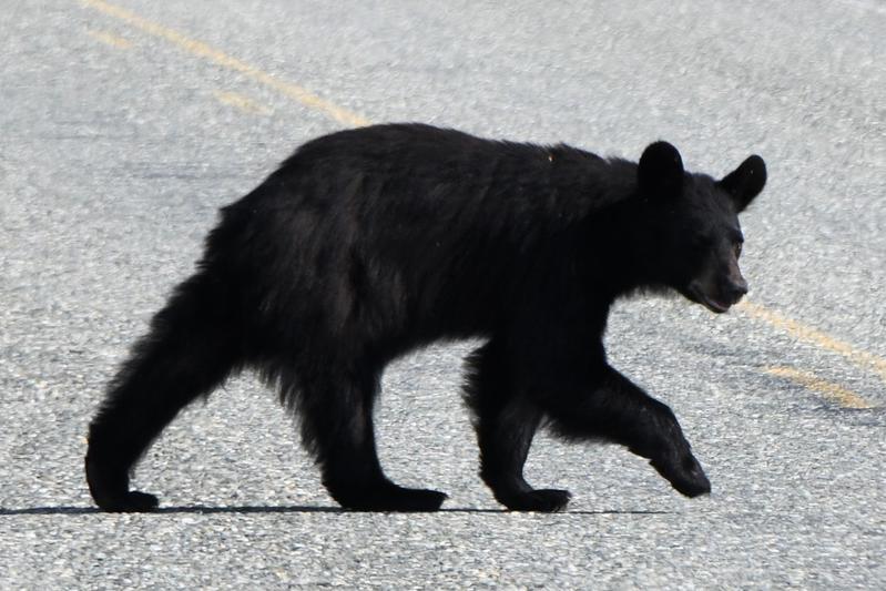
Day 8 (July 23, 2022) Papa fought off the mosquitoes to finish hooking up the car so we could roll out of town. Today was a long drive to Whitehorse. We made it past the area where the road had washed out when a beaver dam released a torrent of water from a nearby lake. The road crews made a crude road through the forest to bypass the area. We stopped for a bear on the side of the road. He watched us cautiously, standing on hind legs, then eventually ran away. Two foxes, with big bushy tails, were playing by the side of the road. In Watson Lake, we went to the sign post forest, which was started when the road was being built, and people from all over the world leave signs meaningful to them. We found a nice spot for a NASA sticker. The Norther Lights Center taught us about how the sun interacts with the Earth to cause the aurora. It featured images from the Solar Dynamics Observtory that Papa and Juju worked on. On the drive from Watson Lake to Teslin, we had awesome views of rivers, forest, muskeg, mountains, and wildlife. I was getting hungry, so we made highway pizza! The pizza had been in the oven for a few minutes when we stopped to see a bear that was digging up flowers on the other side of the road. When we stopped, about 200 yards away from the bear, he started walking up the road toward us. We just thought he was going to cross for more flowers. However, he just kept coming right towards us. We backed up quickly to keep our distance. He ran to the bushes for a minute, but the smell of cooking pizza must have overwhelmed him as came right towards us again. He sniffed the door of the RV, then came toward Papa and I farther up the road. Papa made himself big and the bear backed away and eventually ran off. Juju stayed in the RV, ready to drive off and pick us up down the road if needed. In Teslin, we checked out a cool bridge and a wildlife museum to see examples of Yukon wildlife. We made it to Whitehorse, the capital of the Yukon! We went to a rustic restaurant (Woodcutters) and saw some of town. Papa woke up at 1:30 am to try to see if we could see the aurora, which was supposed to be active. However, the night sky was still light like dusk. A few stars could be seen, but no aurora. We are now 1,680 miles from the start. |
 This area of the road washed out a month and a half ago, making the news back home. There is now a 2 mile detour through the woods to go around. Apparently, a beaver dam broke, causeing a major release from a lake to wash away a major section of mountain. |
 Birch trees shining through the canopy. |
 A black bear seeing what we are up to. |
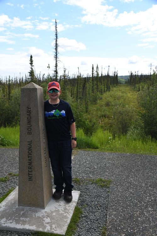
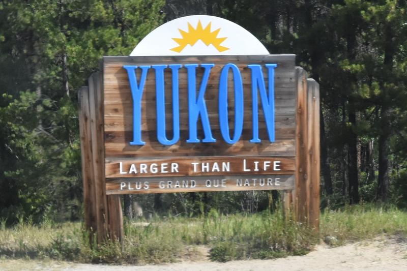 We made it to the Yukon! |
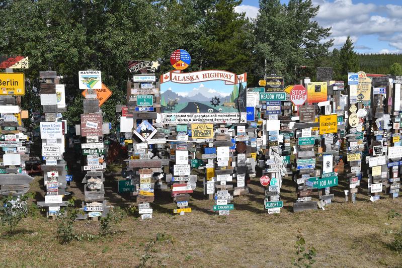 Sign post forest, which was started in 1942 by a homesick soldier and is now home to 100,000 signs. |
 |
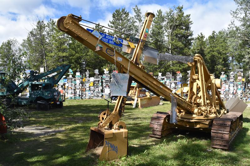 Diggers and dozers helped build the road. |
 We found a space theme post that was in need of a NASA sticker. |
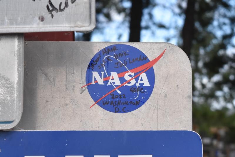 NASA sticker in the forest. |
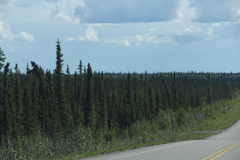
 Alaskan Highway winds through the forest. |
 Forest along the drive. |
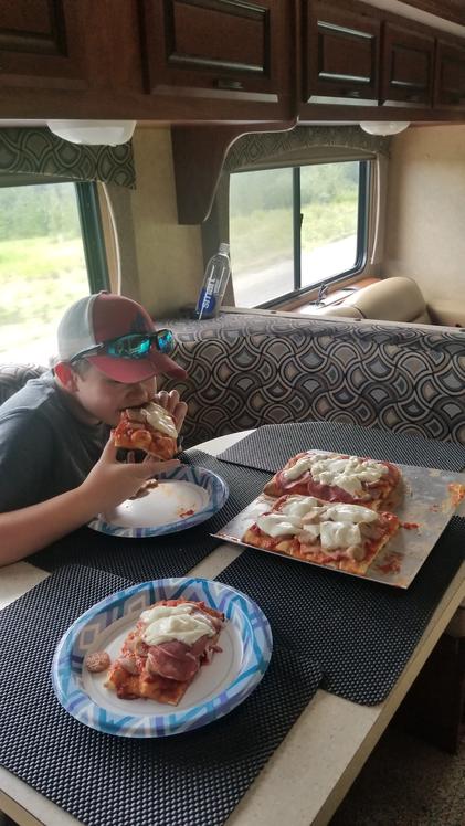
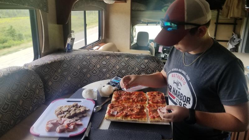 Highway Pizza! |
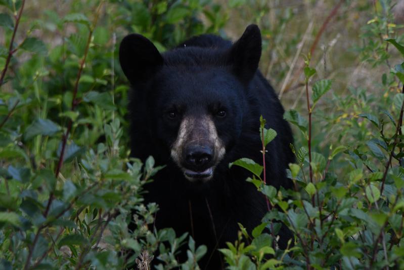 While the pizza was cooking, we stopped for a bear that was digging up flowers on the side of the road. The smell of cooking pizza enticed him to check us out. |
 The bear apporoached carefully. |
 Pizza back on the road! |
 Bridge in to Teslin. |
 Another bear walking across the road. |
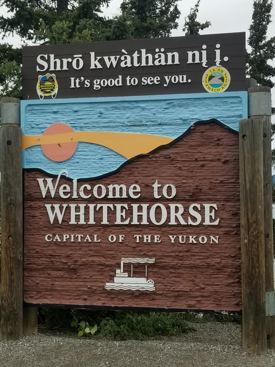 Made it to Whitehorse! |
|
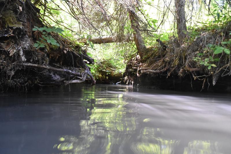
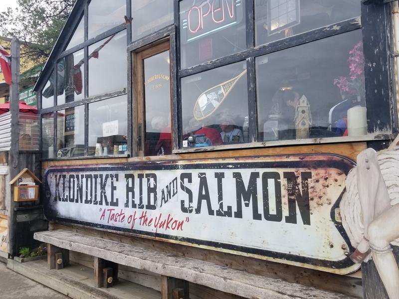
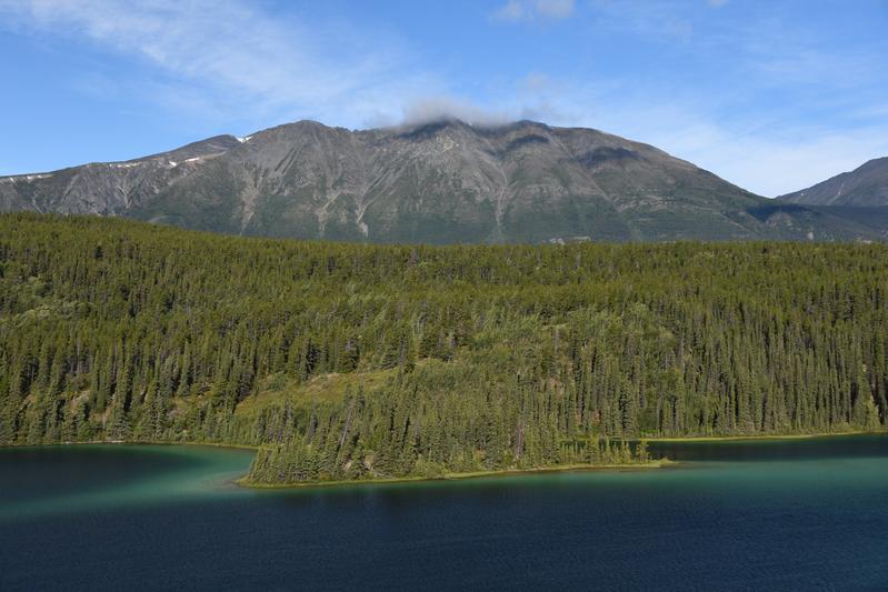
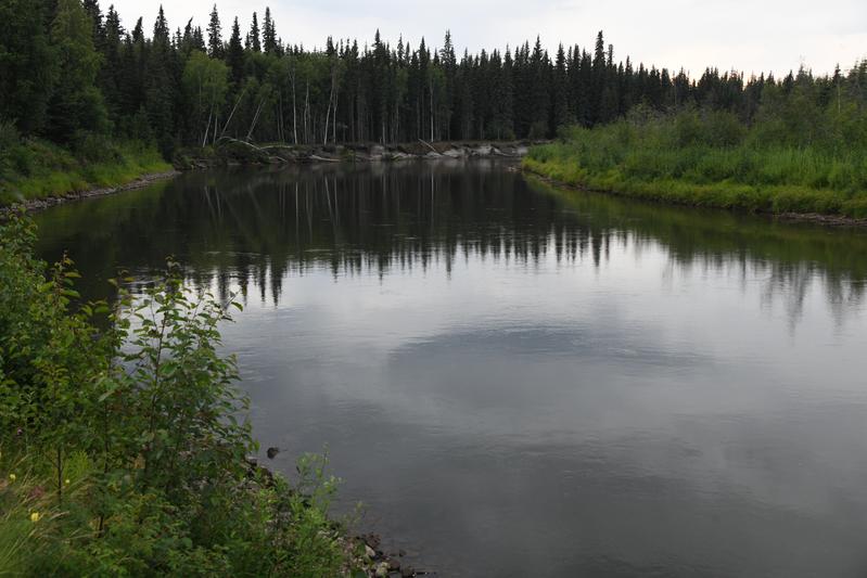
Day 9 (July 24, 2022) We had a nice day exploring Whitehorse. It was raining in the morning, so we held off on hikes and tried some glass blowing in town. We then had lunch at a historic restaurant, where I had salmon with berry sauce and Papa had Halibut with brie and berries. We checked out the Klondike, a steam-driven paddle boat that carried the gold rush prospectors. There is a fish ladder that helps the salmon get past the dam on the Yukon river. We stopped to try a brewery in the mountains, then, went to Miles Canyon. This canyon makes a narrow passage that must have been a challenge for the river boats. Back in camp, I made a fire while Papa worked on pulling up the floor to tighten a bolt that was sticking up because it loosened during the drive. |
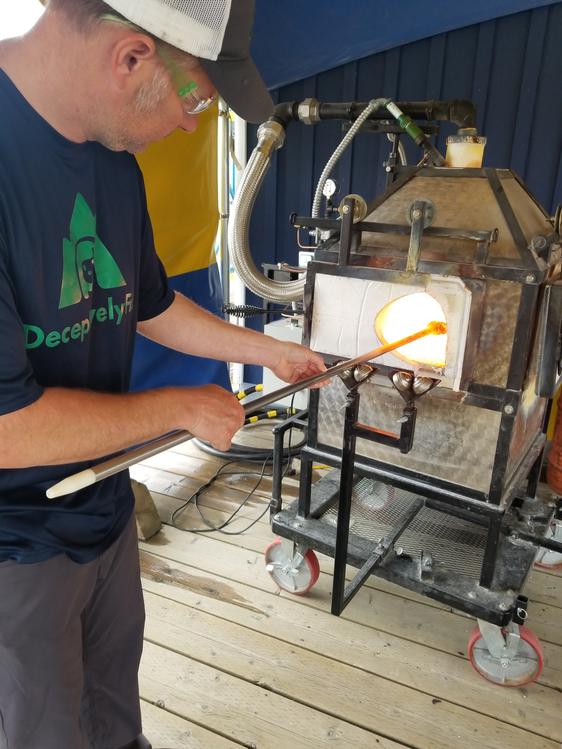 Papa heating the glass in the furnace. |
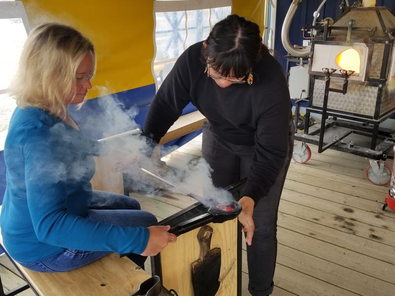 Juju shaping the ball ornament. |
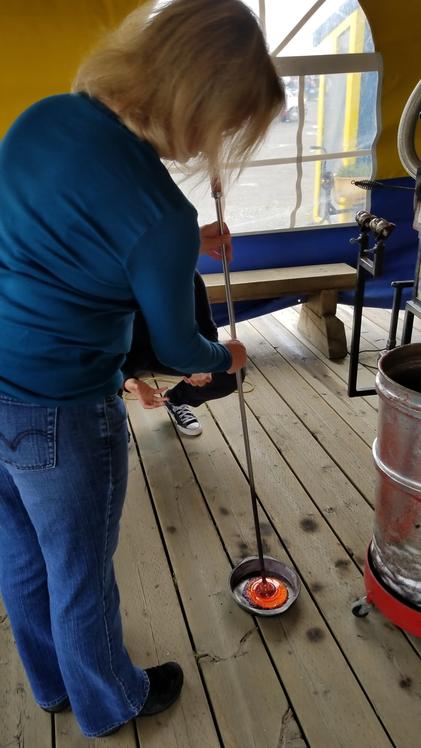 Stamping the colors into the flower. |
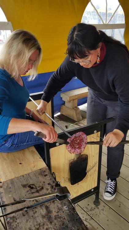 Pulling the flower shape. |
 Historic restaurant. |
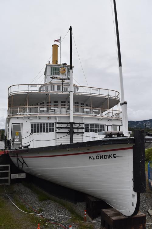 The Klondike was one of the river boats used to carry passengers from Carcross to Dawson. |
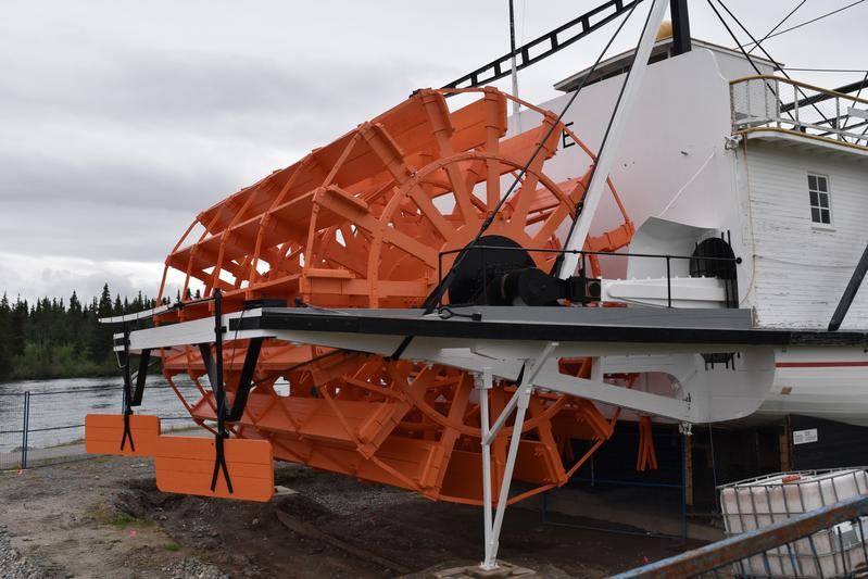 The sternwheelers made around 14 trips over the 5 month season. |
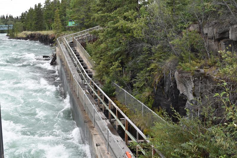 The largest wood fishladder in the world helps Chinook and Sockeye salmon move up the Yukon to the Wolf Creek for breeding. |
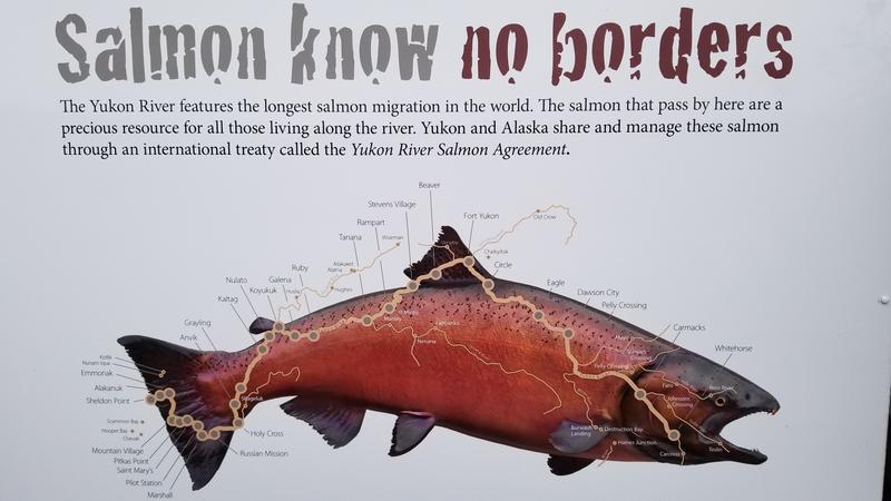 The salmon enter the Yukon river from the Bearing sea, cross Alaska, in to Canada! |
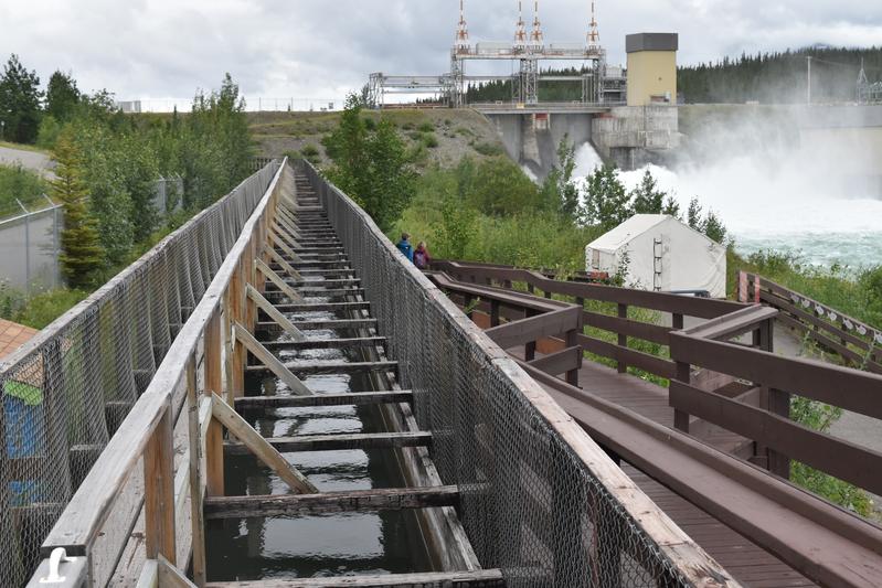 Fishway headed toward the dam. |
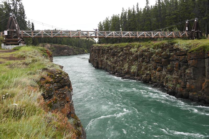 Miles Canyon on the Yukon. |
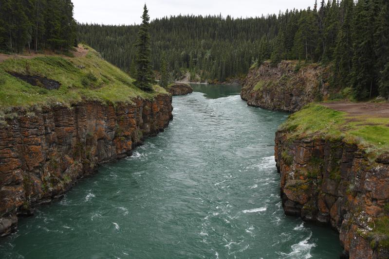 Can you believe the paddle wheelers came through here?! |
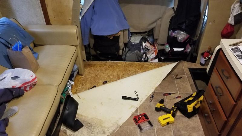 Pulling up the floor to tighten the loose bolt that shook itself apart during the drive. |
|
|
|
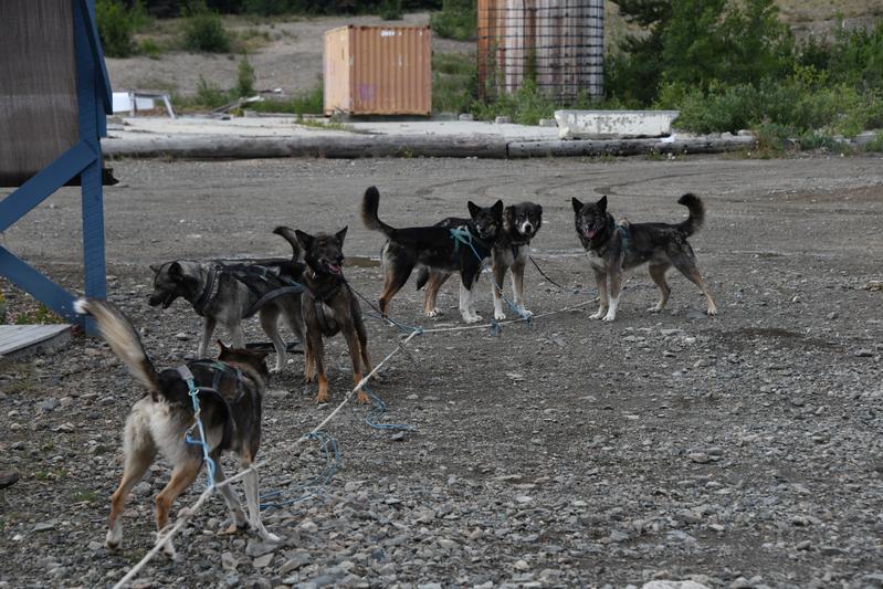
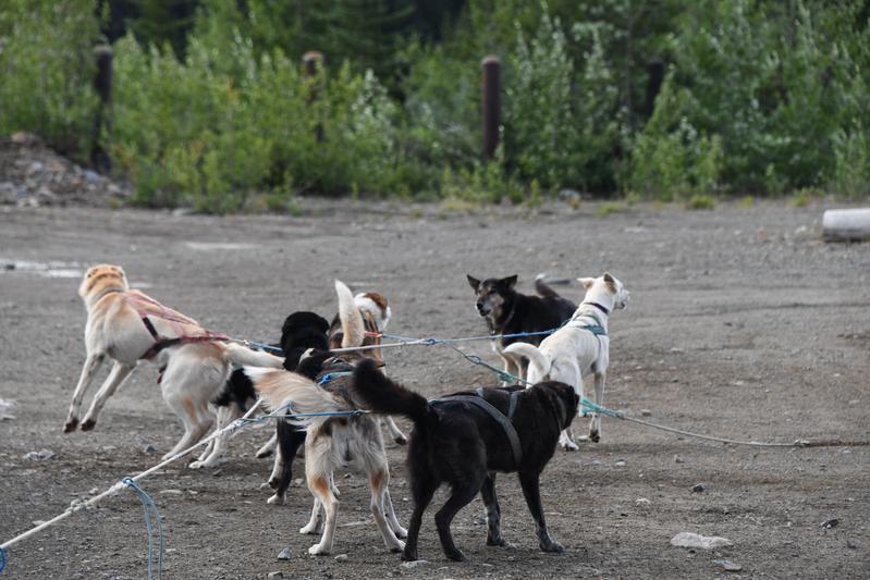
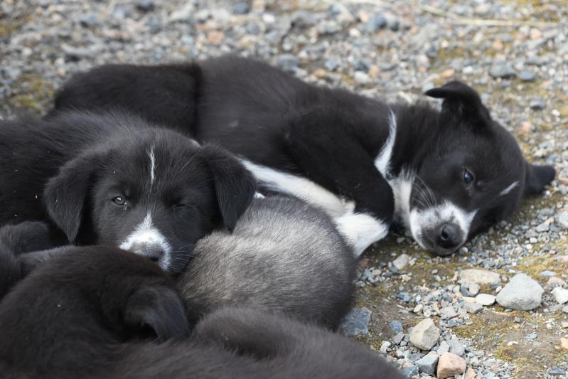
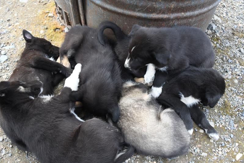
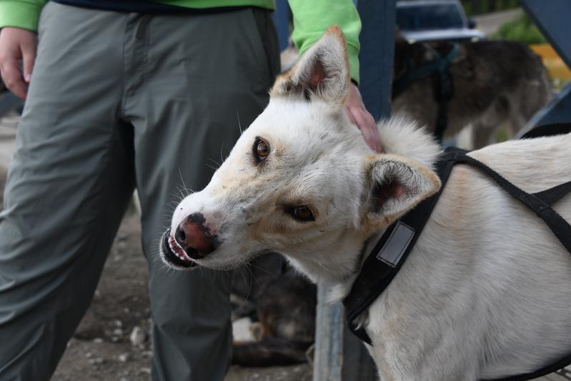
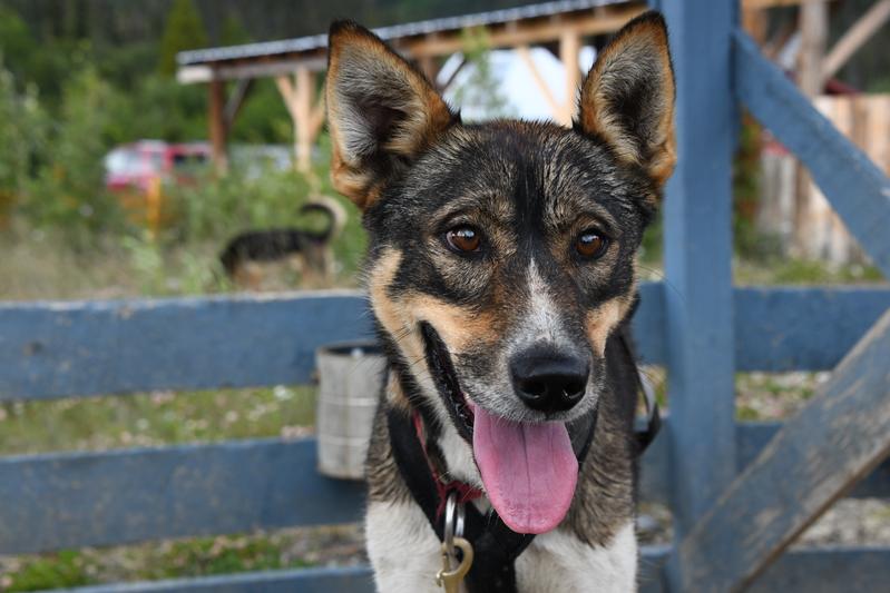
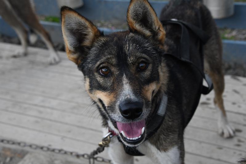
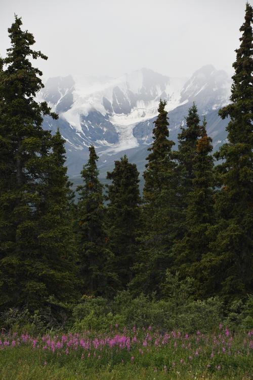
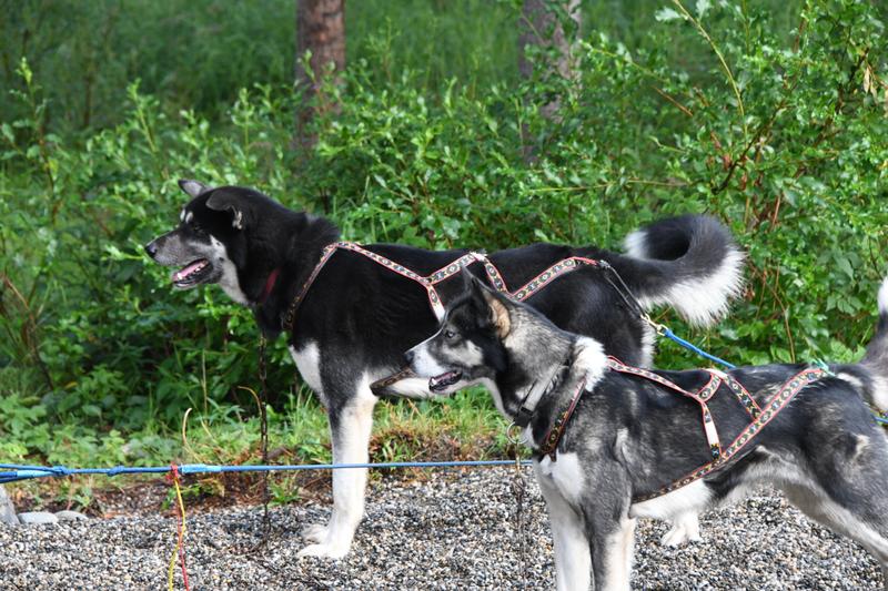
Day 10 (July 25, 2022) Today, we are driving to Skagway for an overnight side trip. The RV stayed in Whitehorse. The drive was beautiful, winding through the forset, then up in to the alpine tundra, before dropping down a steep pass in to Skagway. We stopped at some sand dunes near Carcross, then went to Carcross. Carcross is short for caribou crossing where large herds used to cross the river. This was also where the goldrushers would be picked up by river boat after their overland and small boat trip from Skagway. We went to the oldest store in the Yukon and saw an original train bridge from 1900. Along the drive, we had many pretty views of the terrain and mountains. Papa and Juju suprised me with a visit to a sled dog training facility. They had piles of puppies and race dogs in training. We got to play with the puppies, then meet the real sled dogs training to run the Ididarod and Yukon Quest races. We met a professional musher that has done 20 1,000-mile races. 12 Ididarods! A dog team pulled us on an ATV, and we could feel their power. They were all so excited to run and pull us. Afterward, they were tired and a bit calmer, so we could say high to them. Just before the boarder, we stopped for a hike to a lake. We made it a mile in and found a gate that said the area was closed for caribou, bummer. We jumped back in the car and hit the boarder to Alaska! This was my first time to Alaska and the 45th state I have visited. The boarder guard was from West Virginia and welcomed us back to the US. The drive down the pass was pretty and we could see the railroad on the other side of the valley. We had lunch at the Skagway brewery, which has spruce tip ale. We walked around town for a while, then went an checked in to our cabin. The cabin was cute and peacefull. Back in town, we made a quick stop at a distillery and then had a waterfront table for some King Crab! The red onion saloon offered a nightcap with some guitar players. |
 Lake along the drive. |
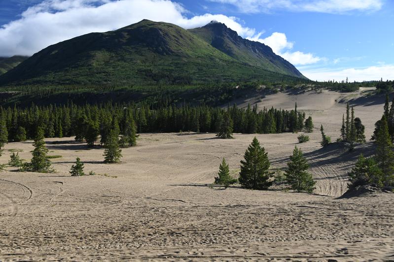 Sand dune 'desert' near Carcross. |
 Mountains raising near White Pass. |
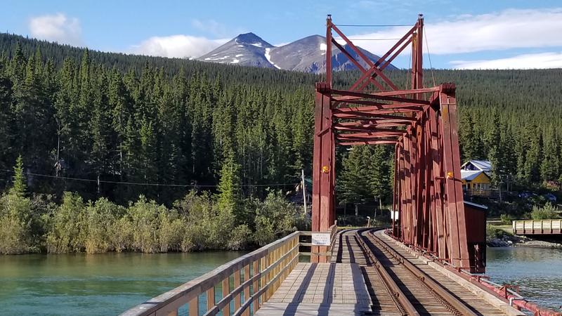 Original railway bridge in Carcross. |
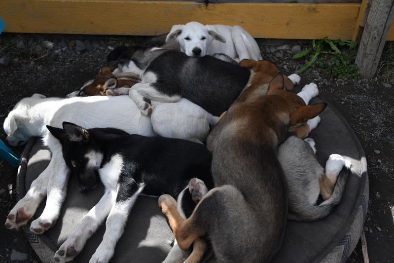 Pile of puppies! |
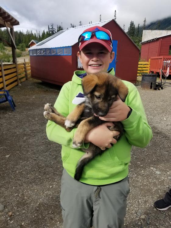 This little guy is only 6 weeks old. |
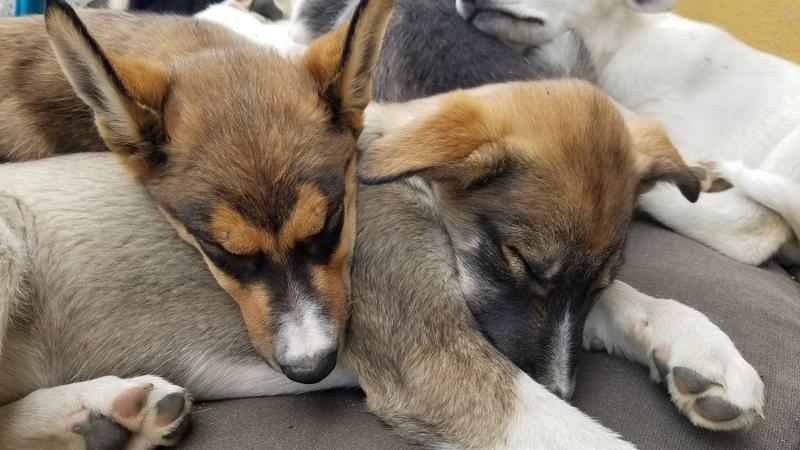 These sled dog puppies are 12 weeks old. |
 We are ready to run! |
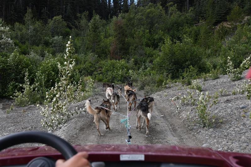 Sled dogs pulling us in an ATV. |
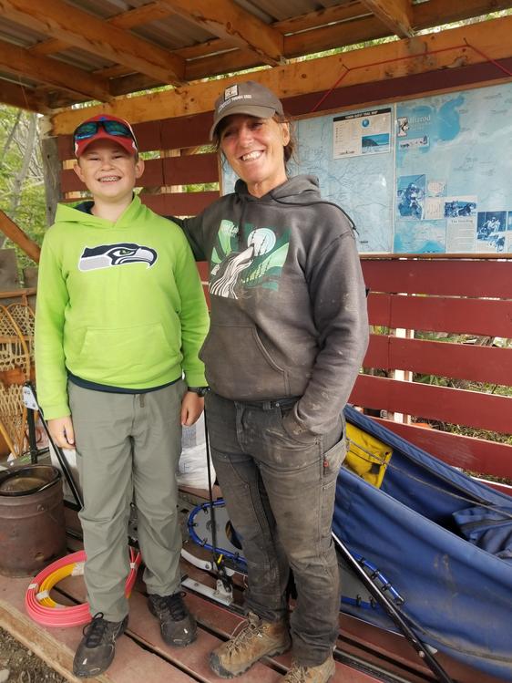 Dog race discussion with Michelle who has done the Ididarod 12 times! |
 Racing dog sled. |
 We are really excited to run! |
 The sled dogs are a mixed breed of Alaskan Huskies. |
 Another pile of puppies! |
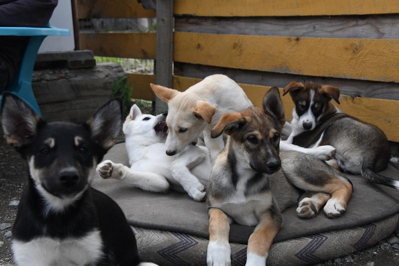 Puppies are waking up. |
 This race dog loved Papa's dog kissy sound. |
 These dogs are in training to be race dogs. |
 |
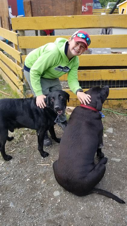 Big boy muscled a ball away from the other Lab. |
 Trail along the hike to Byant lake. |
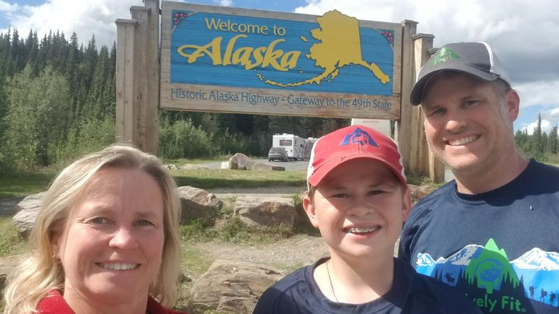
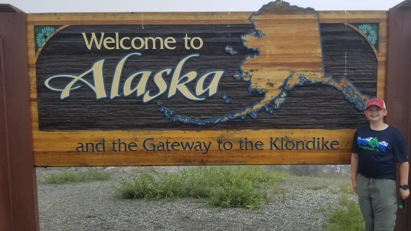 Alaska for the first time! |
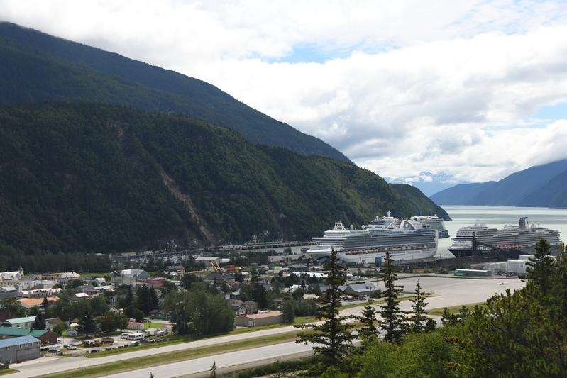
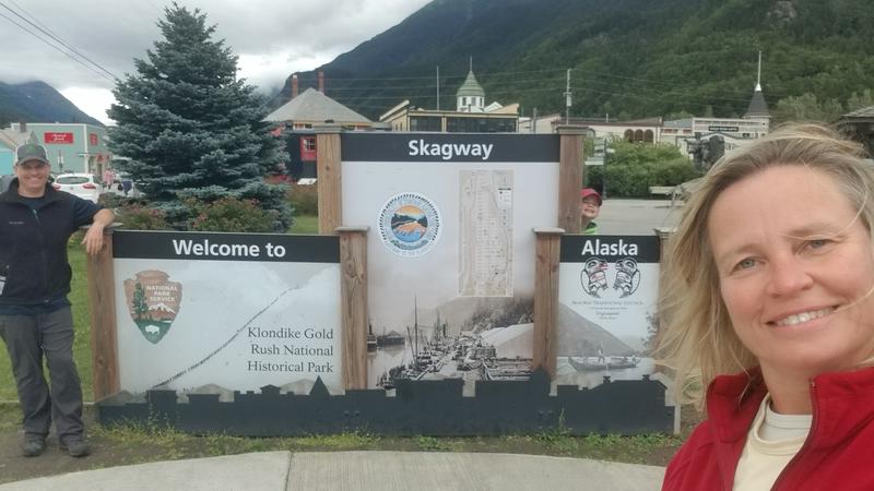 Skagway! |
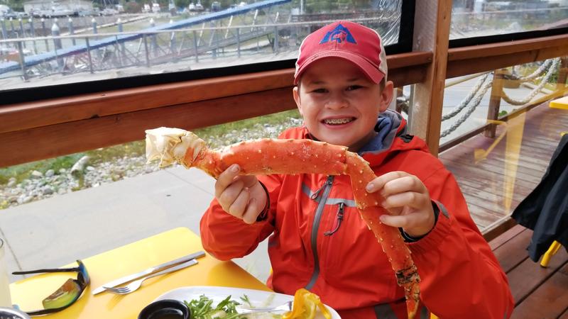 Alaskan Red King Crab! We later found out it came from the Deadliest Catch boats. |
 Red onion saloon for a night cap and some guitar music. |
|
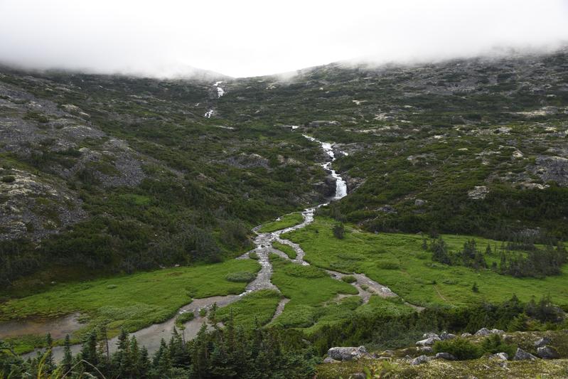
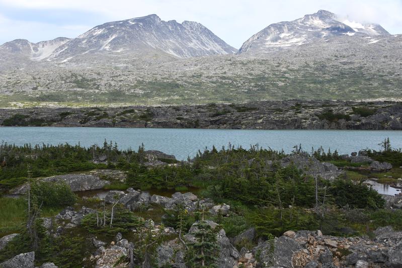
Day 11 (July 26, 2022) We slept in a little bit and enjoyed our beautiful cabin. There was a cute dog that came up on the porch, but he really just wanted to lay on the outdoor couch where Papa and Juju were sitting. We where going to do a big hike to a alpine lake (upper dewey lake) but it was up in a cloud and rainy, so there would not be a good view. So instead, we decided to do a shorter hike on a historic trail callled the Chilkoot trail. This is the same trail miners used during the Klondike gold rush in 1898. We learned that the miners had to carry 2,000 pounds up to the gold fields. That a ton, Literally! In total, it was about 30 trips across 33 miles and 6,000 feet of vertical up a steep pass. We hiked along a river for a few miles and crossed some beaver damned areas of the river on cool boardwalks. After our hike, we had some lunch outdoors at a nice little restaurant as far from the boats as possible. I had a salmon and gnocci, Papa and Juju both had halibut sandwhiches. Then I got ice cream as Papa and Juju had a beer on the outer patio of the Klondike brewery. It was getting late, so we started to drive up to Whitehorse. The Canadian board guards are very skeptical. We could see the mountains in the pass as the clouds had lifted. Back at camp, we had a fire and I had some chinesse take out. |
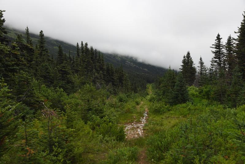
 Taiya River next to the Chilkoot trail |
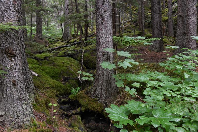 The trail runs through a damp, rainforest like region |
 Bridge across the river on the trail. The miners walked through the river some of the time. |
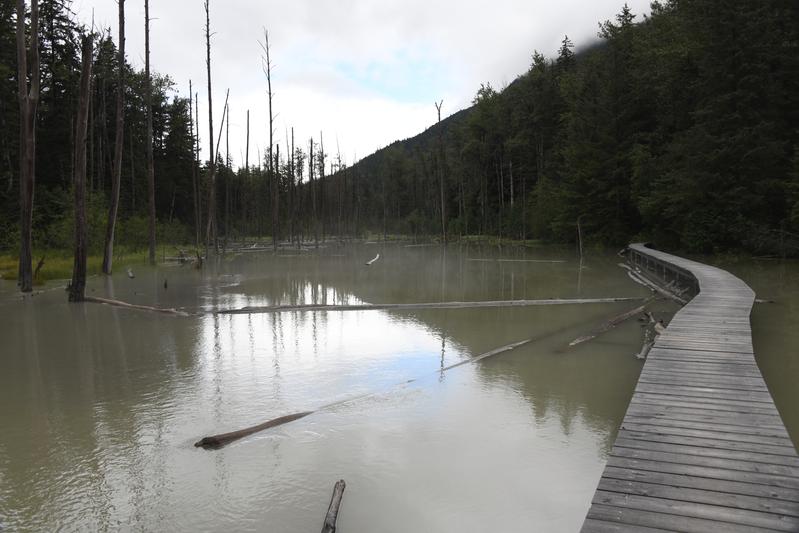 Beaver ponds |
 Skagway from a bluff. |
 International falls just across the boarder in to Canada at the top of White Pass. |
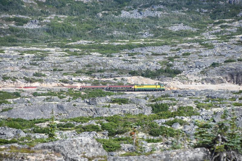 The train crosses the alpine tundra. |
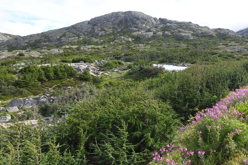 Alpine tundra. |
 Mountains rise over a lake at the top of the pass. |
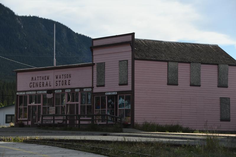 Oldest store in the Yukon. |
|
|
|
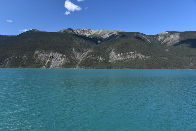
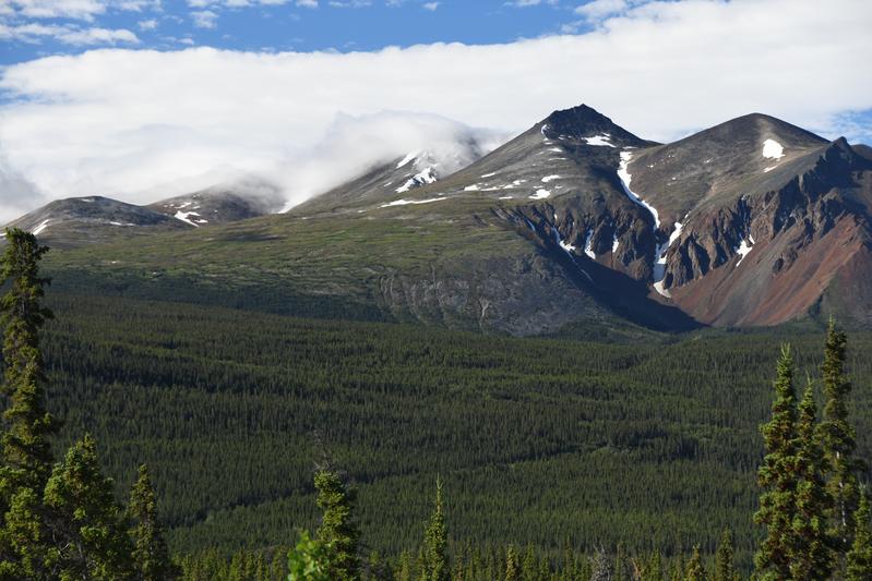
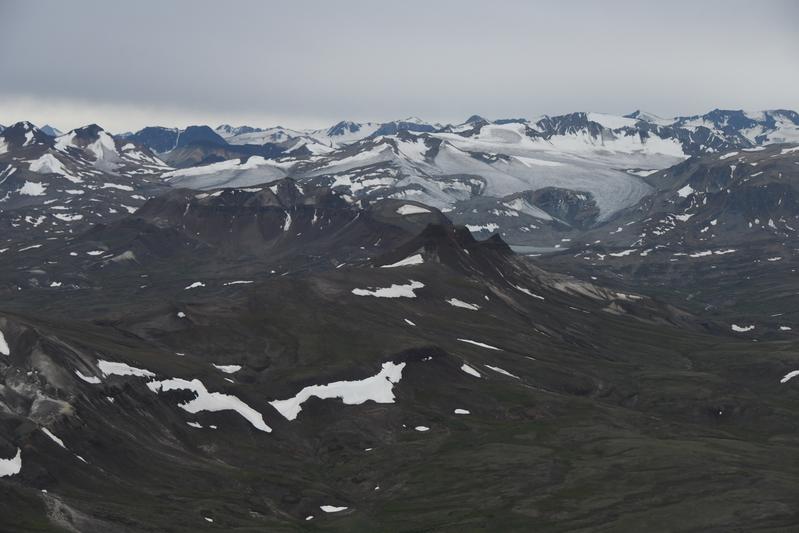
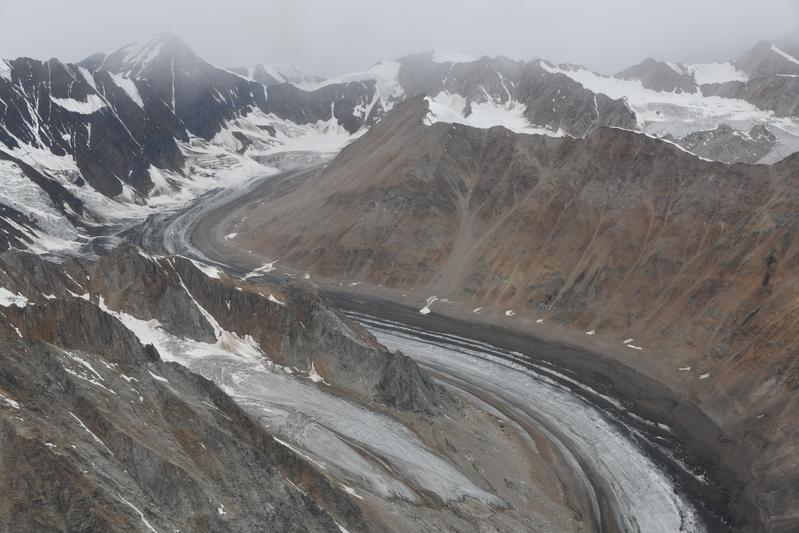
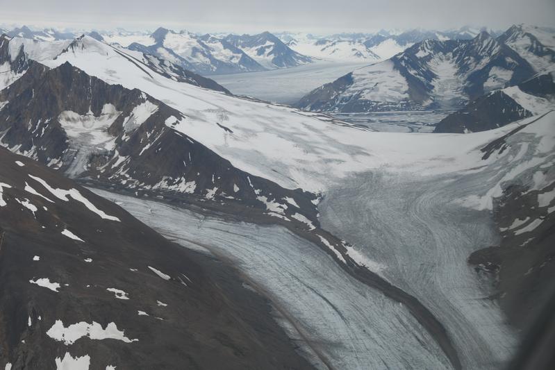
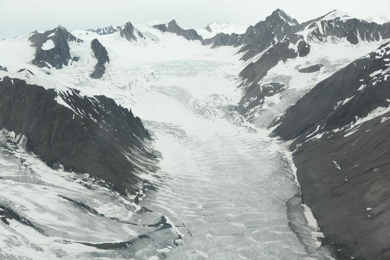
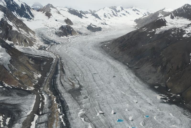
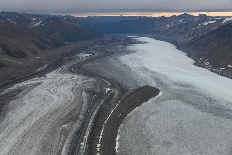
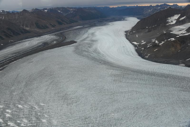
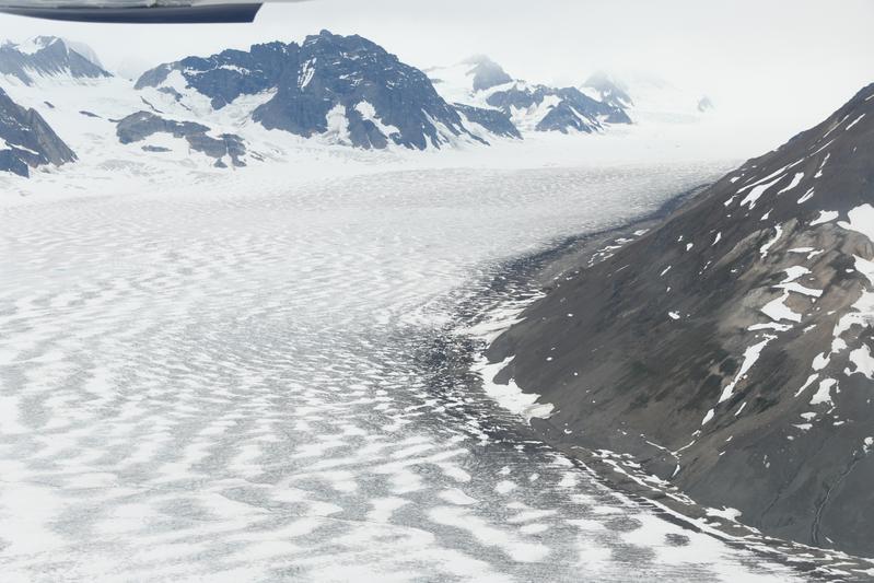
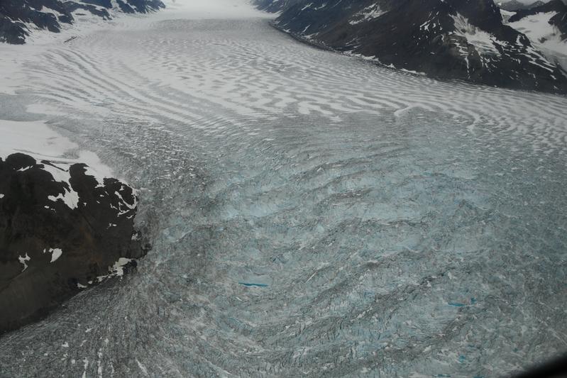
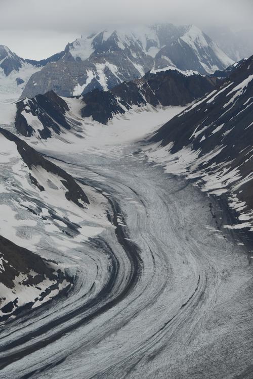
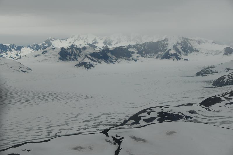
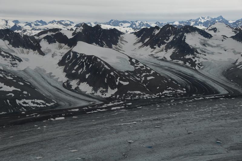
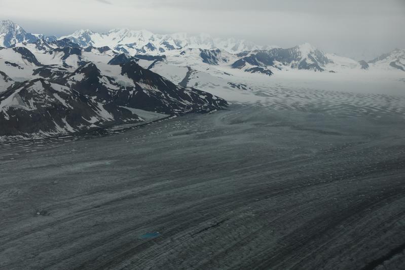
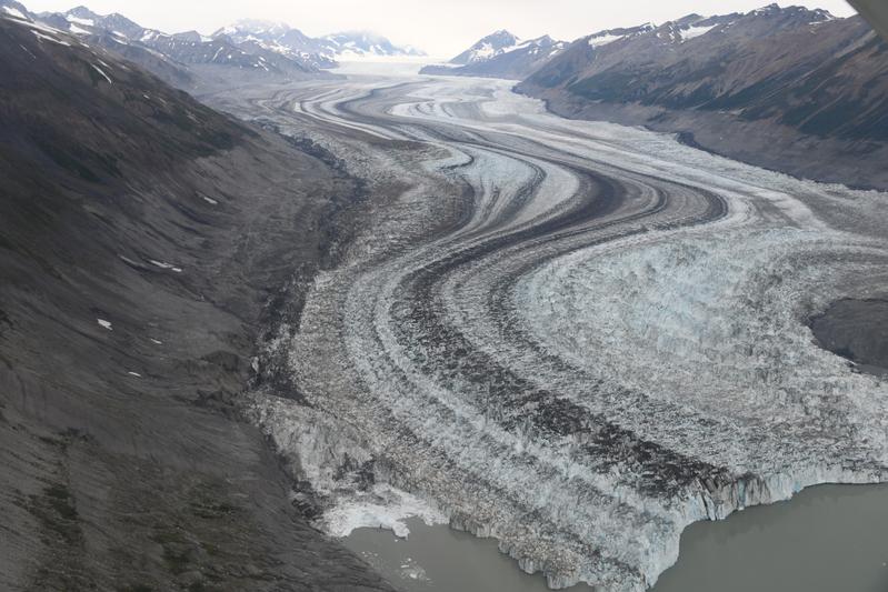
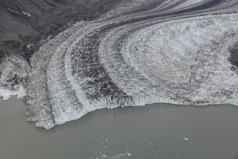
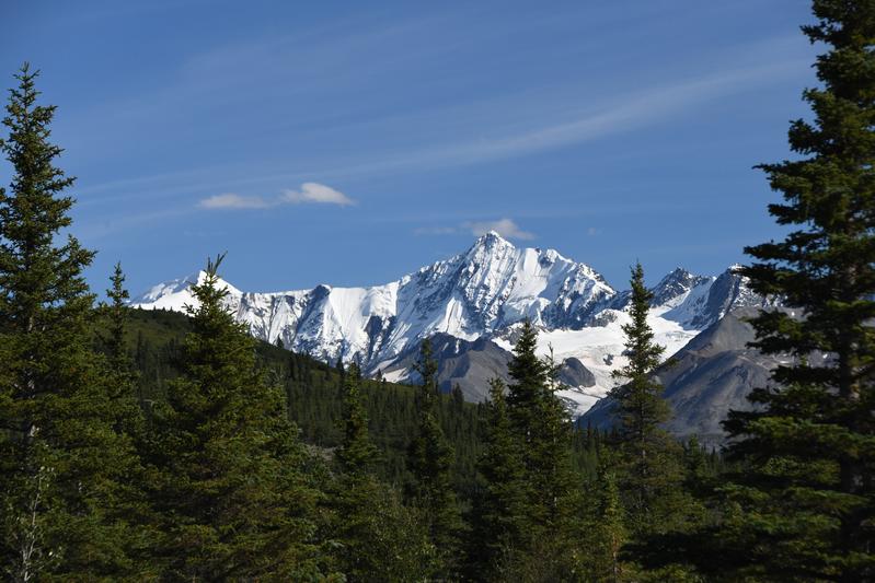
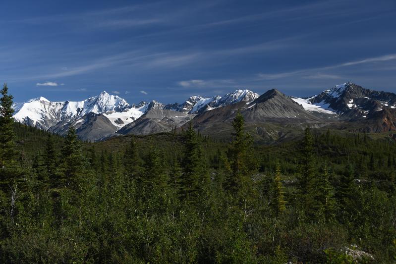
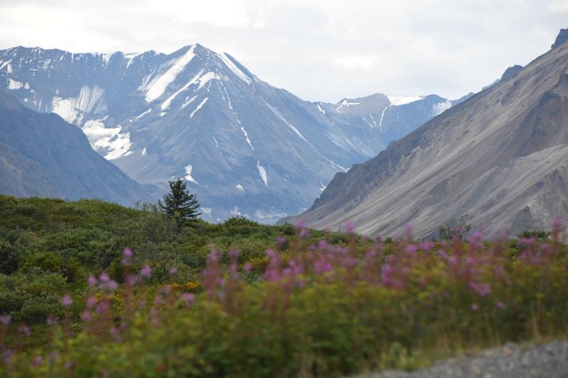
Day 12, Morning (July 27, 2022) We took an awesome air tour of the Kluane National Park. It is home to the largest non-polar ice field in the world. It includes Mt. Logan, Canada's tallest mountain. We took off in a small plane from a dirt runway that was built in 1942. We flew into a valley and up in to the icefields. We could see the glaciers flowing down the valleys, the ice field at the top that feeds the massive glaciers. This works like a lake and a river, it is just that everything is frozen. When the frozen lake at the top overflows, the ice starts to fall and move down the mountain. It was breathtaking! It was an overcast day and the air was not bumpy. Our pilot Stuart explained the sights as we went. It felt like we were just hanging in the air. |
 Pine creek, just after takeoff. |
 Glaciers higher in the mountains. |
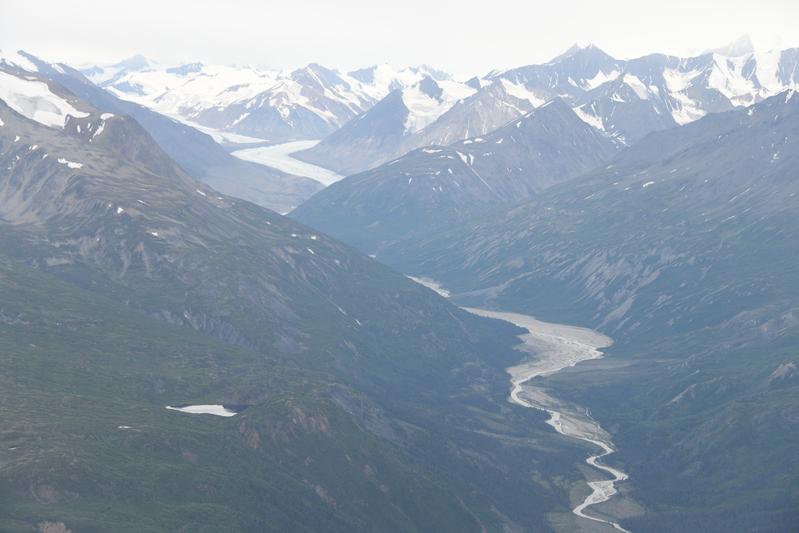 Winding glacier melting in to a winding river. |
 Glacier in its valley. |
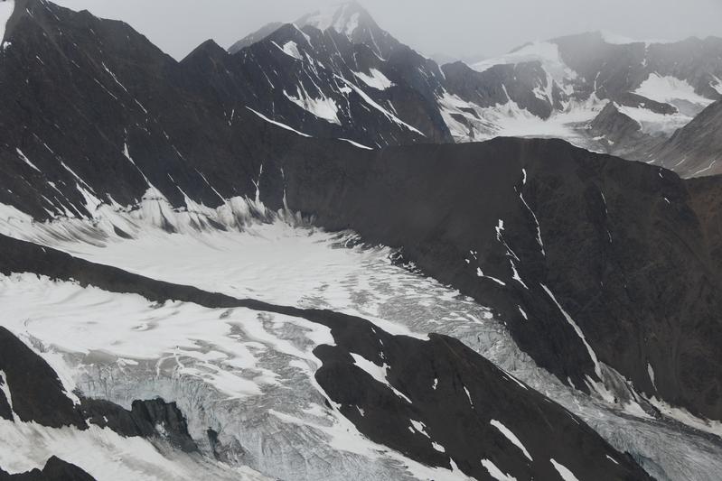 Ice field basin begins flowing down the mountain. |
 Two glaciers joining and a huge glacier in the background. |
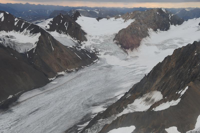 Ice fields feeding a glacier. |
 Better views of an ice field. |
 Debris streaks swirl on the glacier |
 Glacier works its way down. |
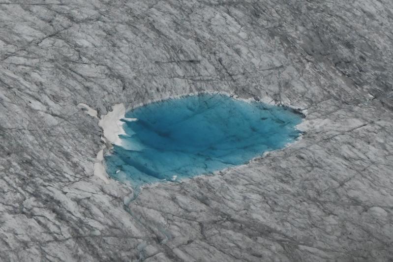 Melt pool shows off the blue of the glacial ice. |
 Glacial till piles are more exposed as the glacier recedes. |
 A larger glacier is joining on the right. |
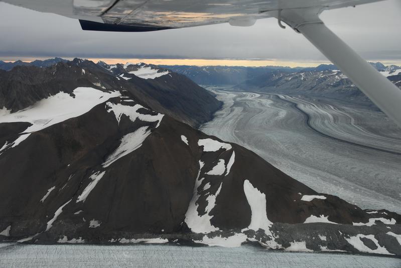 The plane offers an exciting view. |
 Ice field is identified by the flowing snow on the surface. |
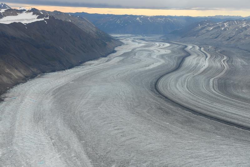 Glacier flows like taffy. |
 As the glacier flows down step slopes, it breaks in to huge blocks. |
 Glacier starting to flow from an ice field. |
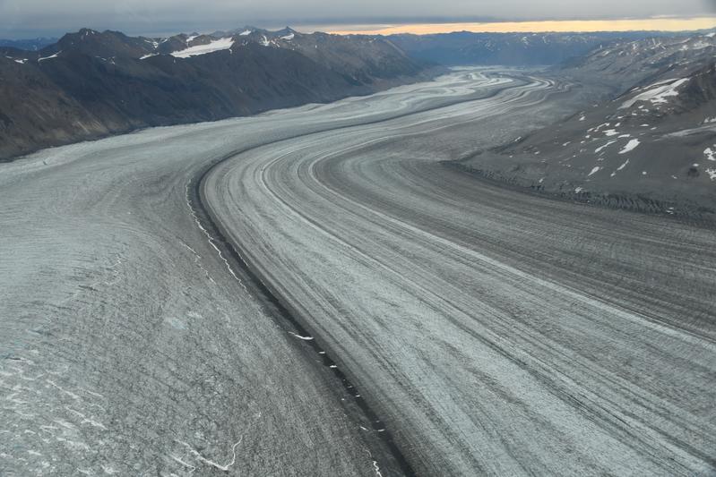 Glacier superhighway. |
 |
 Huge ice field deep in the park. |
 Two galciers feed in to a much larger flow. |
 Ice field gives birth to a massive glacier. |
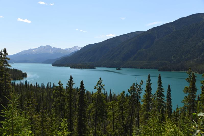
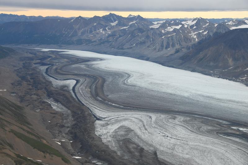
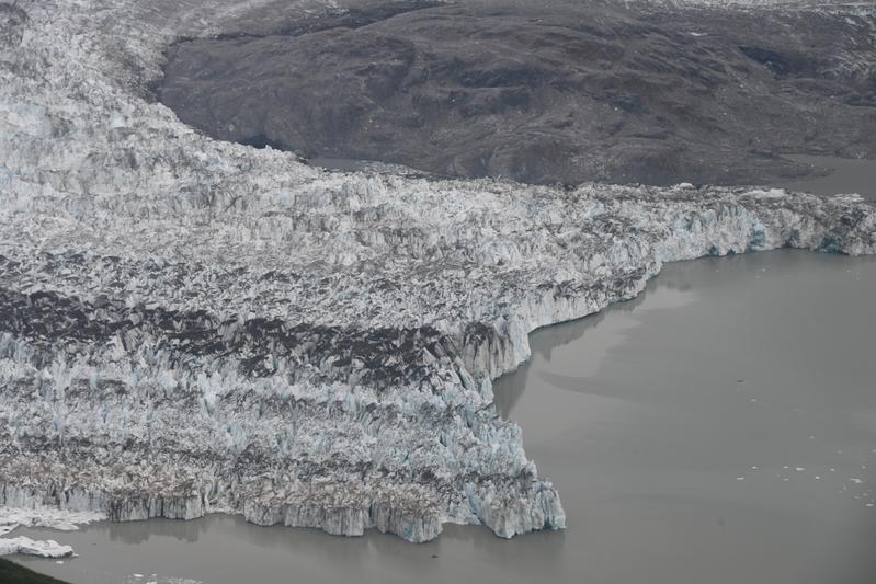 The Lewis glacier ends at a large lake. In 2010, this glacier surged 4 km across the lake. |
 The Lewis glacier bends and curves around an island of rock. |
 |
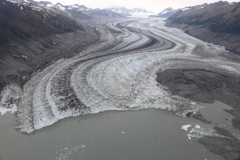 The extent of the Lewis glacier. |
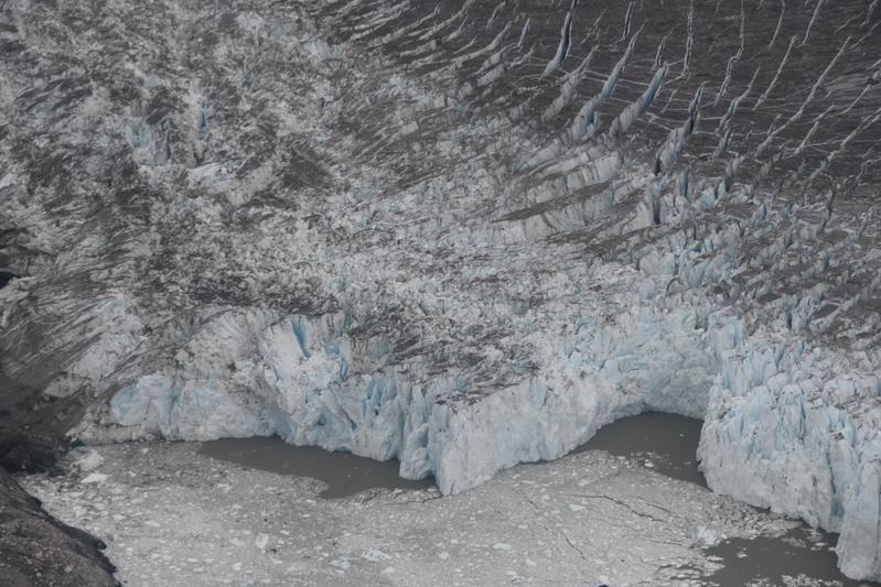 The edge of the Glacier cracks and crumbles. |
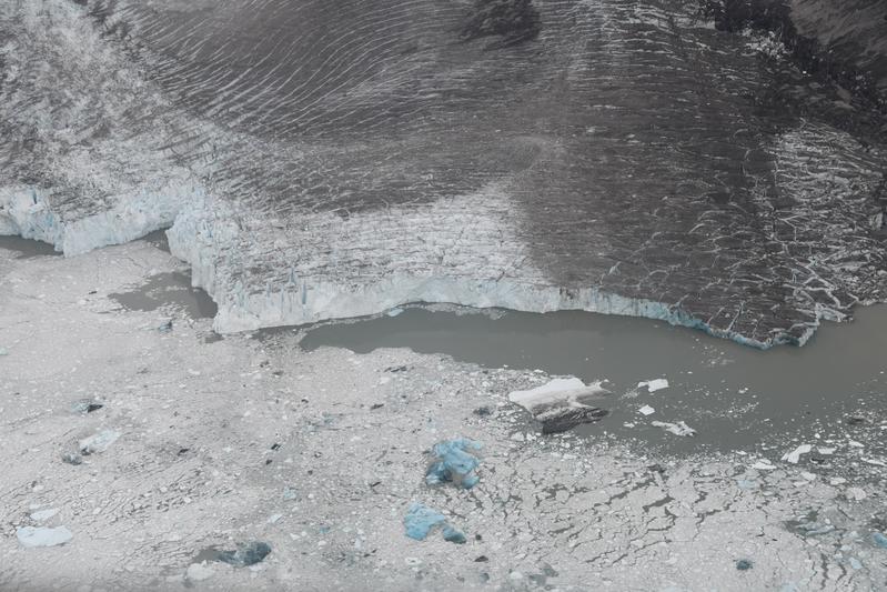 Huge iceburgs float in the lake. |
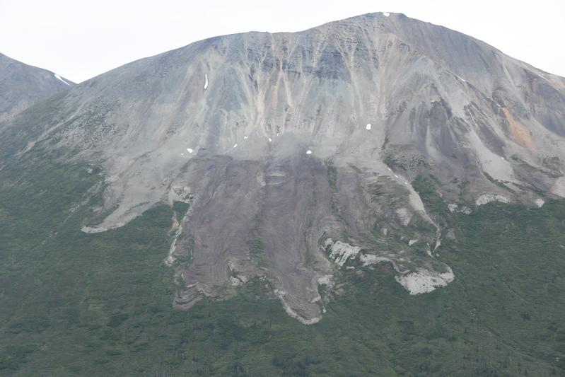 A rock glacier. These are made of rocks frozen together that move down the mountain similar to an ice glacier. |
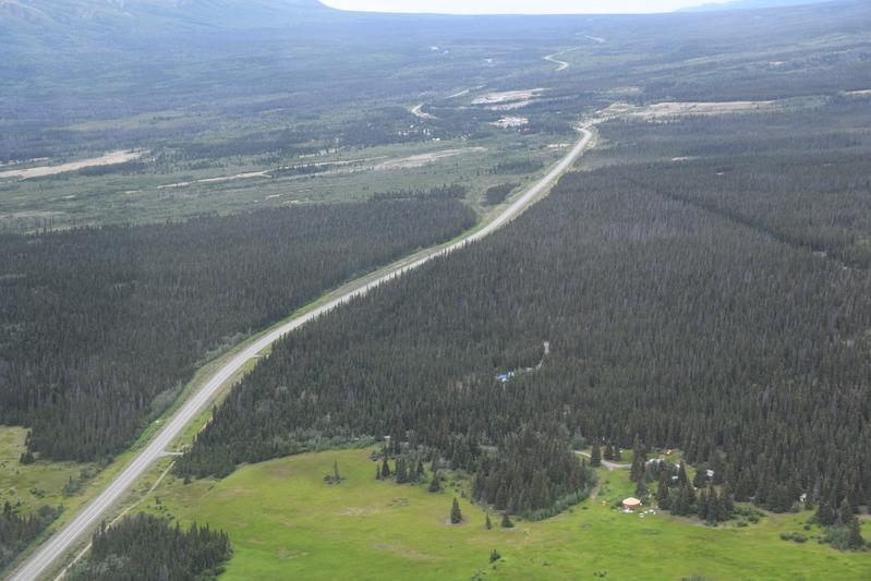 The Alaskan Highway winds toward Alaska. |
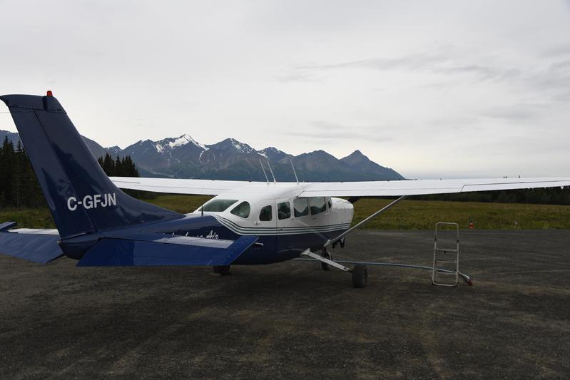 The trusty plane. |
|
|
|
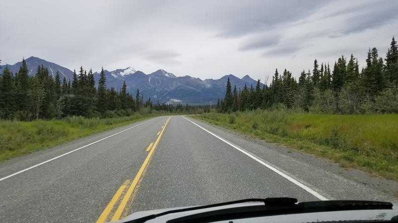
Day 12 (July 27, 2022) We started driving super early, but I kept sleeping! I didn't know it, but we had an early reservation for a plane flight over some glaciers and had to get to Haines Junction on time. There were some elk on the side of the road, but no time for stopping. We took our exciting flight (see above). To relax after the excitement, we had a snack at the Village Cafe in Haines Junction, which was super nice. We had a long drive ahead still to get to Tok. We saw a big grizzley bear chomping flowers next to the road and we stopped to watch him. The road on the Canadian side was wavy from frost heaves with long sections of gravel road. We had to slow to 20 mph for much of these sections. There was a forest burn area, but the fireweed had filled in making for a stark, pink landscape with refections in the lakes. Unfortunately, no safe place to stop for a photo. We made it to Beaver Creek, the most western town in Canada! We made it to the border with Alaska, and are now 1984.6 miles from our start. They had a swath cut in the forest for as far as could be seen. How would you like that job?! After 90 miles of pothole madness, we swerved our way in to Tok. Papa had to keep it slow and dodge the potholes like we were in a sports car, rather than a 20,000 lb hippo. We made a nice fire at camp and enjoyed some food truck Thai/Chineese food. |
 Driving toward the Kluane mountains. |
 View of glacier from the highway. |
 Grizzly! |
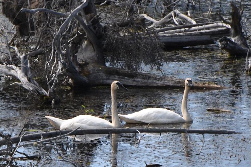 Arctic swans. |
 Back in 'merica! See the border run to the horizon? |
 The RV made it to Alaska! |
|
Day 13 (July 28, 2022) Today was our day in Tok. We started off with some Sourdough pancakes. We spoke to an older woman running a gold store. Her family had been mining gold since the 1890s and still ran a mine now. We talked to her about the history and looked at the family album of mining practices. She had a nugget valued at $4,800. We went to a visitor center where we saw some cool stuff. They had a lot of animals for us to see. Then we decided to go on a hike to an overlook. The hike was about 3 miles round trip with 800 ft of gain. The overlook was pretty. On our way down we saw a badger den, but no badgers. After our hike we went to Mukluk land. A Mukluk is a boot. The place was ran by a very nice old lady. We started with some skeeball. Then we went around the loop and saw a lot of old stuff like, old cars, old engines, and old toys. We went into another building and got some popcorn and cotton candy. The cotton candy was only 50 cents! We got to see him make the cotton candy right there. After some delicious snacks we saw more big engines and old cars. Then we saw a bouncy house and we all went inside. It was a lot of fun to bounce around. Papa kept pushing me, but I got him back! Then, we played some bush golf, which is just mini golf but in the forest. After Mukluk land we had some chores to do. Papa and I washed the car and Juju did laudry. After our chores Papa and I started to cook our steaks. We decided to cook them over the fire. They had and amazing crust on them! After our steaks I built us a better fire and we had smores and leftover rhubarb pie. Papa stayed up to look for some Northern Lights. |
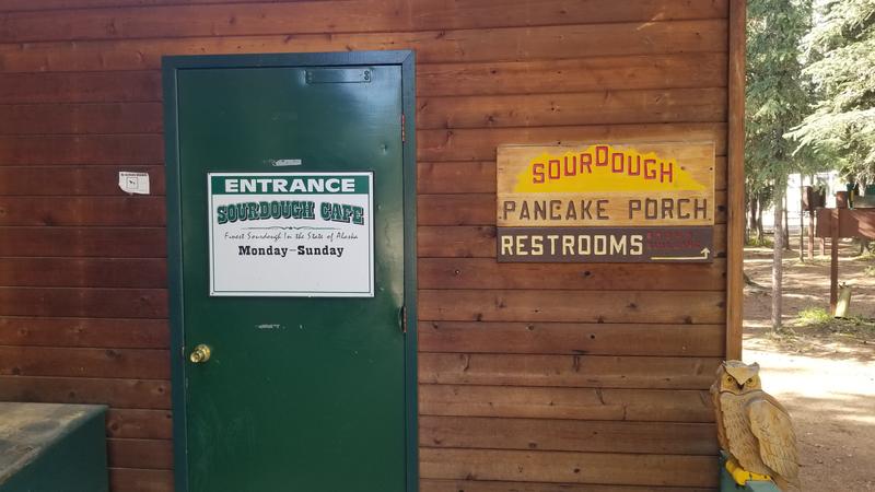 Sourdough pancake porch! |
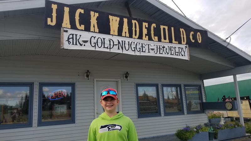 Gold nugget store. |
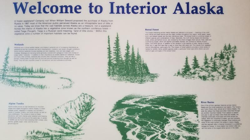 Description of terrain in interior Alaska. |
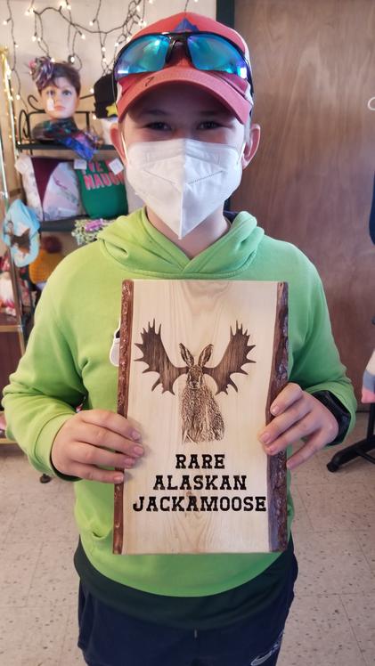 Jackamoose, cousin to the Jackalope! |
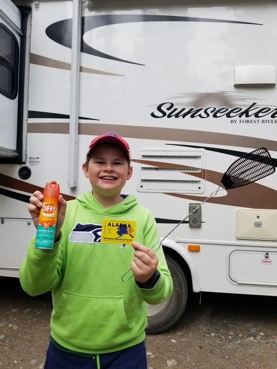 Mosquitos are so big, I needed a hunting license! |
 Tok river valley from our hike. |
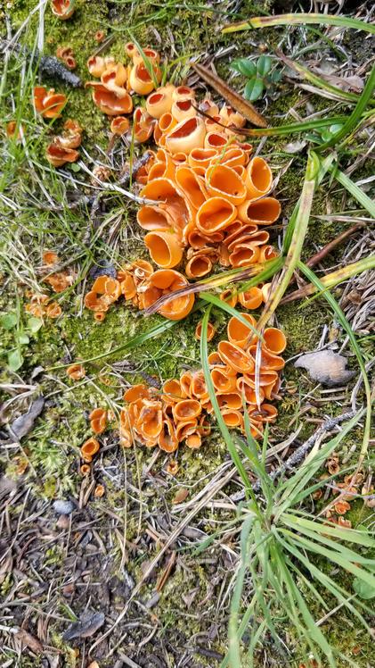 Interesting lichen. |
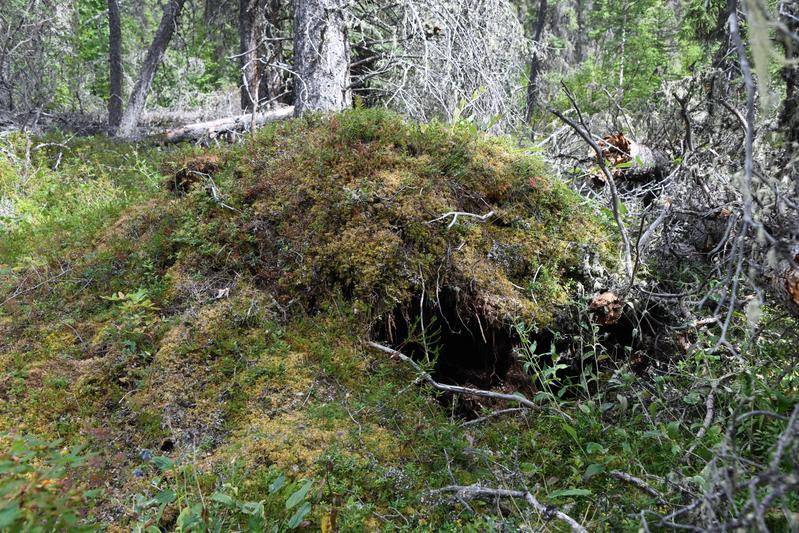 Looks like a den, maybe wolverine, bear? |
 Boreal forest on the hike. |
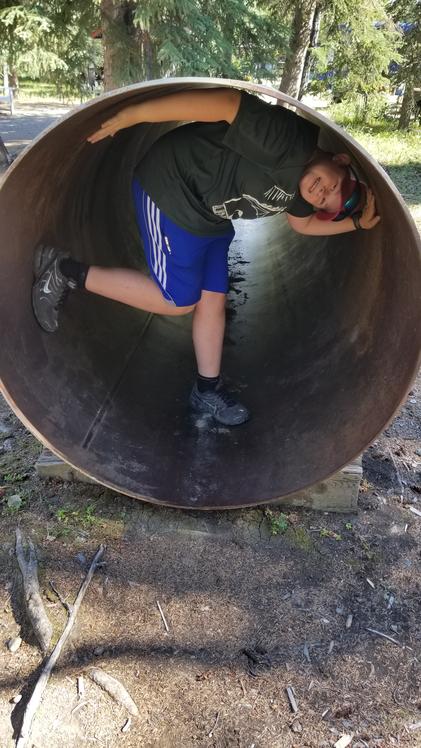
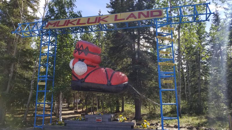 Mukluk land! |
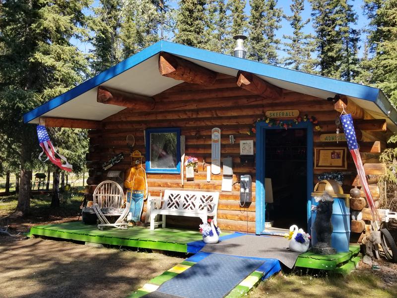 Main office of Mukluk land, housing skeeball and other fun items. |
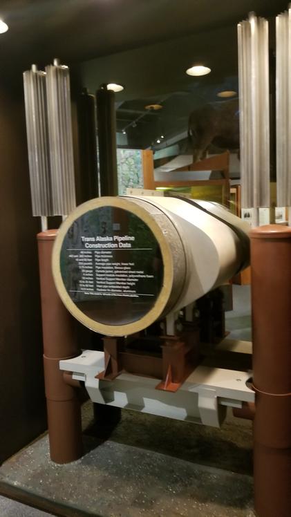
 Trans-Alaska oil pipeline. |
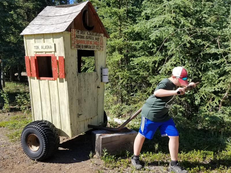 Outhouse racing. |
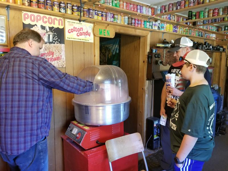 Old fashioned cotton candy. |
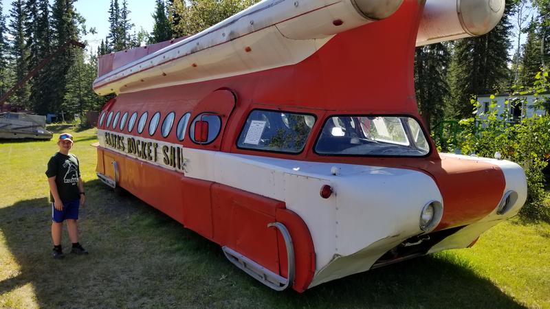 Santa's rocket ship! |
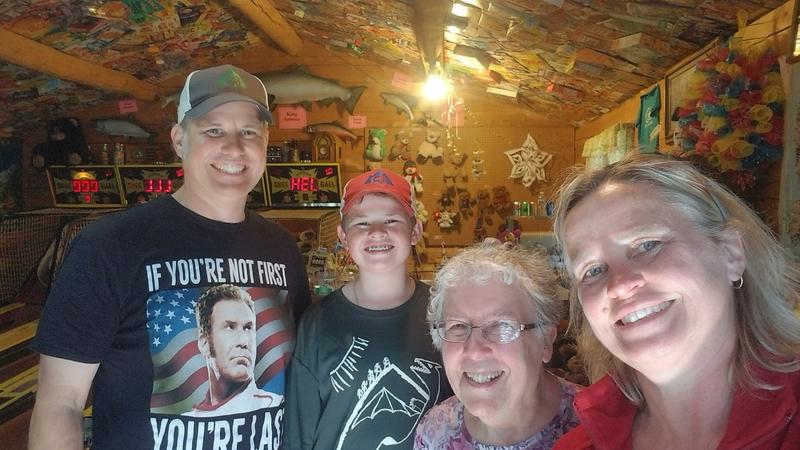 Beth is the star of Mukluk land, forever a teacher helping kids learn and grow. She and her husband started Mukluk land while working in Tok as teachers. Her son helps her run it today. |
 Campfire at sunset. 10:40 pm! |
 Watching for northern lights, but this is the darkest it will get. 01:30 am! |
|
Day 14 (July 29, 2022) Today we started our drive to Fairbanks. We drove a couple hours to a town called Delta Junction, the offical end of the Alcan highway. The Alaskan highway is 1,422 miles long from Dawson Creek to Delta Junction. We are 2,184 miles from the start. For lunch we had burgers at a drive in, enjoying the nice weather. Then we went to a cool hike to a glacier. On the way to the hike there was a long wait for a pilot car to lead us through a construction zone. I had to make a pit stop while we waited in line. The hike was 3 miles to the front of the Castner glacier. The foot of the glacier was covered in rocks, but there was a really cool ice cave. You could see the blue in the ice. Papa found a piece of ice we could taste and he ate the rest of it. I wanted to climb up the rocks to the top. The rocks where so slippery and I kept sliding. Ice was just a few inches below the rocks on top. At the top, you could see the rest of the glacier. The glacier had tilled up so many different types of rocks, it was a geologists paradise. When we got down, we went to the back of the cave where we saw a big stream gushing through the cave, creating the major part of the outflow from the glacier. The water had so much silt in it. We hiked back to the car and made our way back to the RV. We stopped a brewery and shared a pizza on an outside patio. It was good. They put beer in the dough. We started to drive to Fairbanks. The Delta Mountain Range was clearly visible as we drove along the Tanana River. We arrived at camp and went to bed. We are 2,274 miles from the start and 1,523 miles from Dawson Creek. |
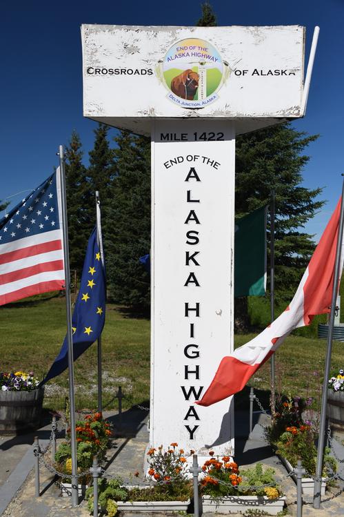 We made it to Delta Junction, AK, the end of the Alaskan Highway! |
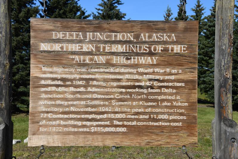 History of the highway. It was built in 8 months in 1942. |
 Burgers and raspberry dole whip at the drive in. |
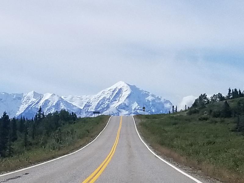
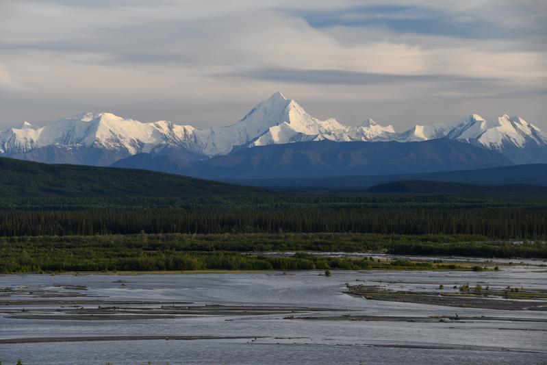
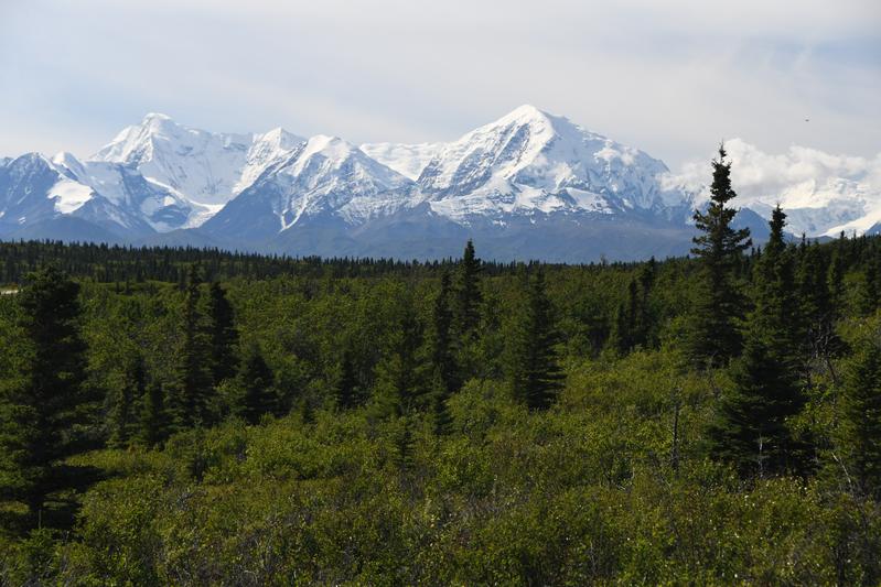 Delta range on the drive down the Richardson Highway to the glacier hike. |
 We could just jump right to the mountain. |
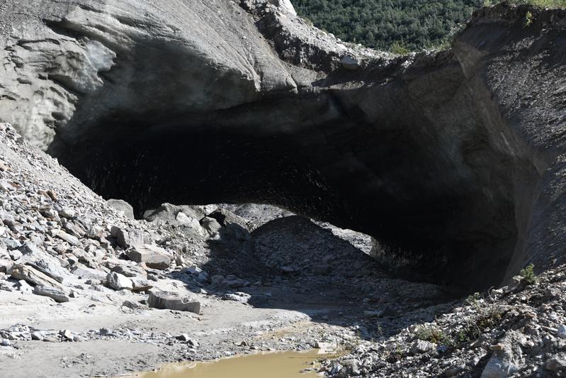 The ice cave at the foot of the Castner glacier. |
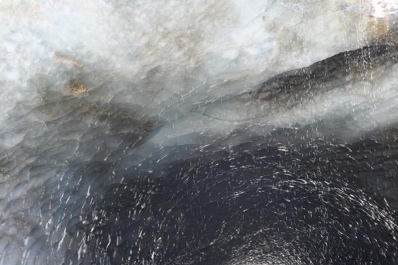 Ceiling in the ice cave. |
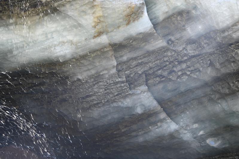 Ice wall with layers of silt and debris with the blue ice. |
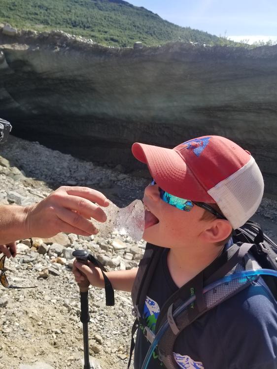 The old ice was tasty! |
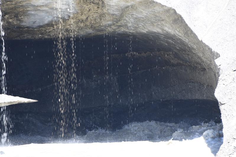 Main river coming from under the glacier on the other side of the ice cave. |
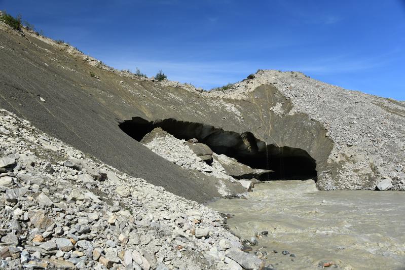 Other side of the cave and the river. This river and silt ran in to the Tanana River, which then led to the Yukon river. |
 A Delta mountain. |
 Part of the Delta Range with the boreal forest foreground. There is another glacier in the upper right. |
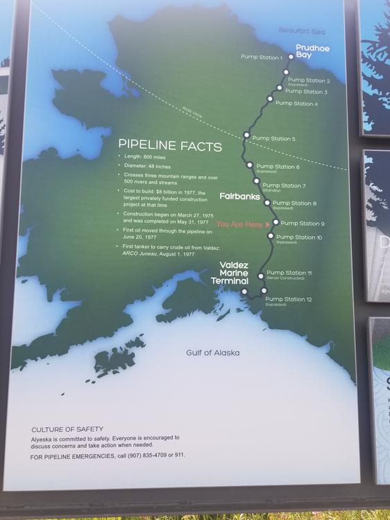 We saw parts of the Alaska pipeline that runs from Prudhoe Bay to Valdez. |
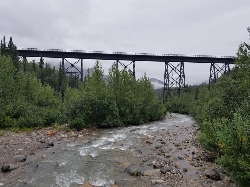
 Pipeline suspension bridge. |
 Delta Range over the Tanana River. |
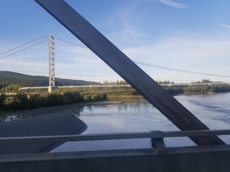
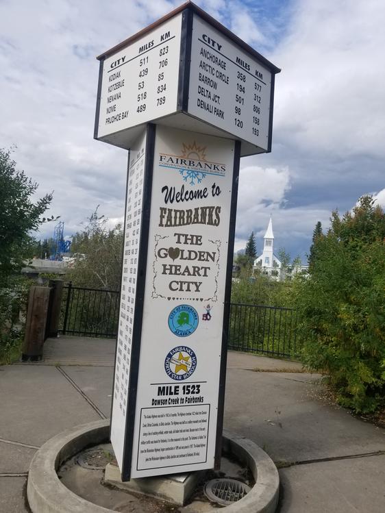 Fairbanks! |
|
|
|
Day 15 (July 30, 2022) Today, we drove to the Arctic Circle! It was a grueling drive up the 415-mile long Dalton Highway that goes all the way to the north coast of Alaska. The drive to the artic circle was long but it was super cool to be able to say that I was in the artic circle. The road was super tough to drive on because it was a lot of lose gravel. We drove on the same highway that the Ice Road Truckers drive on. On our drive we saw the pipeline that brings crude oil from Prudhoe bay to Valdez. Once we got to the Artic Circle sign, we got our photo and decided to go a bit further to see if there was a good place to eat. It was cool to go across the Arctic Circle, my first time. After some snacks we decided to head back. On our way back from the circle we saw a grizzly bear digging up some flowers. We had nice views up and down the hills and across the valleys. We were in permafrost regions and alpine tundra. We got to a place and had chilly and salmon cake sandwiches while I fished for salmon in the Yukon river! We made it back from the drive safely and went to a brewery in town. We had some food from the chowder house to go with Papa and Juju's beer tasting. In camp, I tried to fish while Papa and Juju enjoyed a snack at the edge of the river. A beaver came up on the bank near me, but soon swam off. A bald eagle flew up the river, presumably to nest for the night. |
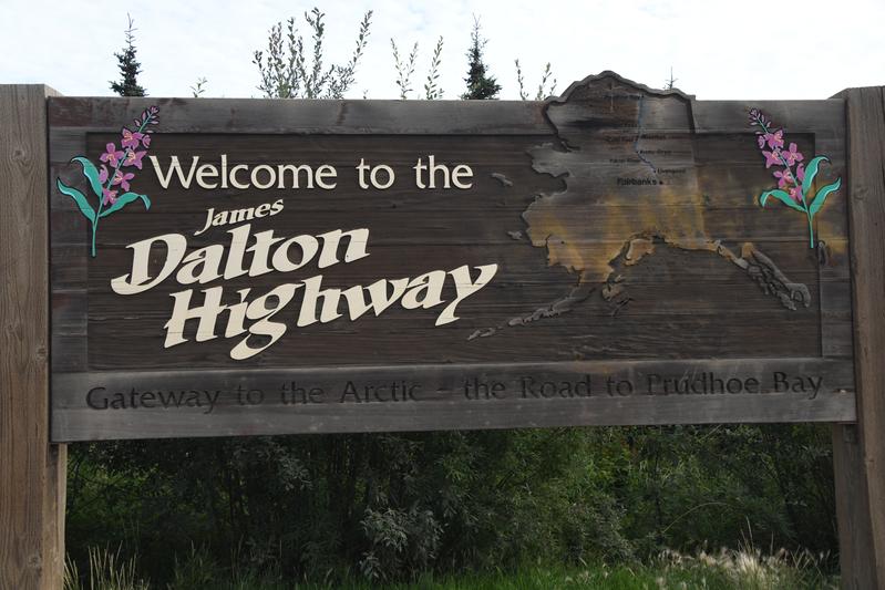 Start of the Dalton Highway that goes from Fairbanks all the way to the north coast at Prudhoe bay, 415 miles away. |
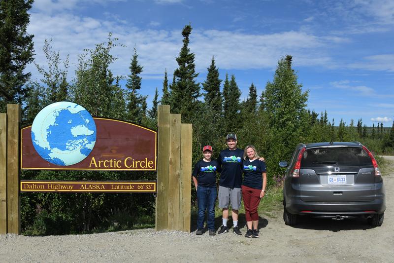 We made it to the Arctic Circle! |
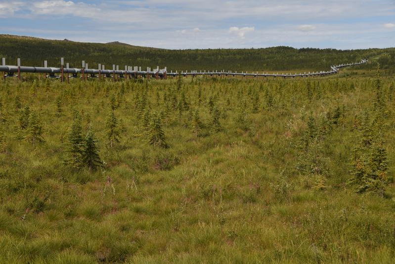 The oil pipeline ran along the road in most places. |
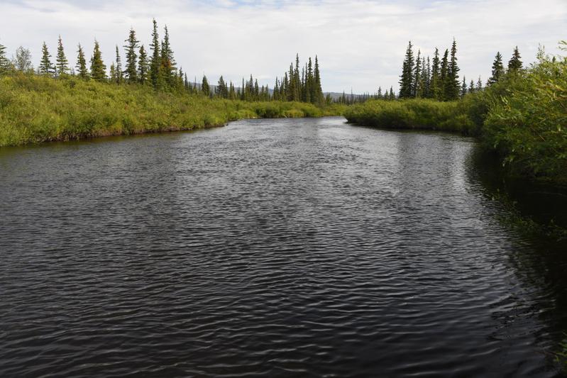 Nice river through the tundra. |
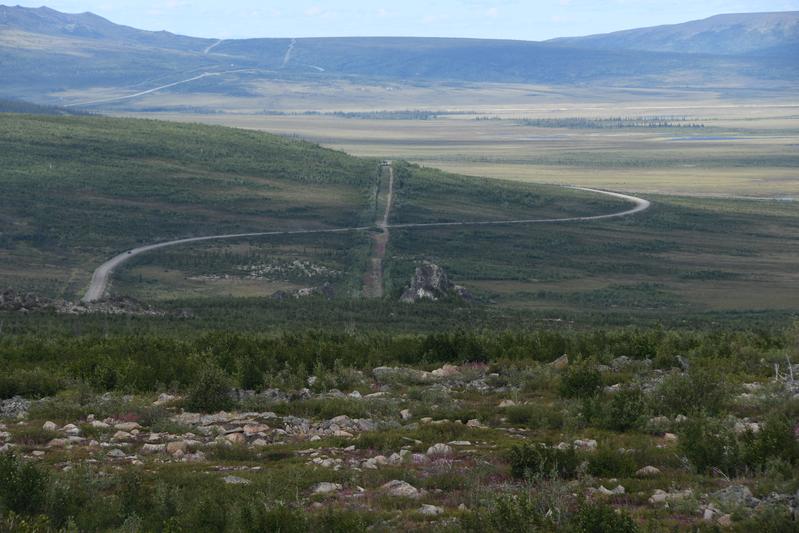 Artic tundra with the road crossing the pipeline. |
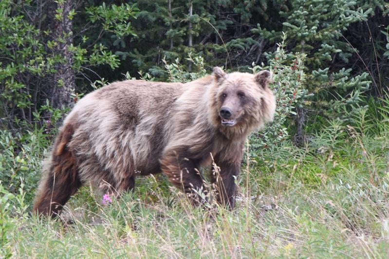
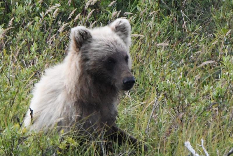 Grizzly bear. We learned that Grizzlies and Brown bears are the same species. The bears tend to be larger in the coastal areas. |
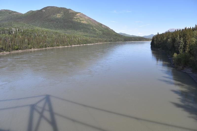
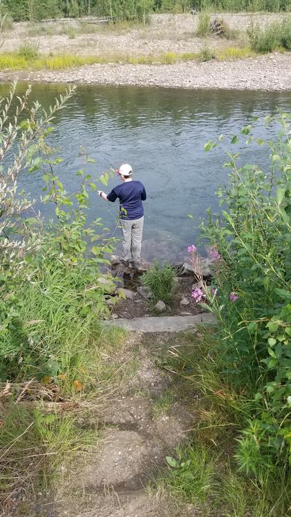
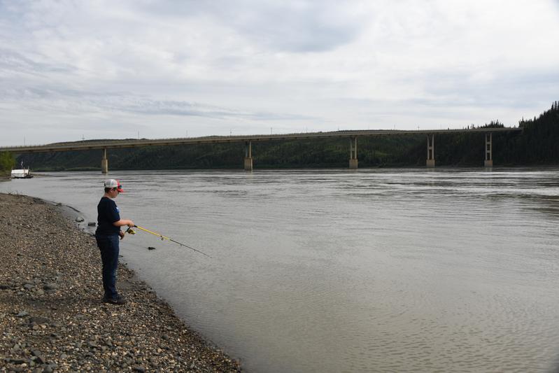 Fishing for salmon on the Yukon river! This is the only place in Alaska where you can drive across the Yukon. |
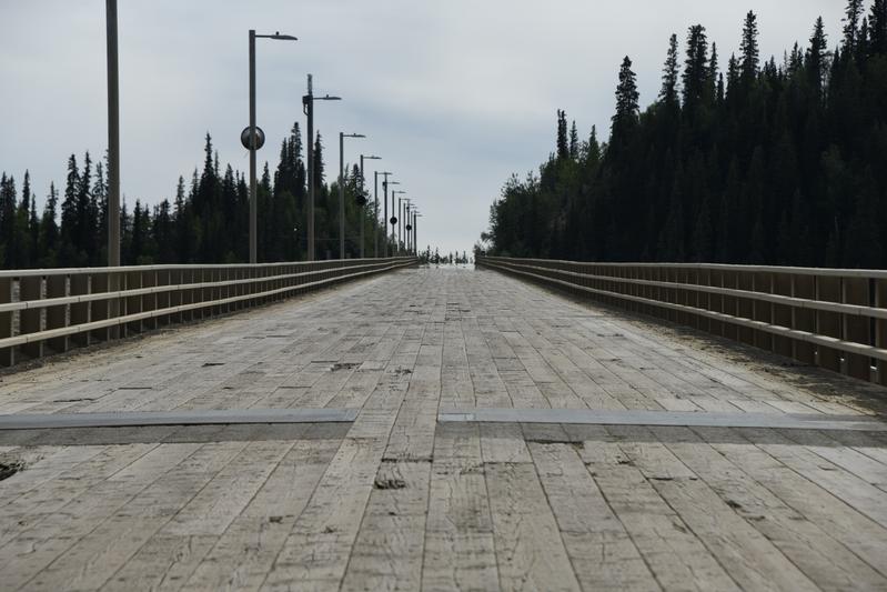 The bridge over the Yukon has a wood deck. |
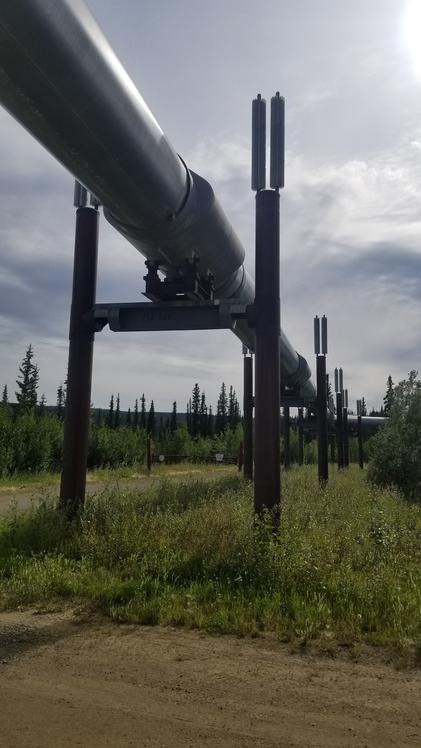 Pipeline! We learned that the support poles contain amonia heat pipes to pull heat from the bottom of the supports to prevent melting of the permafrost. |
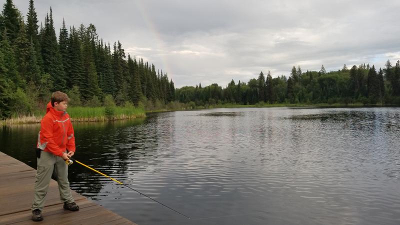
 The Chena river back at camp in Fairbanks. I tried some fishing and saw a beaver and a bald eagle. |
|
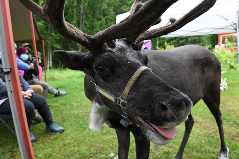
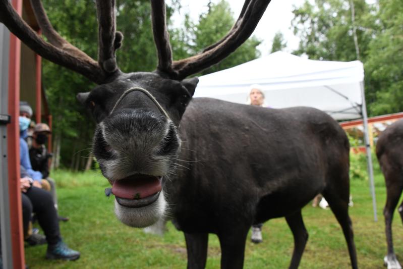
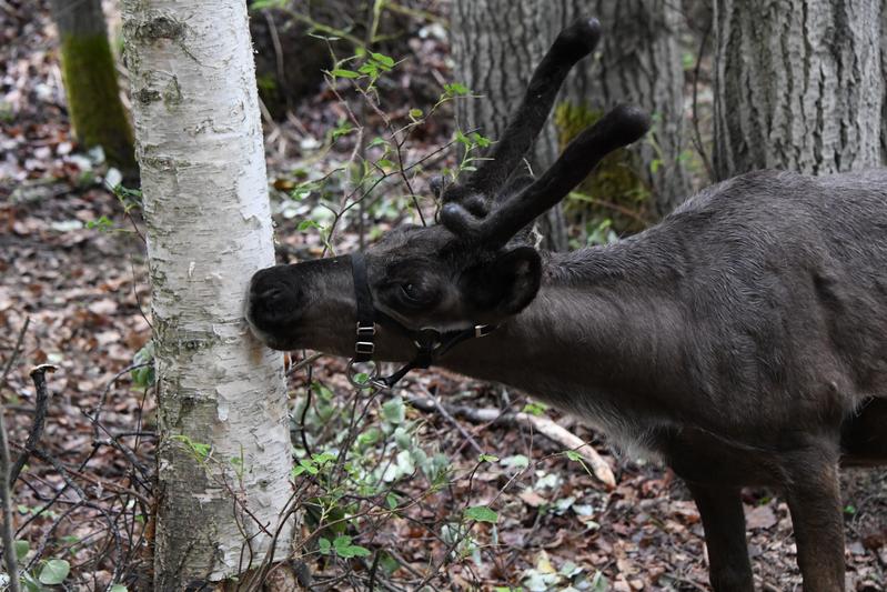
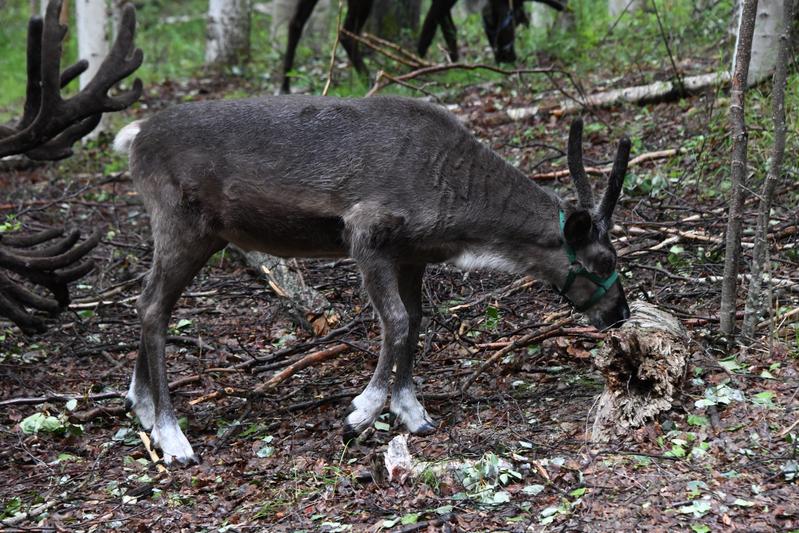
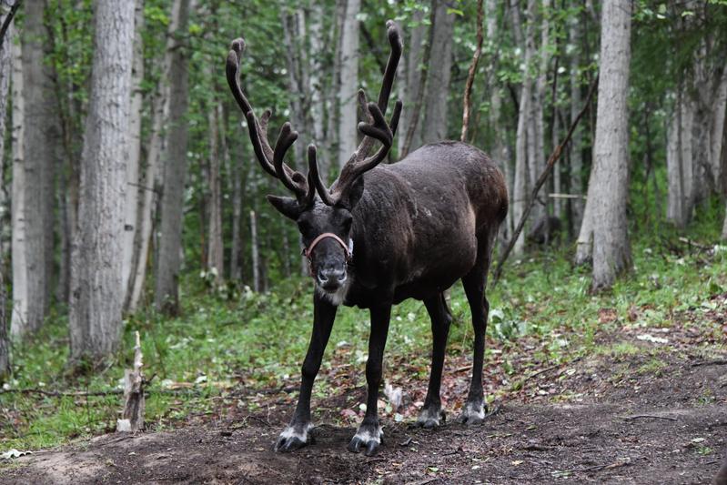
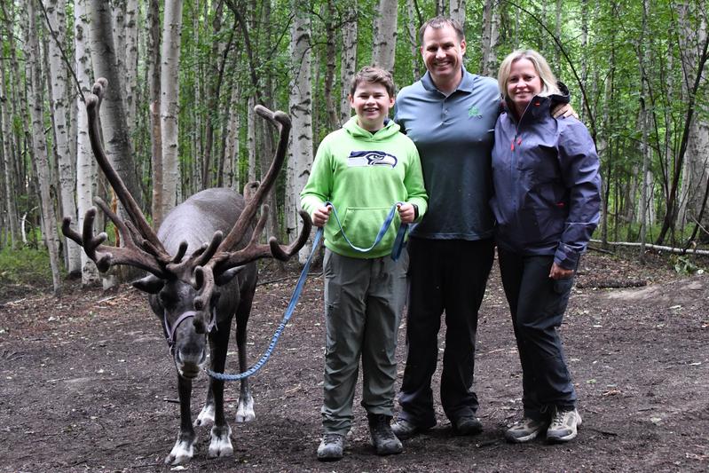
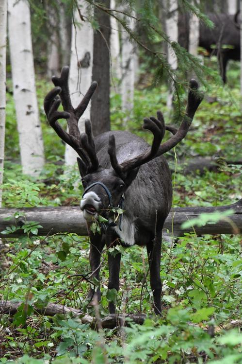
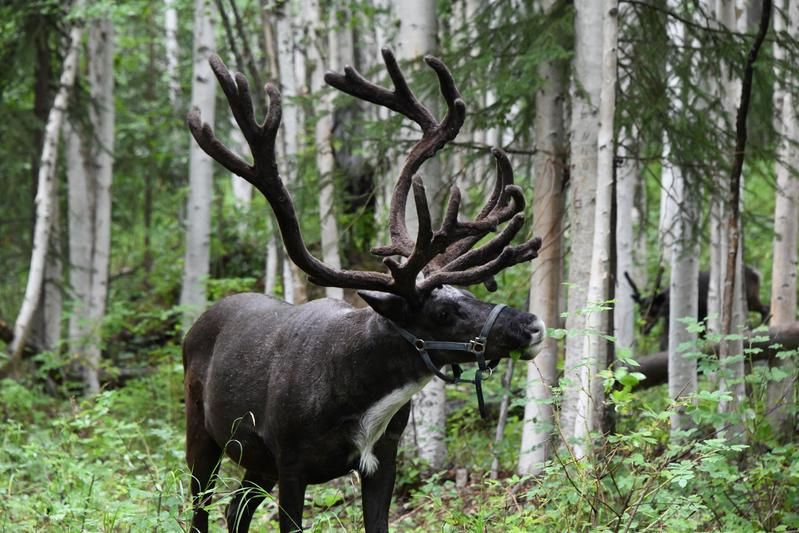
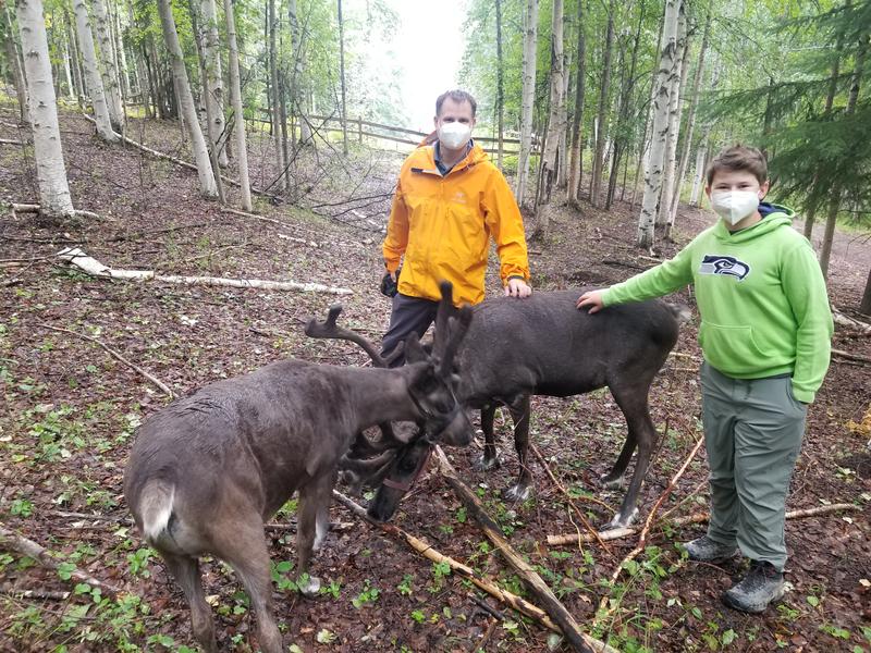
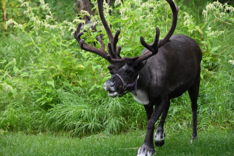
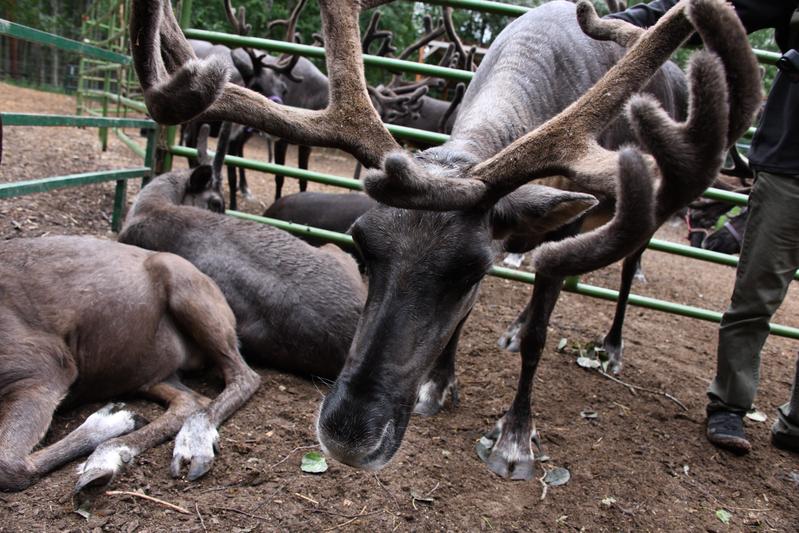
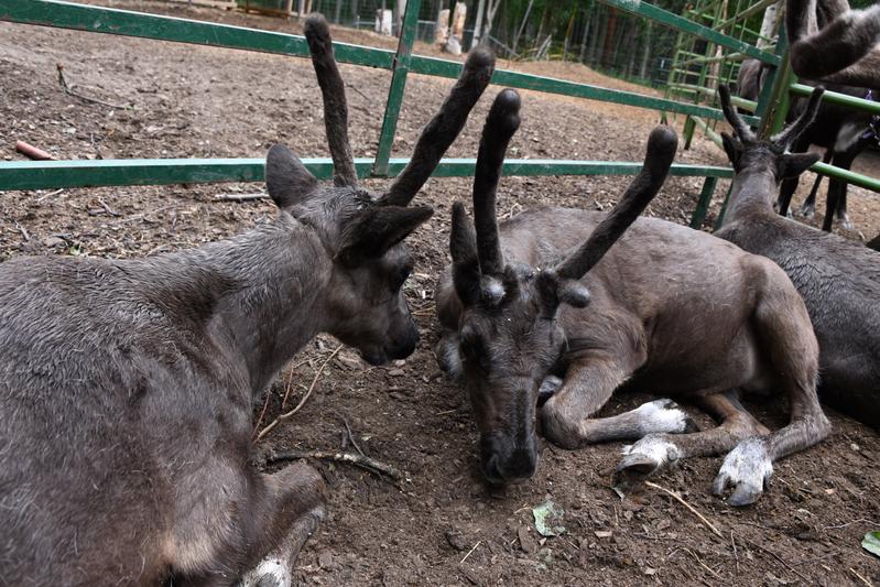
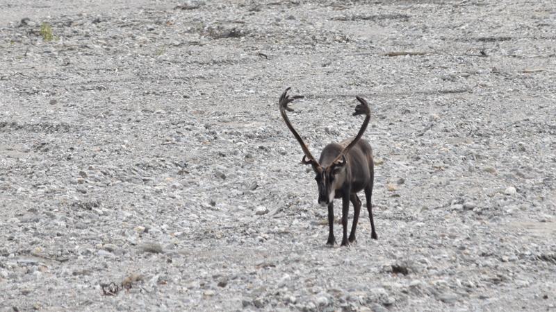
Day 16 (July 31, 2022) We visited a Reindeer ranch! The herd of Reindeer surrounded us as we learned about them and had a nice walk in the woods. When the reindeer came out, they had so much energy they kept running around us. Once they warmed up to us, we could pet them, and feel their lush, soft fur. They where so soft and oilly. They had their dark summer coats, but would soon start to grow their winter coats. Their antlers wher covered in fuzzy, short fur called velvet, which helps them grow. We learned that her daughter wanted to get a pony, but they got reindeer instead after she raised enough money by selling cookie dough. The had funny personalities, and there was always something going on between the reindeer, reindeer games I suppose! Since it was cool and rainy, they were energetic and ran all around. They still became overheated and stopped right in front of us to pant and cool down. It was a great experience. Afterward, we headed to downtown and had some lunch at a Moldovian restaurant. The food was unique and very good. We walked over to the visitor center and then went to the Museum of the North at the University of Alaska. It had great exhibits to learn about the unique parts of Alaska. We visited the university animal research area and saw a musk ox. We drove up the Esther dome to see some views. We were really tired. Dinner was a simple chicken meal by the river back at camp. I tried more fishing, but again, no luck. |
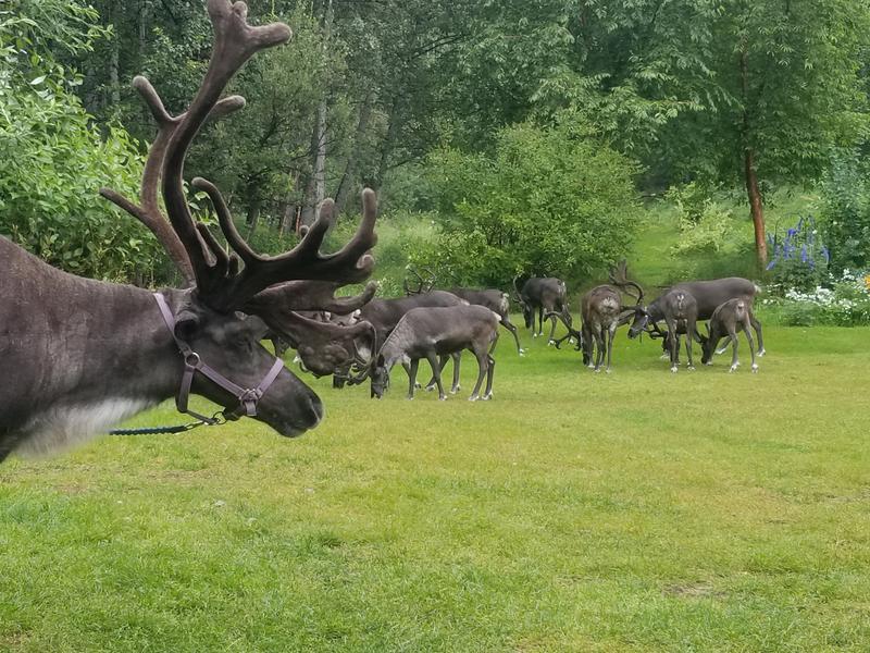 Reindeer! |
 They ran around and got overheated, so they stood right next to us to cool off. |
 Smoochy! |
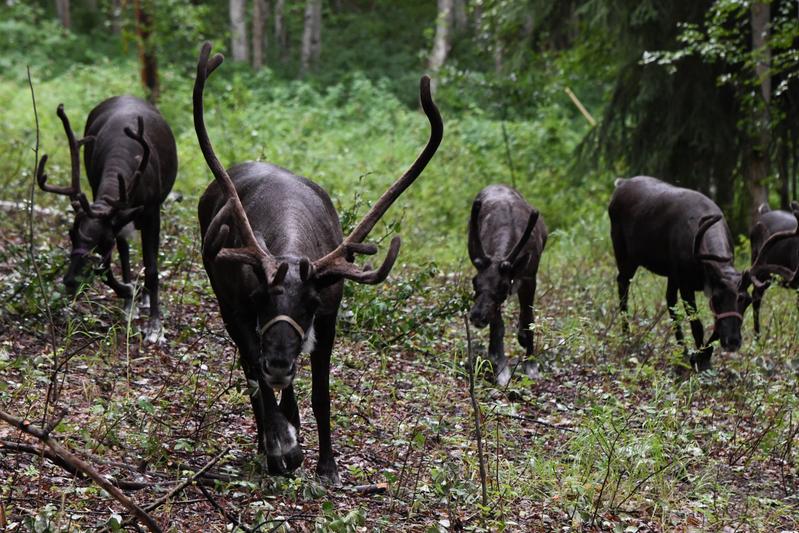 Walking with the herd. |
 3-month old calf checking out a tree. |
 Baby, so cute. They can run on day 2 after being born. They start growing their antlers right away, too. |
 Daisy, is the boss reindeer of the herd. |
 Toby, a 450-lb steer, posing with us. |
 They love eating leaves. |
 Grabbing a snack. |
 When they got used to us, they let us pet them. So soft! In the summer, their hair is 9,000 per square inch, in winter, 15,000 per square inch! |
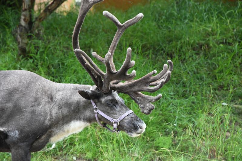 Their antlers re-grow every year. They have velvet on them when they are growing. In early fall (mid-Aug) the antlers harden, stop growing, and the velvet falls off. |
 |
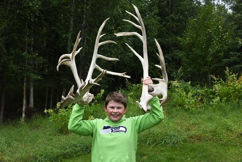 The antlers are so heavy, I can barely hold them up! |
 Mama with the babies. |
 The babies. |
 We went to the museum of the north at the University of Alaska. We learned about the pipeline, permafrost, and the animals and people of Alaska. |
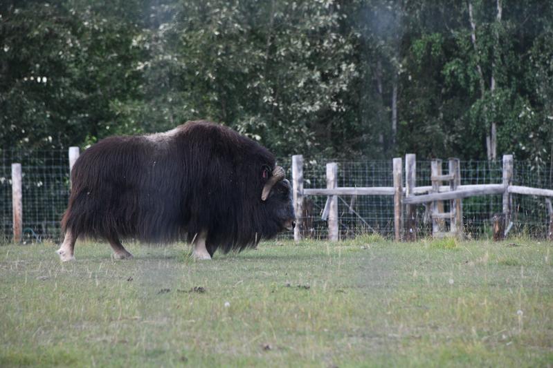 Musk Ox found in Northern Alaska. |
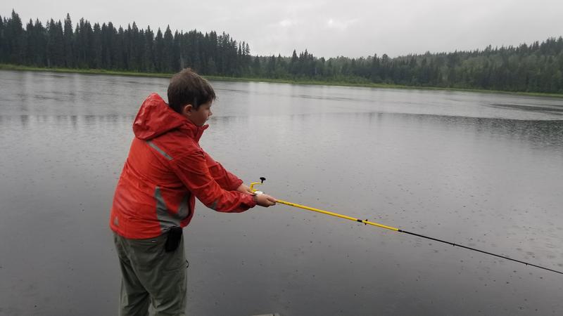
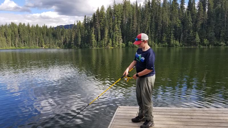
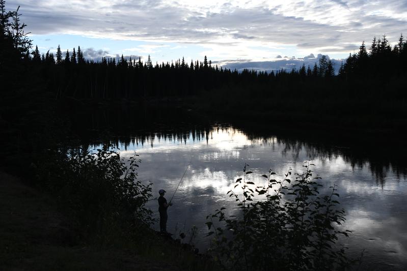 Fishing on the Chena. |
|
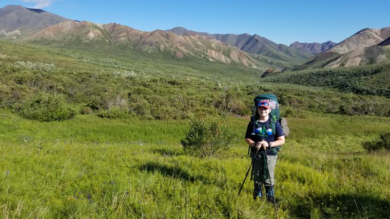
Day 17 (Aug 1, 2022) We caught up on sleep in the morning, which was needed as we had some long days. We headed out to hike Angel Rocks about an hour outside of Fairbanks. We could see some fish in the river at the trailhead, so we gave it a shot, trying a number of different lures, but no bites. The hike was fun. I carried a 25 lb pack to help train for the upcoming backpack. The view from the top of the rocks was nice. We tried a bit more fishing, but we were hungry and had forgotten to bring lunch. We went to North Pole! Santa's workshop was fun. Finding a place to eat in Fairbanks on a Monday proved to be impossible. Many places were closed, even if they were supposed to be open, and one place was so busy, there was no way we could get in, so we went to a distillry instead. They specialized in vodka and flavored vodka. Back at the RV, it had started to thunderstorm, so we made some dinner and watched a movie. It was a quiet evening. |
 Trying some fishing on the Chena River at the Angel Rocks trailhead. There were some fish jumping, but now nibbles. |
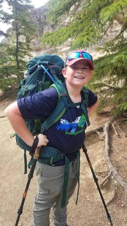 Training for the backpack. |
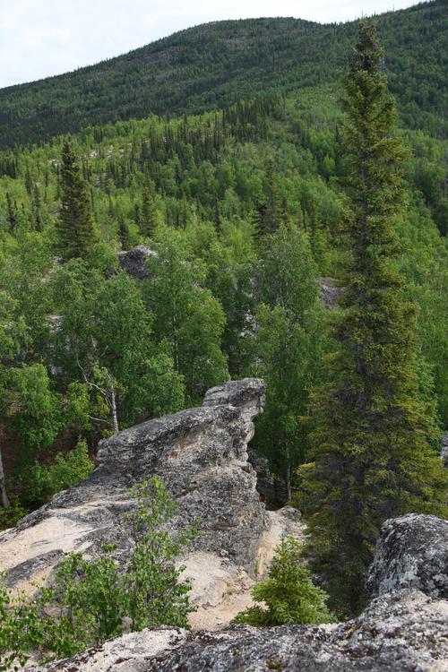
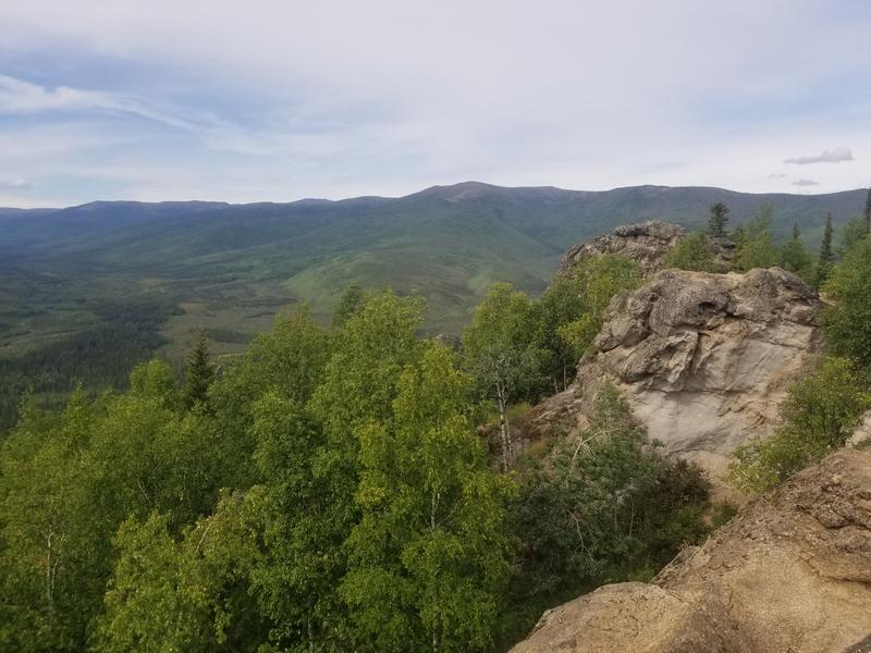 Angel Rocks, granite outcropping providing a nice view of the valley. There had been a fire, so the forest is regrowing in some areas. |
 View of the hills behind the rocks. |
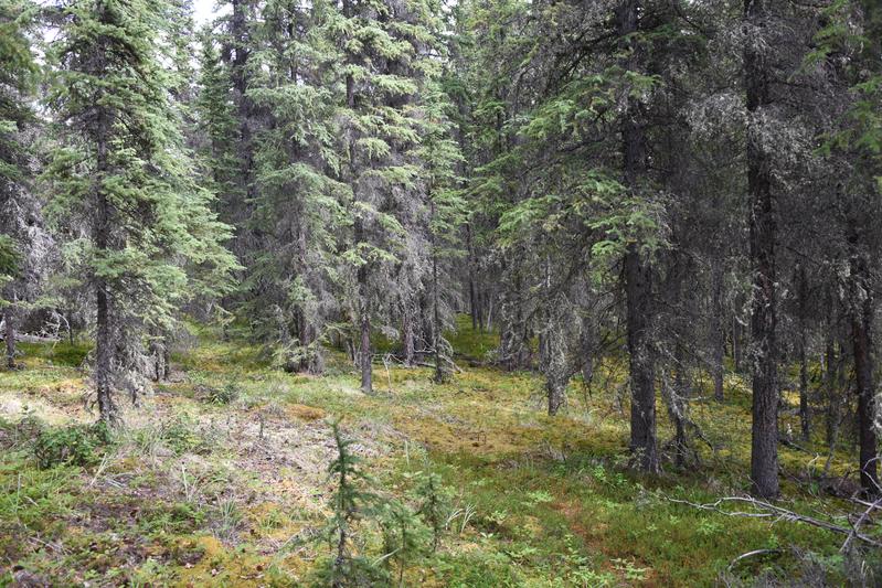
 Forest on the permafrost. The black spruce are the only things that grow well on the permafrost regions, so dense areas of black spruce indicate permafrost. Black spruce grow slower than other trees, so that is why they look small, but they can get larger. |
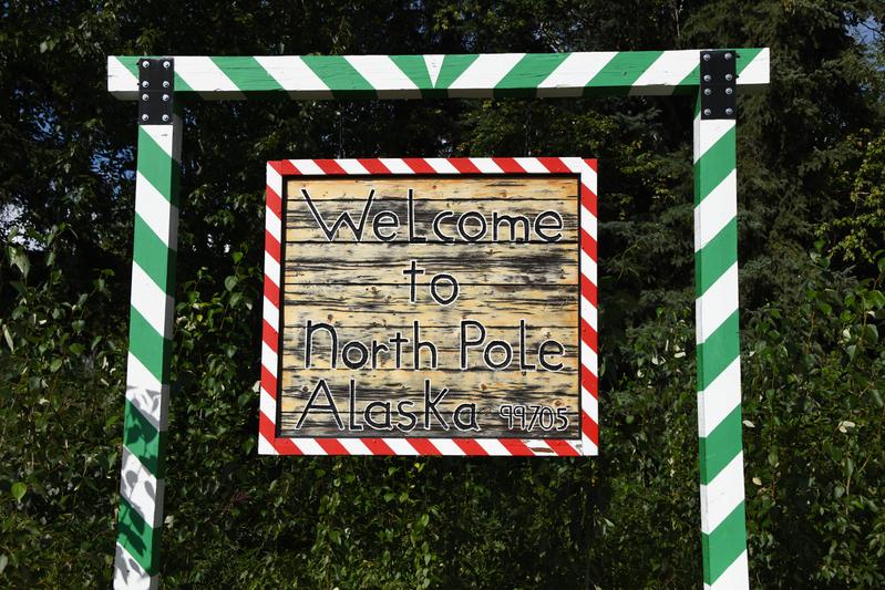 North Pole, AK! |
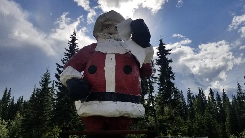 Santa! |
|
|
|
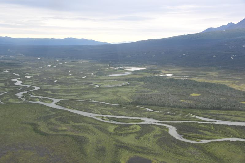
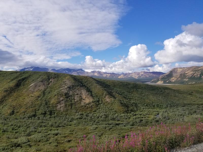
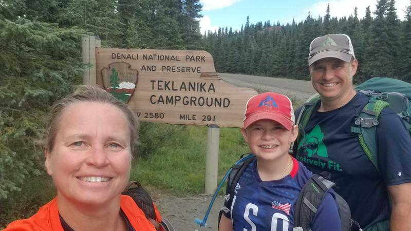
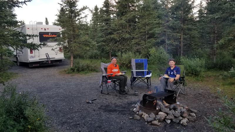
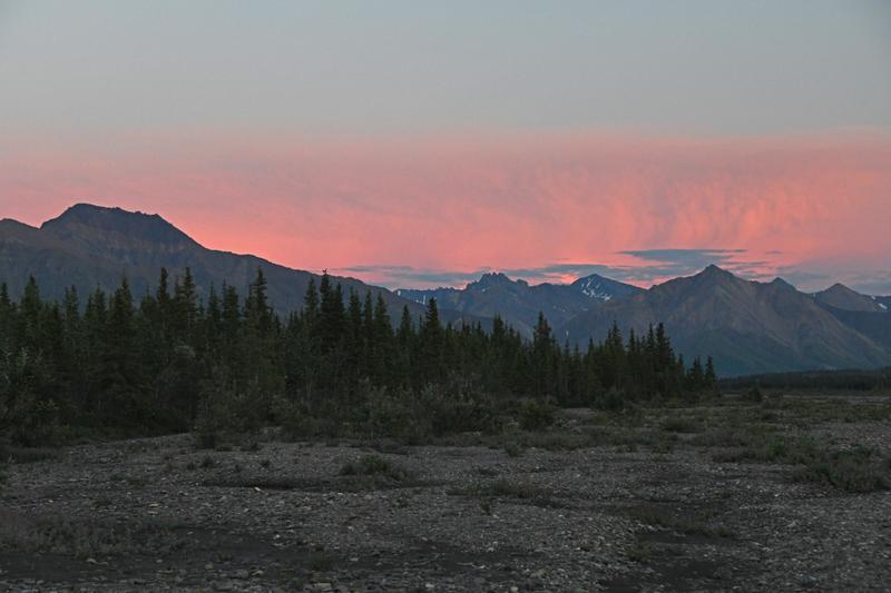
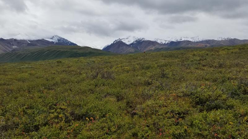
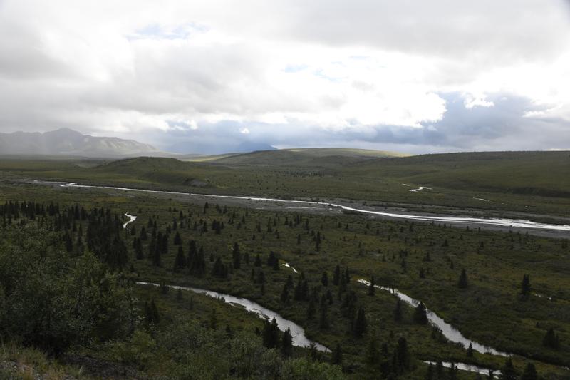
Day 18 (Aug. 2, 2022) We left Fairbanks and started to head to Denali. It was a short drive, so we left a little later. I went fishing on the Chena river at camp for a bit. Near Denali park entrance, we stopped at a pizza place called Prospectors. The pizza was super good with reindeer and elk sausage. We arrived in Denali and went to the visitor center. Papa and I mapped out our backpack after talking with the backcountry rangers to get our permit. We drove along the park road and were allowed to continue past where the public must turn around because we were camping deep in the park at Teklanika. We saw beautiful views of the valley and the park along the 30 miles of park road. There were river crossings, boreal forest, and alpine tundra. I made a campfire and we walked on the river next to us. We where 2448 miles away from Bothell. |
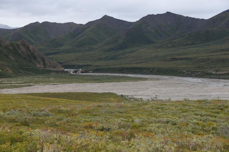
 Bridge across the Nanana River. |
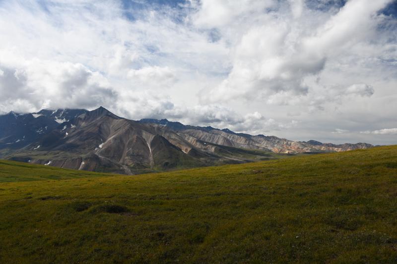
 View in Denali National Park. |
 Savage River. |
 Nice boreal forest. |
 Teklanika river behind our campsite. |
|
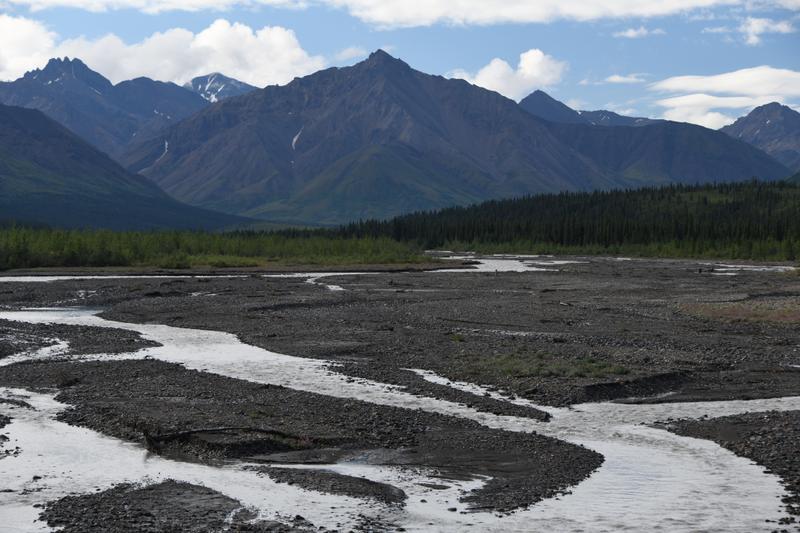
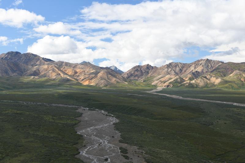
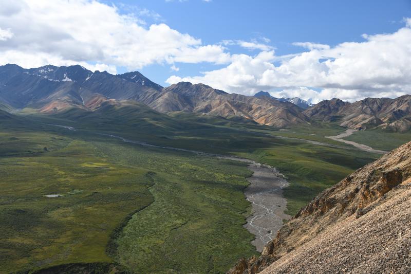
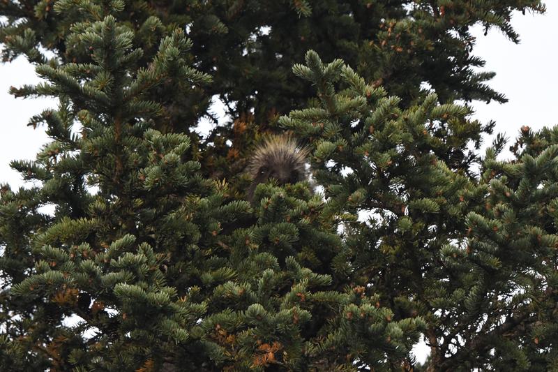
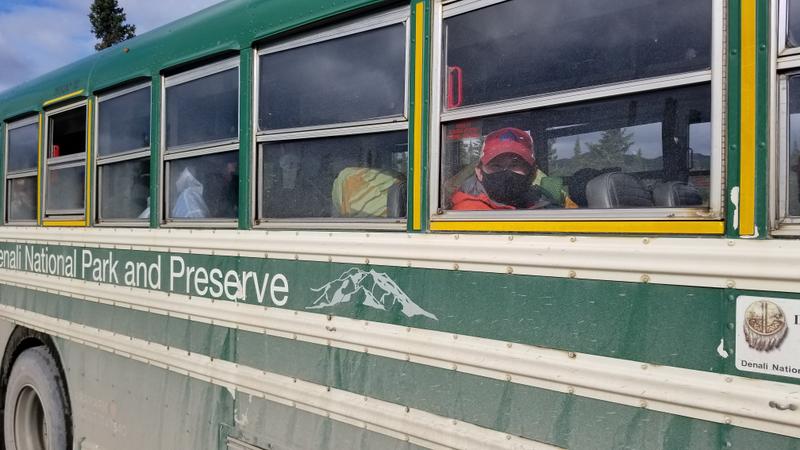
Day 19 (Aug. 3, 2022) We woke up and had breakfast and caught a park bus that took us as far as the road could go. There was a landslide of rock glacier that had taken out the road and the busses could go no further. On our bus ride we saw a grizzly bear walking across a river. We got off the bus and hiked up to the landslide and then we decided to go hiking off-trail to a ridge to try and see Denali. It was too cloudy to see Denali, but we saw a few other big moutains. On the ridge there where little ground squirels that where so cute. We rode the bus back up the park road to camp, but no animal sightings, just nice mountain views. It was a sunny afternoon. I made us a fire while Juju made us a Shepard's Pie. We finished packing for our backpack. We enjoyed dinner and a berry crumble dessert outside by the fire. We explored the river next to us and walked through the forest back to camp. There were many signs of moose and bear. After I went to bed, Papa and Juju went to a small lake and then back to the river. On the river, they saw a porcupine walk by. It had a funny little waddle. Back at the campsite, Papa noticed a sound in a tree next to the RV. It was the porcupine! Not sure if he was eating something up there, sleeping, or trying to hide, but he would poke his head out to try see if Papa was still watching. |
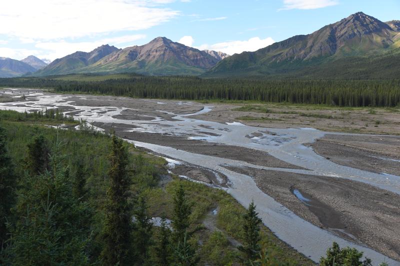 Teklanika River from view point on bus ride in to the park from the campground. |
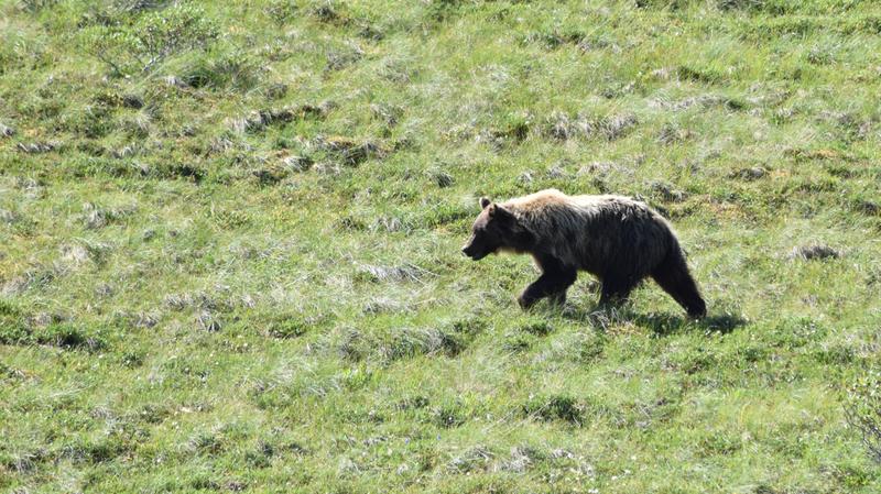
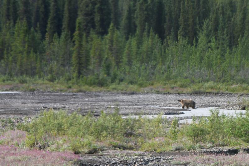 Grizzly along the river. |
 Teklanika river valley. |
 View along the path of our backpack the next day. |
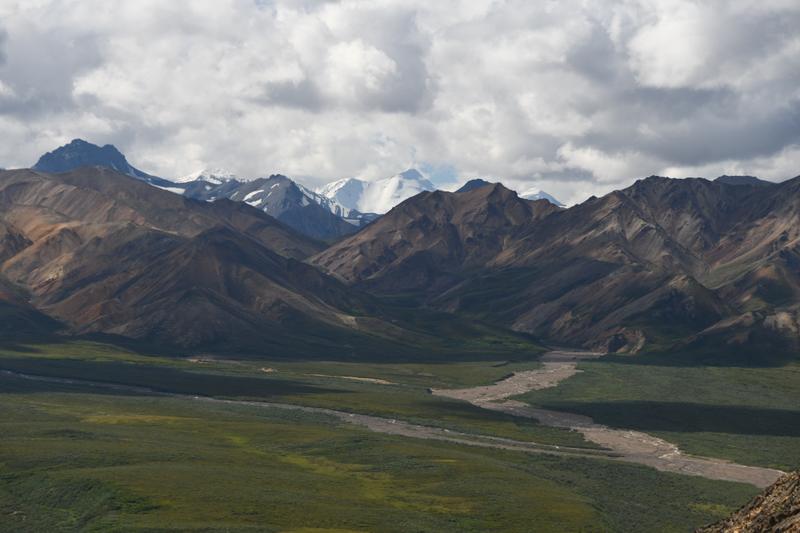
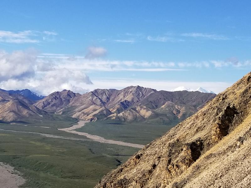
 Main park valley toward Denali near the high point of the park road. |
 Beginning of the walk up the park road from the last bus stop. |
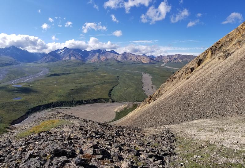
 Mountains rise above the river valleys. Each river originates at a glacier. |
 Glacier fed rivers wind and join. |
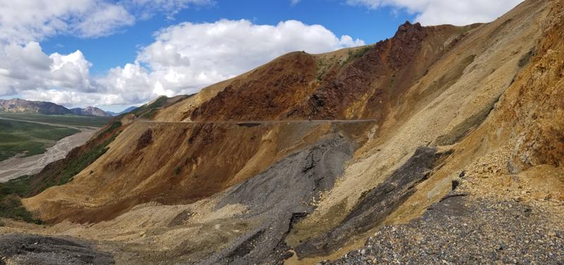 The park road has collapsed at around mile 45 due to permafrost melting under the side of the hill. |
 View deep in to the park. |
.JPG) What a stretch from a nice nap! |
.JPG) Columbian ground squirrel. |
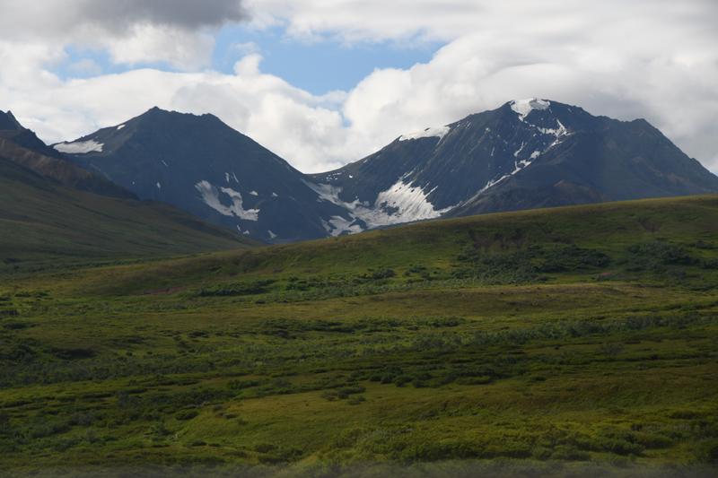
 View of valley from the top of a hill in attempt to see Denali, but the clouds were in the way. |
 River valley showing 'braiding' of the river. |
 Mountain near Denali rises above the valley. |
 View up the valley for the future backpack. |
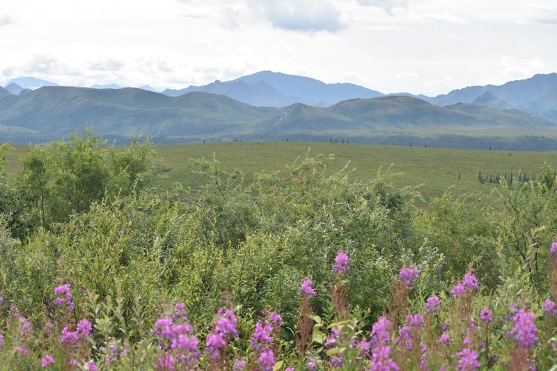
 Fireweed along the road. |
 Back at the Tek campground, about 25 miles in on the park road. |
 Enjoying our campsite. |
 Pond near camp at sunset. |
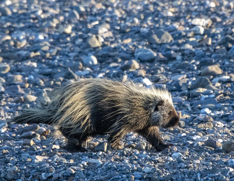 Porcupine! |
 Tek river near sunset. |
 Porcupine peeking down at me. |
.JPG) Porcupine in the tree! |
 Mountains near camp at sunset. |
|
Day 20-22 (Aug. 4-6, 2022) While Papa and I were on our Backpack, Juju enjoyed some nice days in the park. She took a bus about an hour after us and went by our hiking zone. She had great views of Denali on the clear morning and was entertained by all of the animals that were avoiding being seen by us. She went to the end of the bus route and hiked up the road and hill to try to see more of Denali. On her way back to camp, she saw more animals and great views of the park. She had one more night in the Tek campground, then checked out to move to the campground near the entrance. She went to the end of the publicly accessible portion of the road and hiked through the meadow and forest. She hiked a nice loop near the entrance and saw the sled dogs. She had a nice dinner in town outside the park. We finally met her at the campground in time to clean up and go to dinner. |
 View up the route that we took on the backpack. If you look close, just above the first shadow, near the tip, by a big bush, you can see Papa and I with our backpacks! |
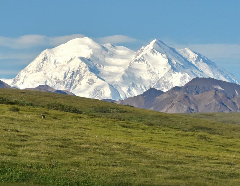 Denali with wolf. |
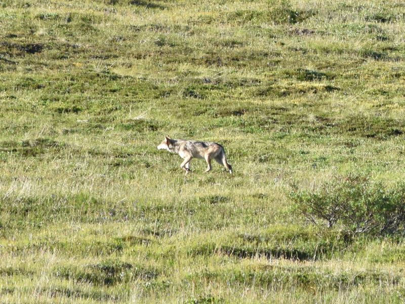 Wolf. |
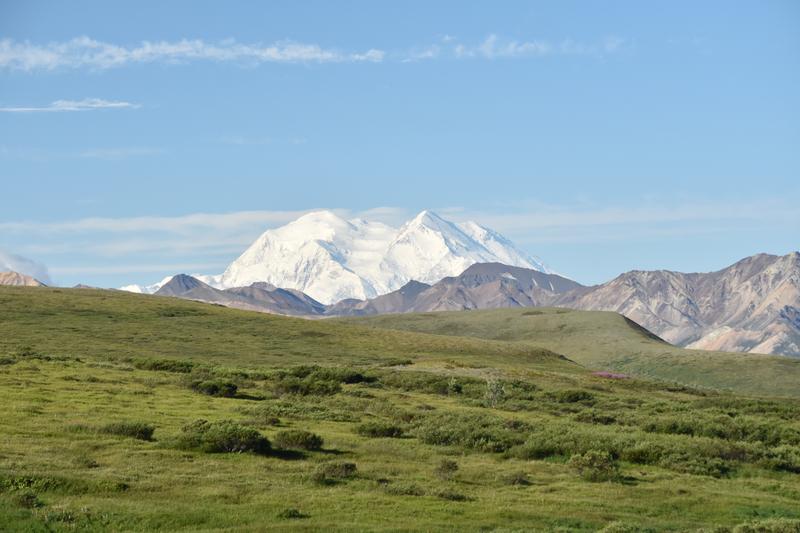 Denali peering over the park. |
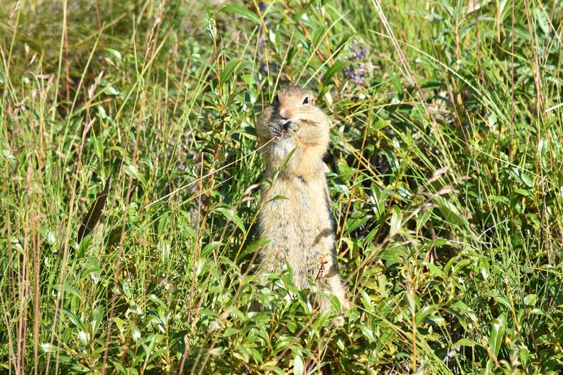 Columbian ground squirrel. |
 Denali on the right from the hill top past the end of the bus route. |
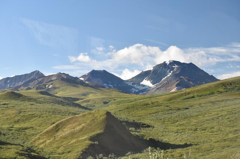
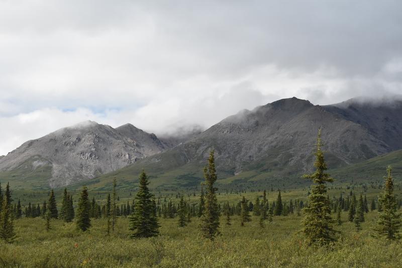
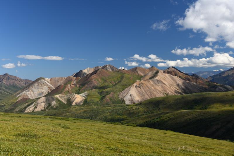
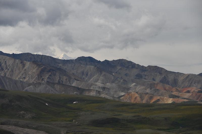
 Panchromatic mountains across the valley. |
 Moose grazing. |
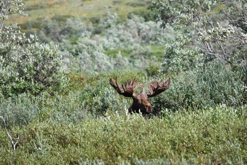 Moose! |
 Grizzly. |
.JPG) Grizzly snacking along the road. |
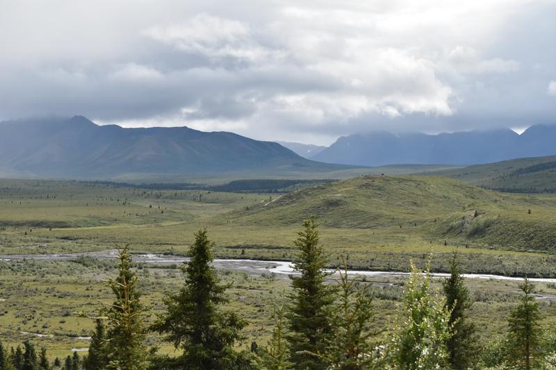
 Vast views in the park. |
 Caribou. |
 Train bridge from trail near the park entrance. |
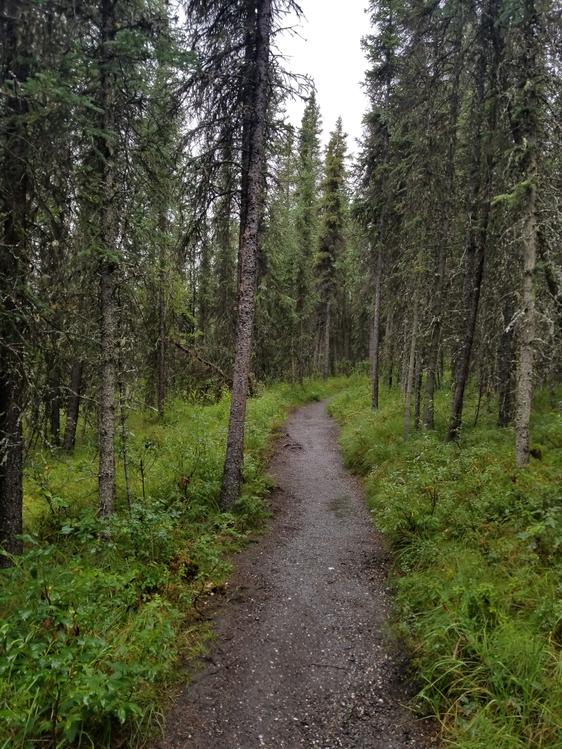 Trail through the boreal forest near the park entrance. |
 River along the trail. |
 Views of the park. |
 Small trees in the tundra. |
 Mountains over the valley. |
 Rain sweeping through the valley. |
|
|
|
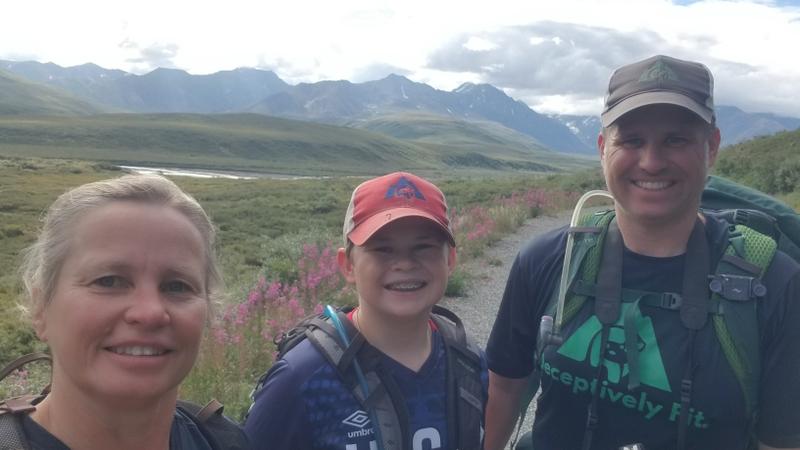
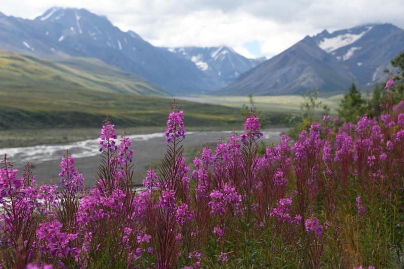
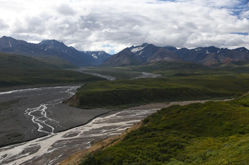
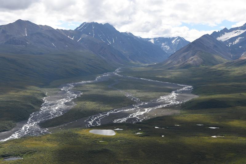
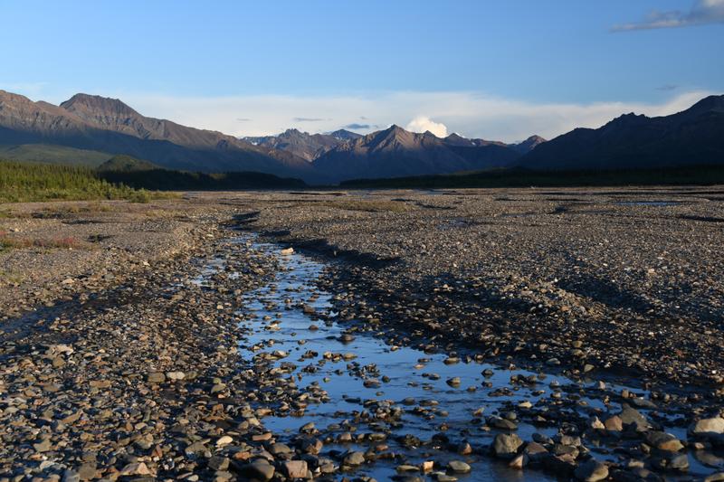
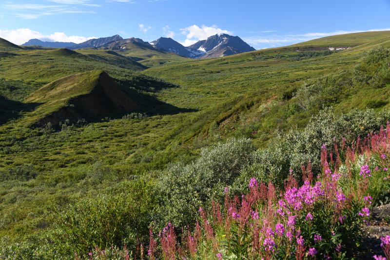
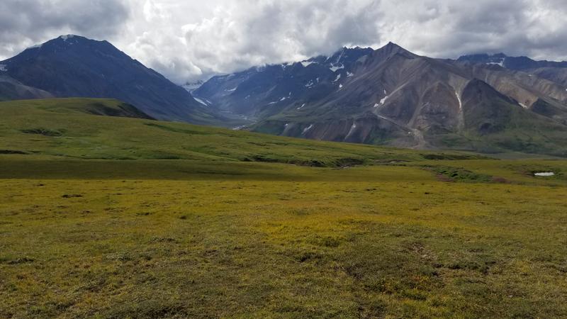
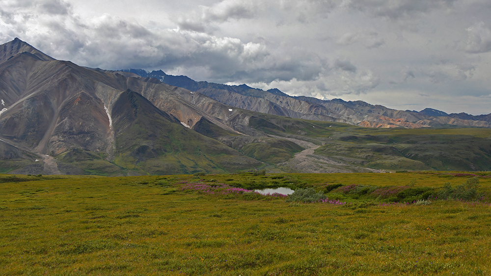
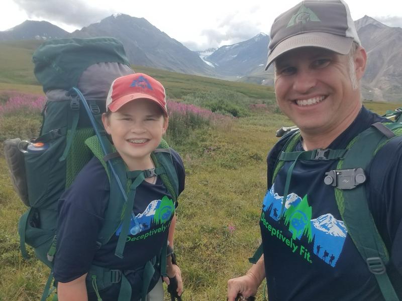
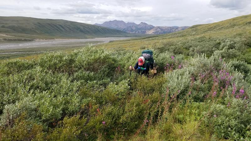
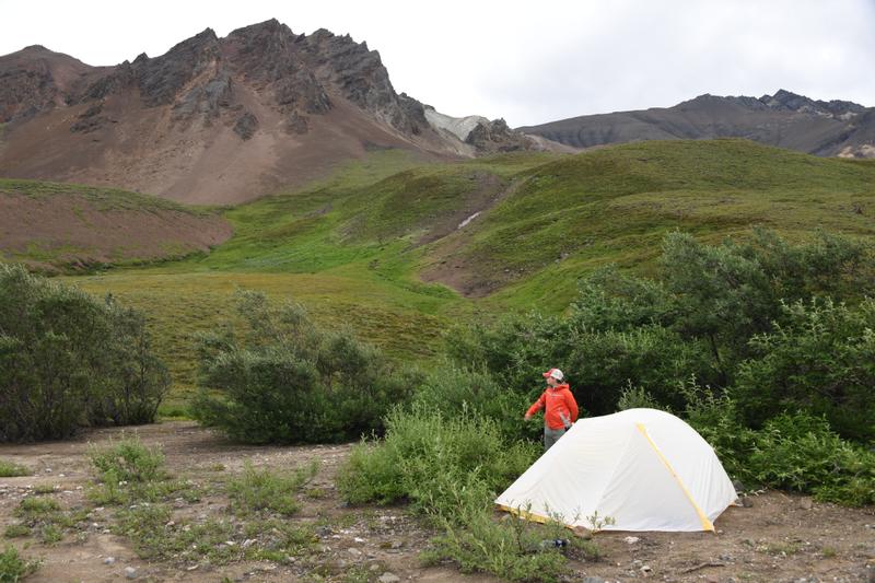
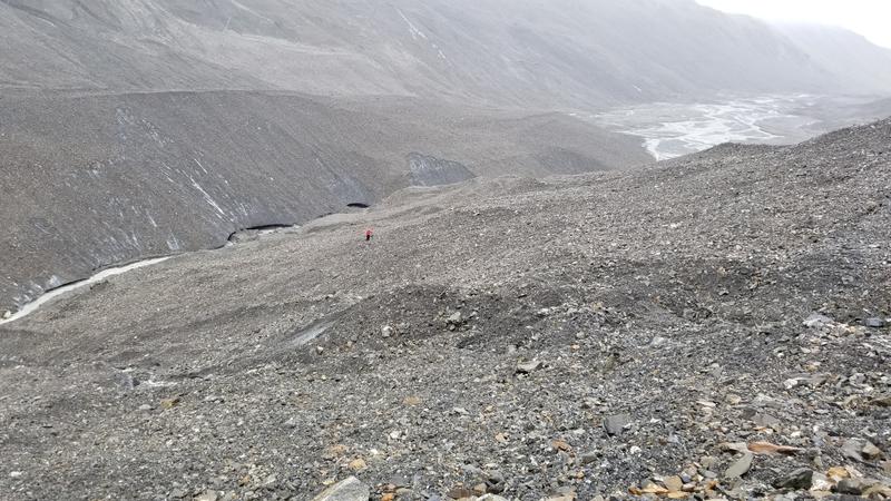
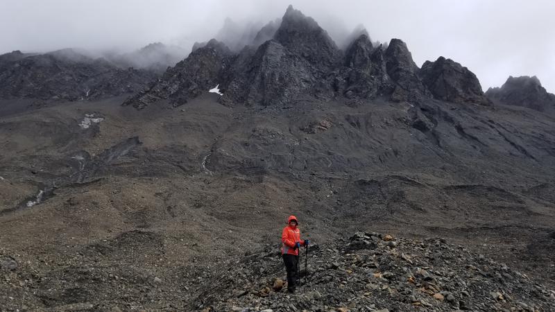
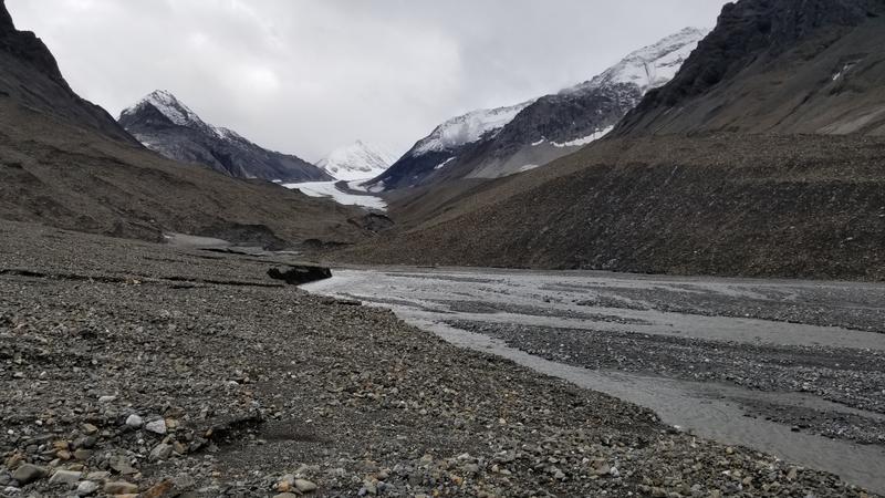
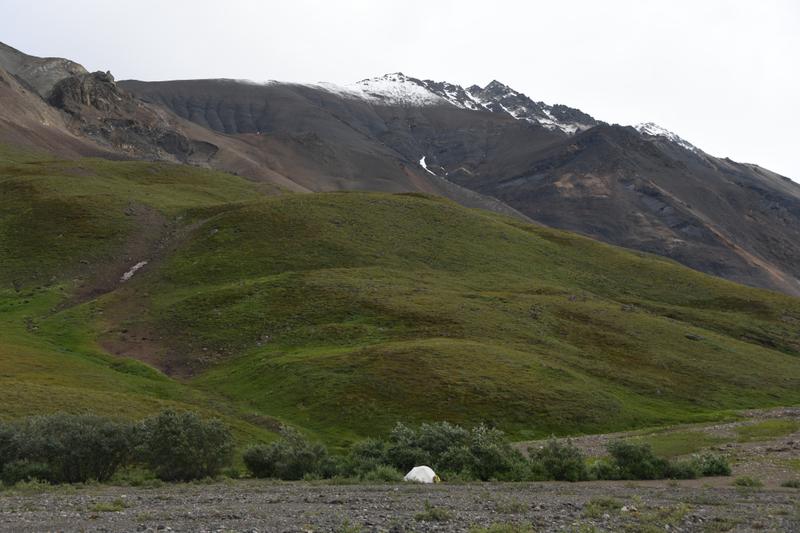
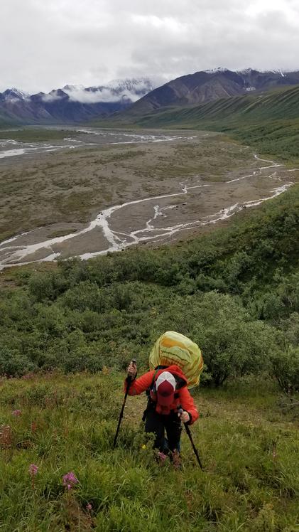
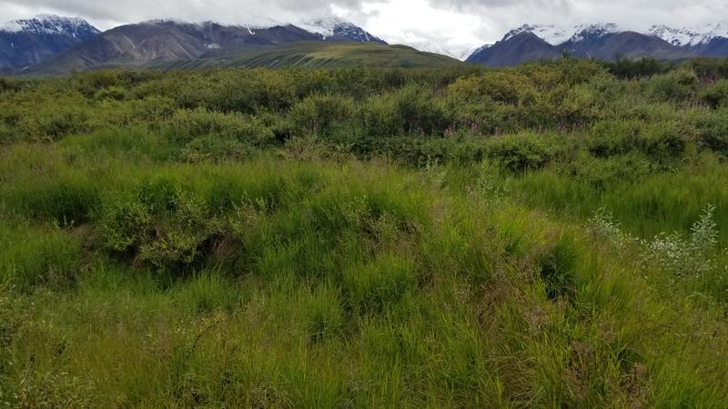
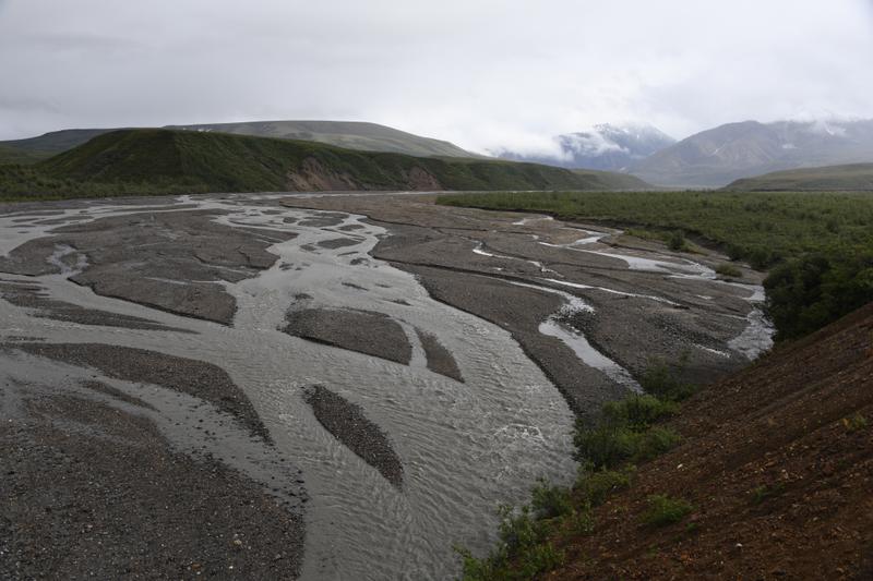
Day 20 (Aug. 4, 2022) We woke up early and caught our bus to the start of our backpack. The bus dropped us off on the side of the road at the edge of wildlife activity closure. We were alone as we gathered our gear and started the hike. Remember, there are no trails in Denali National Park, so we were going to blaze our own way. We dropped down to a large creek and followed it to skirt the boundary of the wildlife area. We found ourselves in tall bushes and marshy area around the creek. As we headed uphill, we came across more creek crossings and had to walk through thick brush and bushwhack our way through. We got to this super dense part where it took us forever to get through. Once we got through and we reached higher ground, there was soft boggy moss. It was very soft to walk on. Long strides worked best and it was like walking on the moon. We got to the top of a mountain and it was just clear enough to see Denali! We stopped for a lunch snack next to some fireweed at a creek and near a pond. We could see our glacier and Denali while we rested. Next, we had to find a way to descend to the river to continue up toward the glacier. One area was very steep, bushy, and sketchy, so I explored up a small hill to find a longer, but safer way down. Once we were down the hill, we came to a large creek running from a glacier to our East. We saw a wolf print while we went up and down the creek to find the safest place to cross. There was no other way, but to go through the water. We decided to go with the textbook method of keeping our boots on. We walked together and I held on to Papa's pack for stability, following in his wake. It was pretty deep and moving fast, our boots filled with water. After the crossing, it was about a mile to our target area to camp. The wind was strong and cold in our faces and it began to rain. The small creeks coming down the mountain that we were hoping to use for clear water were all dry. Fortunately, we found a small outcropping of large bushes that indicated there was more water in that area. We used the bushes for a wind break and there was a clear water creek next to us! As we arrived at the bushes, there was a very loud whistle. It scared us at first, and we wondered if there was a person around. Then we remembered that marmots whistle as an alarm. Sure enough, we saw a busy marmot running up the hill to his family on a mound. This seemed like the perfect spot for a marmot, a steep hill so the bears couldn't get him and fresh water. There was also a big mound full of holes and ground squirles / alpine prairie dogs. We set up camp and established a bearmuda triangle, cooking our food 100 yards from the tent, and storing our food on another 100-yard leg of the triangle. We also dug some catholes near the storage area. We made beef stroganoff for dinner, had desert, and jumped in the tent as it cold, windy, and raining more. I felt pretty good after carrying a 30 lb pack for 7.5 miles overland in tough terrain with no trail. Papa's pack was 55 lbs. We played some cribbage before falling asleep. |
 Route in to the valley to start the trek. |
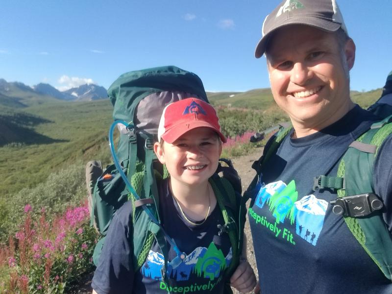 Ready to go. |
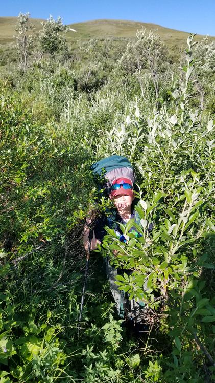 These bushes are tall! |
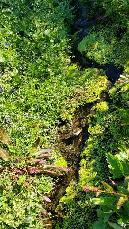 Moss by a small creek. |
 Making our way through the spongy open areas. |
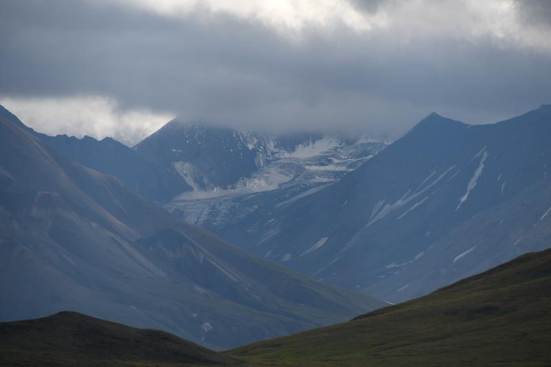 Glacier high in the valley next to us. |
 View of the mountain near the start of the hike. |
 Vast, open area to cross. |
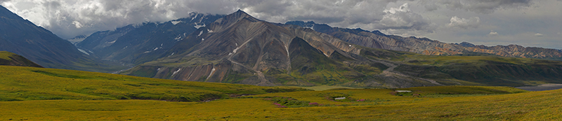 Panorama of the valley with our glacier and the Panchromatic Mountains. |
 Path ahead to our valley, river, and glacier. |
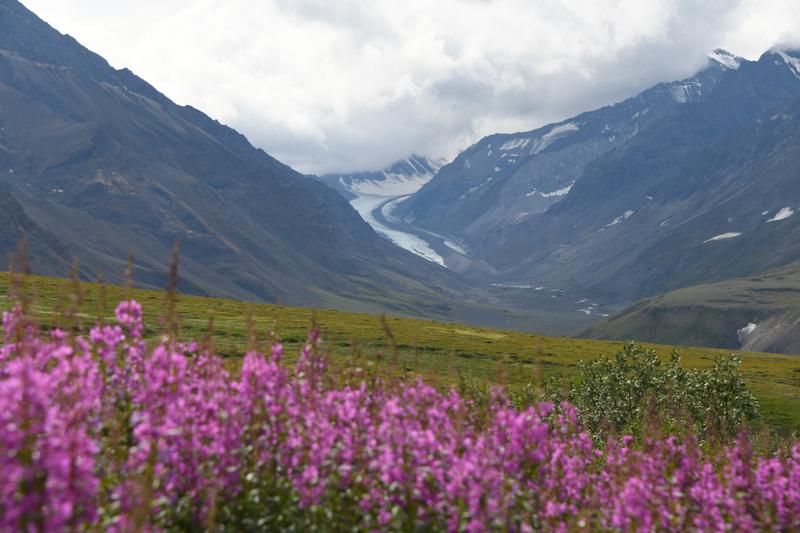 Miri glacier over the valley. |
 The glacier will be our destination the next day. |
 Panorama of the Panchromatic Mountains. |
 Making good progress. |
 We catch a gimpse of the top of Denali as we make our way. |
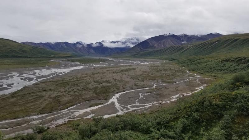
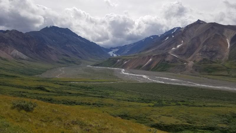 Our valley with river and glacier. We camp on the left side of the river, just before the bend. |
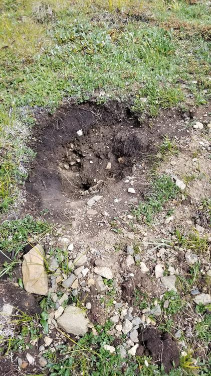 Oh, no! A bear trying to dig up our little buddies (ground squirrels). |
 A stream feeds lush bushes. |
 So much brush to go through! |
 The spongy moss we were walking on. |
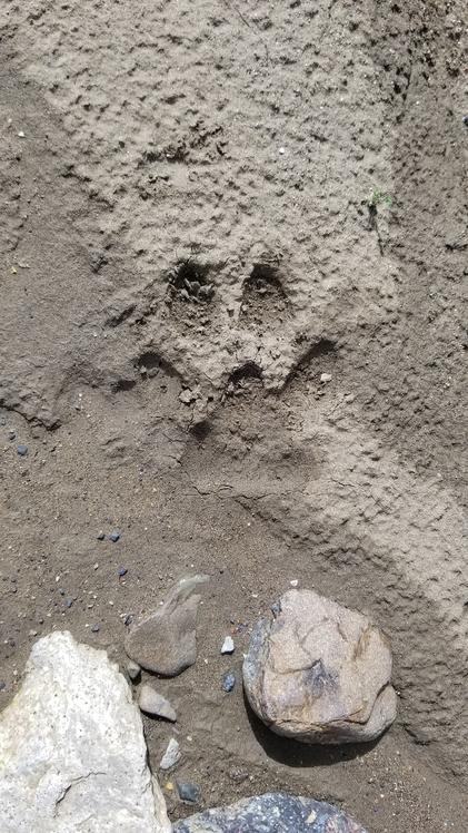 Wolf print! |
 Cooking some dinner in camp, in one corner of the bearmuda triangle. |
 What was that whistle?! |
|
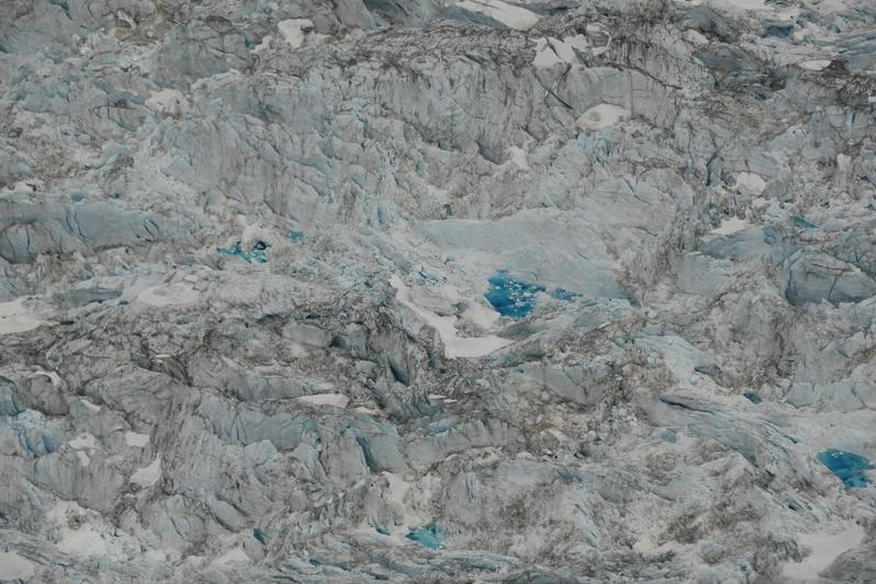
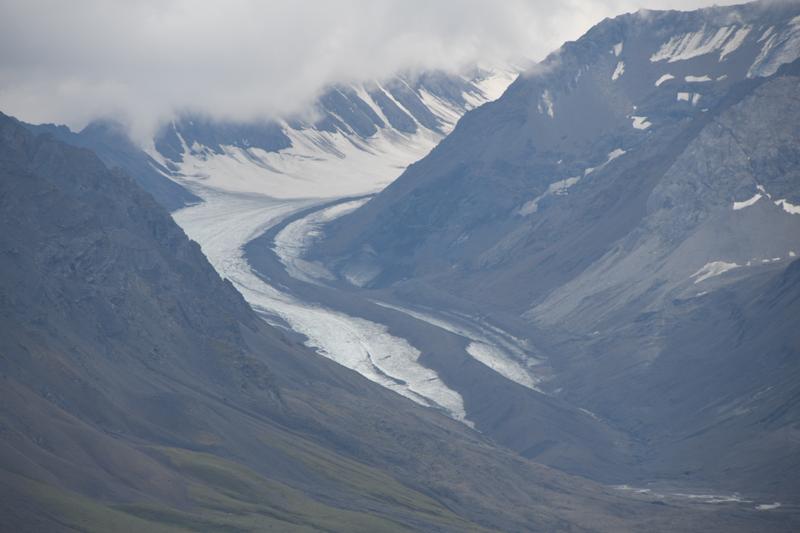
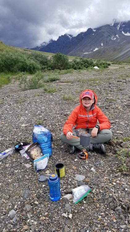
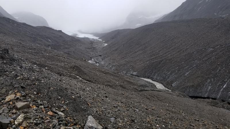
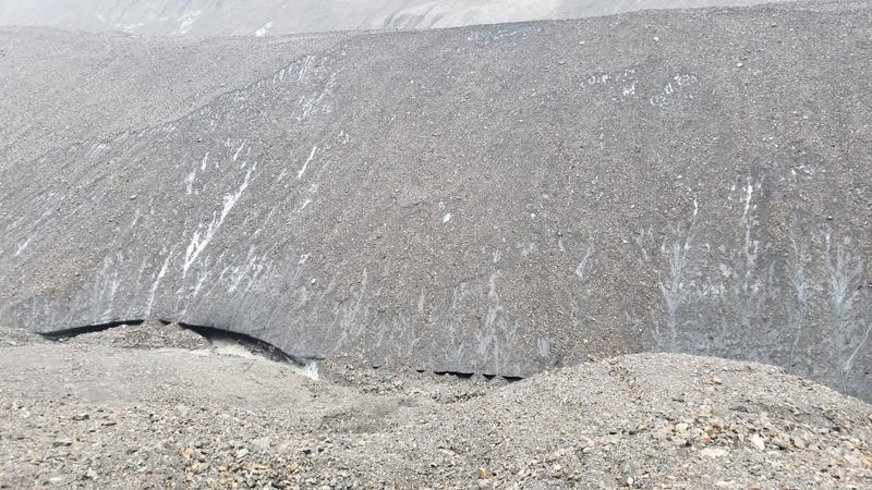
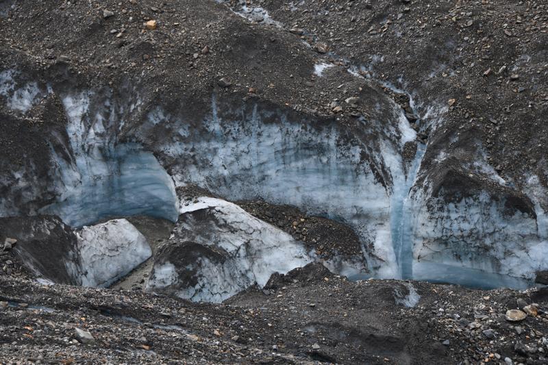
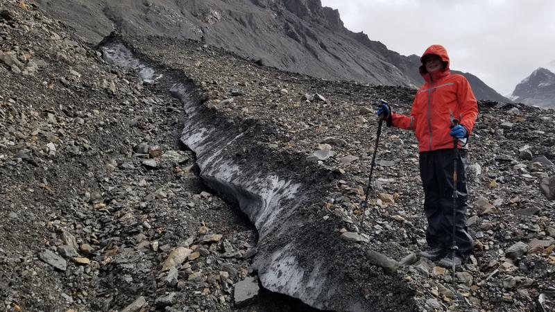
Day 21 (Aug. 5, 2022) It was raining when we woke up. Papa got out of the tent first and got wet while starting water for coffee and hot chocolate. I finally made it out of the tent and we ate our freeze dried eggs. We started our day hike to a glacier. We followed the river bed to the glacier. The river was very silty due to the heavy rain fall and day before and the silt in the glacier. We walked about 3 miles to the toe of the glacier. It was raining pretty hard and our raingear was soaked on the outside. The toe was very moraine and had a lot of rocks on top of it. We climbed up the glacier and checked out where the river was flowing on the ice We found that we werw walking on ice just below a thin layer of rock. On the steep faces, the rocks would slide when we stepped, exposing ice underneath. We learned to avoid these faces. On an ice shelf near the river, we could see and touch the blue ice. On the other side of the river, there was a massive trianglular extrusion pile of rocks that were covering blue ice that we could see in gaps. One could probably walk on this pile all the way up the glacier to the top. There was a well where water had drilled a hole down through the ice. I was tired, wet, and cold, but wanted to see more of the glacier. Papa explored ahead to see if it was safe to go farther. He signaled it was, and I gathered my strength to catch up to him. We climbed deeper in to the moraine, and it was safter to walk, rather than down by where the water was flowing. We climbed up and down rocky hills and crossed icy gluches with streams for another mile on the glacier for a gorgeous view of the rest of the glacier curving up the mountain. We were next to the first pathces of exposed ice and could possibly reach more exposed ice just up from our viewpoint. However, to walk on the exposed ice would be dangerous as there could be crevasses and the river had carved a gorge in the ice, making further exploration risky. The good news was that the sky had cleared, the rain had stopped, and we were starting to dry off. The blue ice exposed by the river was beautiful. On our way back, we saw a place where the river went under the piles of rocks. We could hear the glacier making noises. It was a periodic low sound, like we could hear it slowly ooching down the mountain. We headed down the glacier and Papa almost slipped down an icy face. Back at camp we had dinner. It felt good after 8.5 miles. It started to rain again, so we played cribbage in the tent and went to bed |
 The glacier from the foot. Large amounts of moraine on top of ice! |
 Across the river is a huge ridge of ice that goes all the way up the glacier. |
 Look how small I am in this vast sea of rocks and ice! |
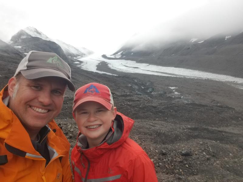 We made it up the glacier. |
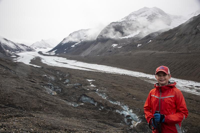 It was great to have this view. |
 Melt water carving canyons in the ice. |
 The steamy peaks are scary. |
 Ridges of ice under the rocks. |
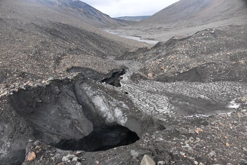 Caverns created by the runoff. |
 River originating from the glacier. |
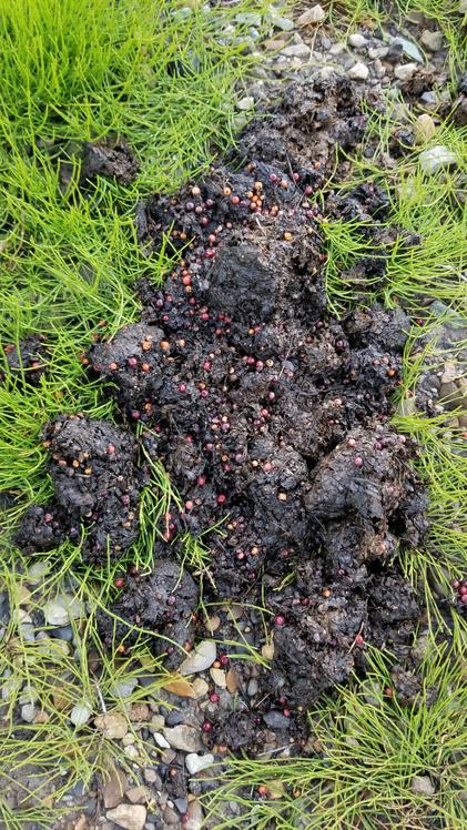 Behind the trees behind our tent, we found this. One guess on who pooped this poop! |
 We are so tiny in this landscape. The snow on the peak was not there yesterday. |
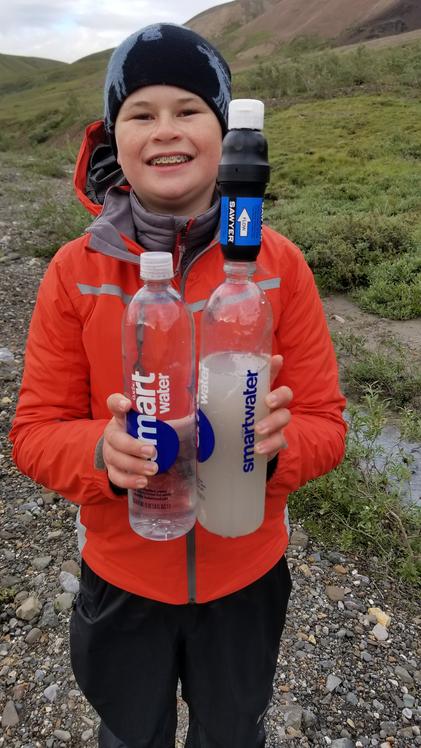 The rain made our stream run with silt, but our filter could handle it. |
|
Day 22 (Aug. 6, 2022) It was raining, so we slept in a little. We enjoyed some hot breakfast, coffee, and hot chocolate, then broke camp. We had decided to take a different route home and hike back along the river to make a triangular route overall. We said goodbye to the marmot family and headed off. We knew we had to cross the large river that began with the outflow with the glacier we had visited. We found a spot were the river had many braids, but there was still a pretty deep main channel. Fortunately, we managed to keep our feet mostly dry. We continued down the river, scanning the hills for wildlife. Eventually, the rain moved off behind us and it began to clear. Clear water creeks entered the river from the mountains. We had to stay on the west side of the river due to an area closure for the caribou, but we reached a spot where the river ran right against a very steep hill where we could not pass without crossing. We could either make two possibly dangerous crossings through very deep water or hike up the ridge to cross back to where the river moved away from the hill. We hiked up the ridge and had to walk on super soft moss which was harder than we thought. I kept rolling my ankles. There were tufts of grass with moss surrounded by water and when I walked on the top of the tufts, they would try to tip over. At one point, there was a big lake with outlet stream and marshy area that we can to cross somehow. Before having to walk all around the lake, we found a miracle, narrow path of high ground that snaked across the stream and marsh. It seemed like it was an old beaver dam that had become overgrown with grass. I was hot, tired, and hangry, so it was a tough hike across the high ground, but we finally began to make our way down to the river. After bushwhacking our way down a very steep and bushy slope, we made it to the river. In this area, we found an illegal fire ring (no fires ever allowed in the Denali backcountry). We picked up the trash, dispersed left over wood and noted the location to tell the rangers. We also noticed many bear scat. As we neared the bridge and roadway, the end of our hike, we knew we had to cross another river coming from the west. It turned out to be much deeper and faster than we thought and there were no other good places to cross. I followed Papa in to the water, holding on to his pack. I had water over my waist and I almost got washed away. The water pushed me back from Papa. He took a few steps backward so I could grab on again. We managed to take a few big steps to cross the deepest part and finaly make it to the other side. We got to a little forest area where we saw a Ptartmigan. There was a ranger truck on the road with lights flashing. We kept our eyes out for wildlife. When we got to the end and made our way up on to the road, we saw a sign that said area closed due to bears. We talked to the rangers that were working to keep the tourists corralled on the bridge. There was a bear that had crossed the road and was eating berries not too far away. We finally got a seat on a bus and took the long ride out to the park enterance. We enjoyed the nice views along the way. Juju picked us up, we took a quick shower, tried to hang up all of our wet gear, and headed out for our traditional victory steak diner. When we got back we met Juju and went to dinner. I had a steak which felt good after a big trip. We got back and went to bed. |
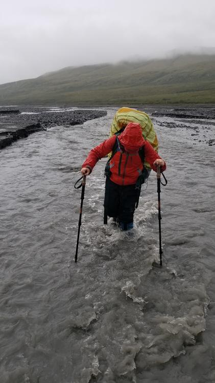 We had to cross the river on the way out. |
 The river braids its way. |
 We climbed a ridge to bypass an area where the river ran deep along a cliff, blocking our route |
 The vast, spongy marsh along our route |
 Water just beneath the surface. We had to talk on tall islands of moss and grass. |
 This old bever damn saved us from walking through a deep marsh or around a pond. |
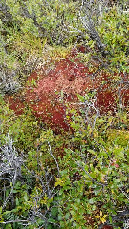 Some of the moss turns red for the fall. |
 I am making it! |
 The end of the trek, the bridge at the end of the bus route. |
 Water collecting on a plant. |
 We made it. The river at the bridge. |
 On the bus to head to the park entrance. |
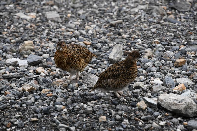 Alpine Chickens! (Ptarmigans) |
 Last views in the park |
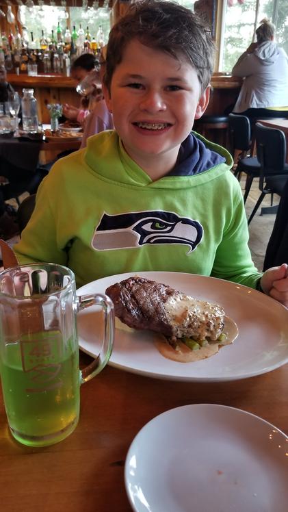 Traditional victory steak after a big backpack! (with spruce tip soda) |
|
Day 23 (Aug. 7, 2022) We enjoyed our last morning in Denali NP. Papa and I headed over to the sled dog kennels. Sleds and dogs are still used to patrol and maintain the park in the winter. We joined Juju for a hike near the entrance to the park, seeing part of the forest and a nice pond. We checked out of the campground and spent some time at the visitor's center, where I earned by ranger badge and we watched a movie about the bears and sled dogs. We had lunch at the 49th State Brewery, then began our drive down to Talkeetna. |
 Denali sled dogs! |
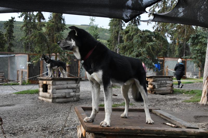 The dogs have houses to go in or sleep on top. |
 Very soft. |
 So sleepy |
 Beavers keep moose lake full. |
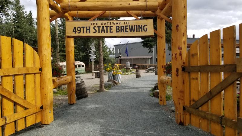 49th State brewery. |
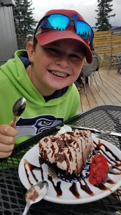 Pie! |
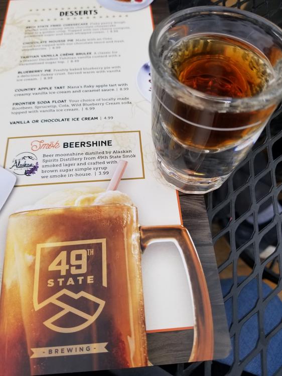 Distilled beer! |
 Wild bus. (from the movie) |
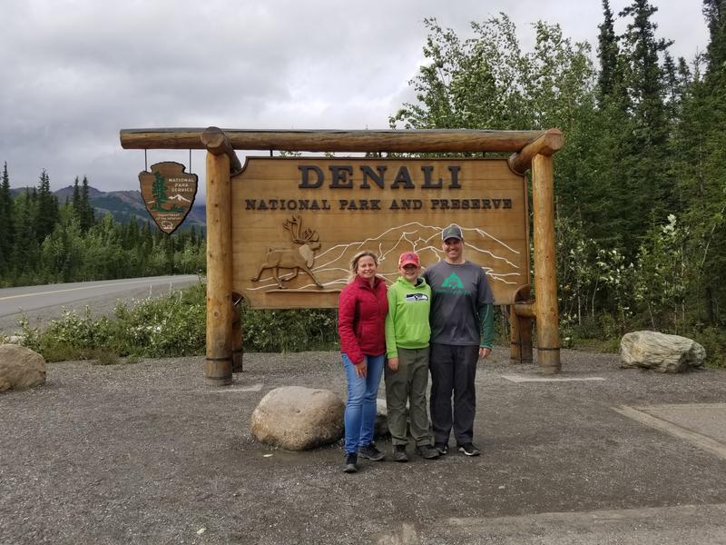 Denali NP! |
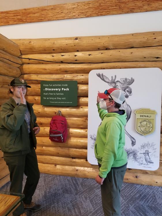 Getting my Ranger badge. |
 Bye bye Denali! |
|
|
|
Day 24 (Aug 8, 2022) We drove down to Talkeetna the day before, checked out town, a little fishing in the fast-running Talkeetna river and some dinner at the Talkeetna brewery before closing. The next day, we had breakfast at a small shack, did a little shopping and tried some more fishing. We went to another river, but the water in the area was all moving too fast and too muddy for good fishing. The local guides had cancelled fishing trips for the next few days due to the high water from the recent big rains. We bought a fox fur at a local guide shop. We ate some dinner at the other restaurant in town. |
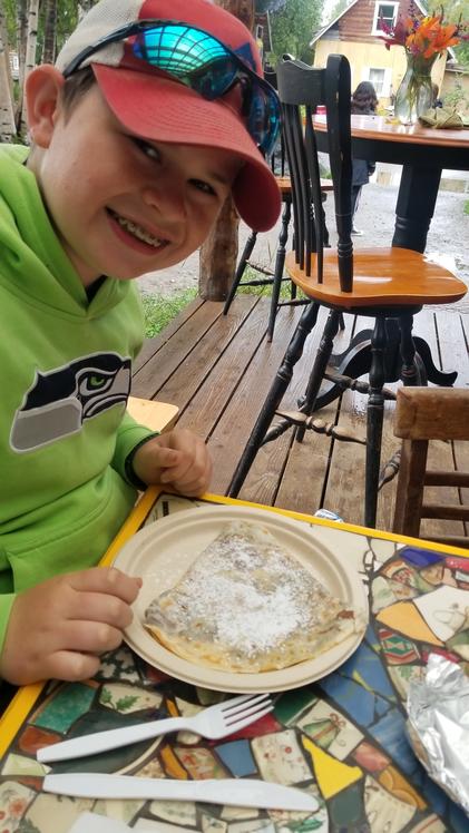 Breakfast crepes at our favorite place. |
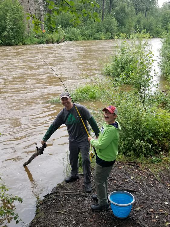 Only thing we caught the whole trip! |
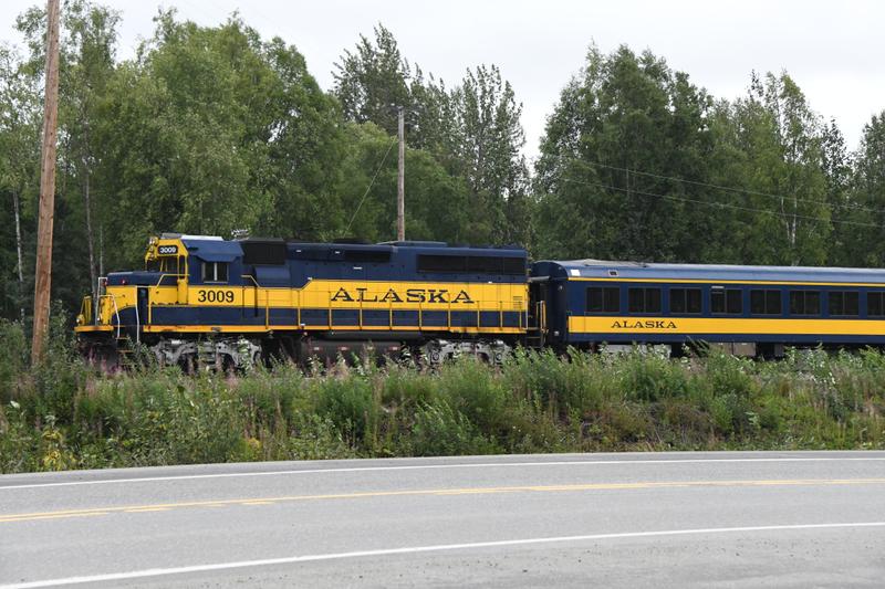 Alaskan Railway |
|
Day 25 and 26 (Aug. 9-10, 2022) We drove from Talkeetna to Anchorage. We stopped to check out the storage location and headed to our campsite in town. We started some packing and cleaning, then went to check out Anchorage and find some dinner. The 49th State Brewery has a nice deck to enjoy the nice weather. That night, Papa and I prepped the RV and car for storage, including late night oil changes. The next day was more packing, cleaning, winterizing, and washing the RV and car. We moved the RV to the storage location, put the cover on, and checked in to a hotel for the last night. We had a quick dinner at the AK Alchemist and then to the 49th State Brewery for sunset. |
 Dinner at our favorite place in Anchorage, the 49th state brewery. |
 View of Denali from Anchorage. |
 Sunset on our last full night in Alaska. |
|
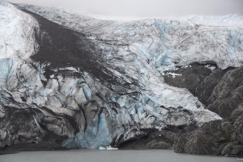
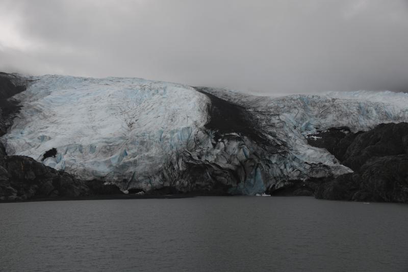
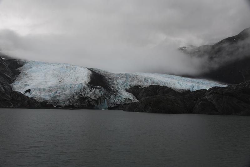
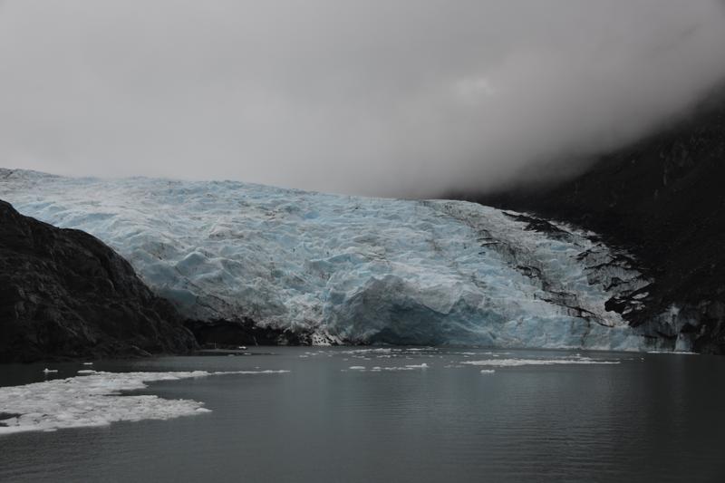
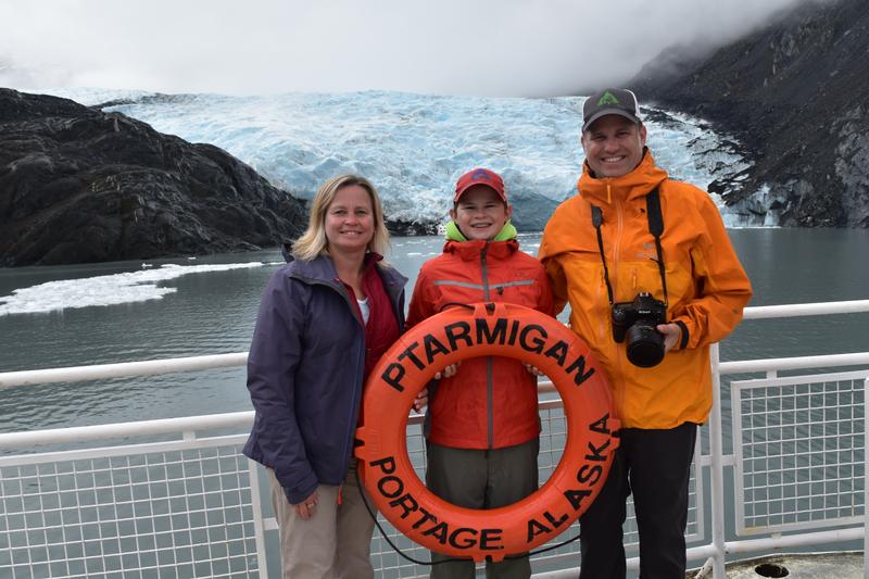
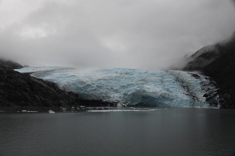
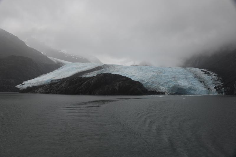
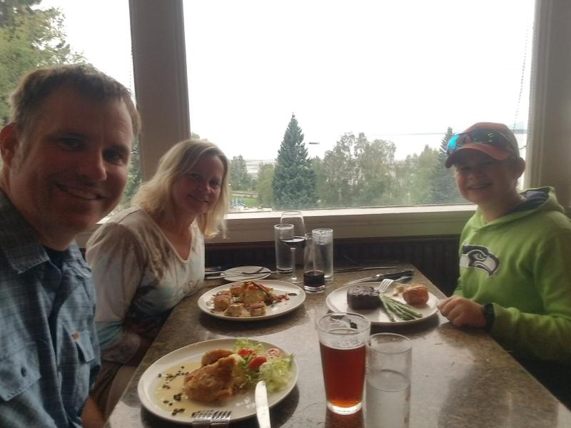
Day 27 (Aug. 11, 2022) With all of the work done and the RV parked, we had some time to enjoyed our last day. After some breakfast in town, we took a drive along the Fjord to Portage Bay, a turn before the tunnel to Whittier. On the way, papa spotted a bear in a tree. We stopped to see two bear cubs sent up trees by mama, who was in the brush below. We took a boat ride in the lake of Portage Bay to the face of the Portage glacier as it entered the water. It was beautiful. We could hold and eat parts of icebergs pulled from the lake. On the way back to Anchorage, we stopped at a small stream, where salmon had made their way from the sea, transforming in to bright red. After storing the car and securing the RV for the winter, we had a final dinner in a nice restaurant in town before flying home. It had been a great trip! |
 Coffee from the AK Alchemist. |
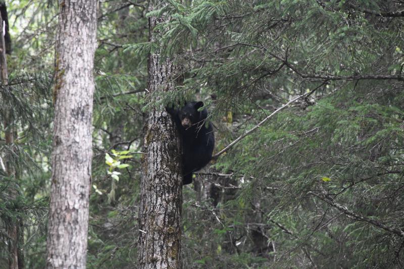 On the drive to Portage Bay, found some bear cubs in trees. |
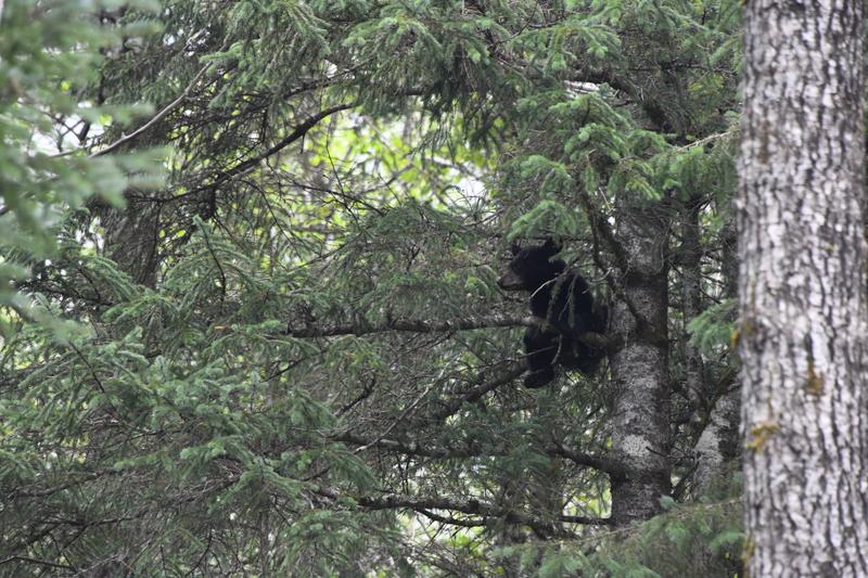 A sibling looking over. What to do now? |
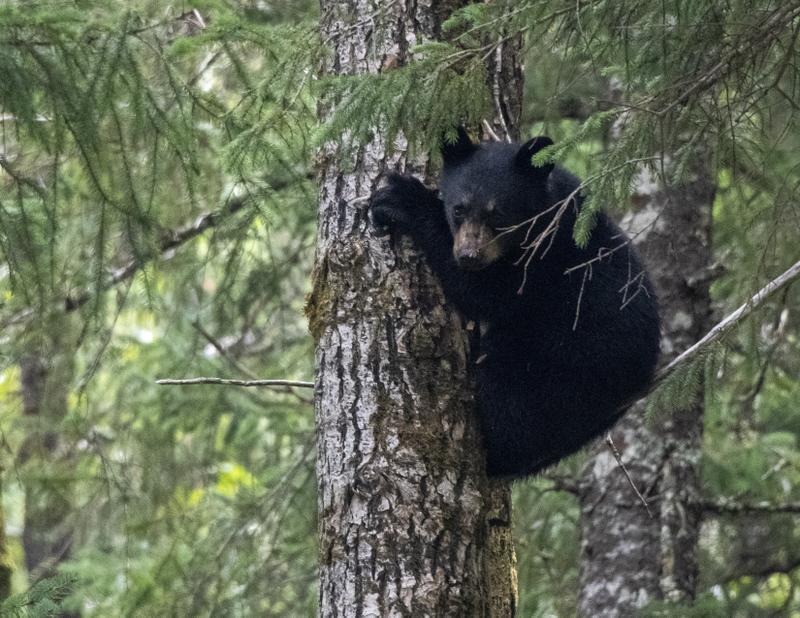 So cute! |
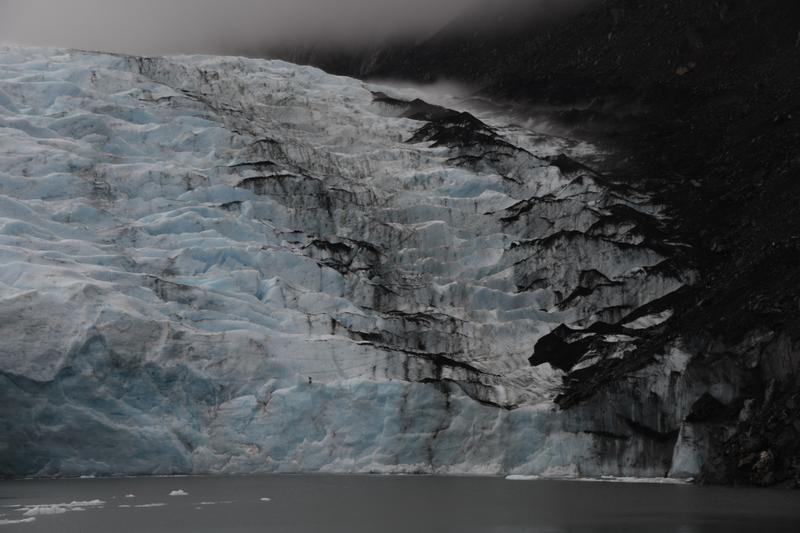
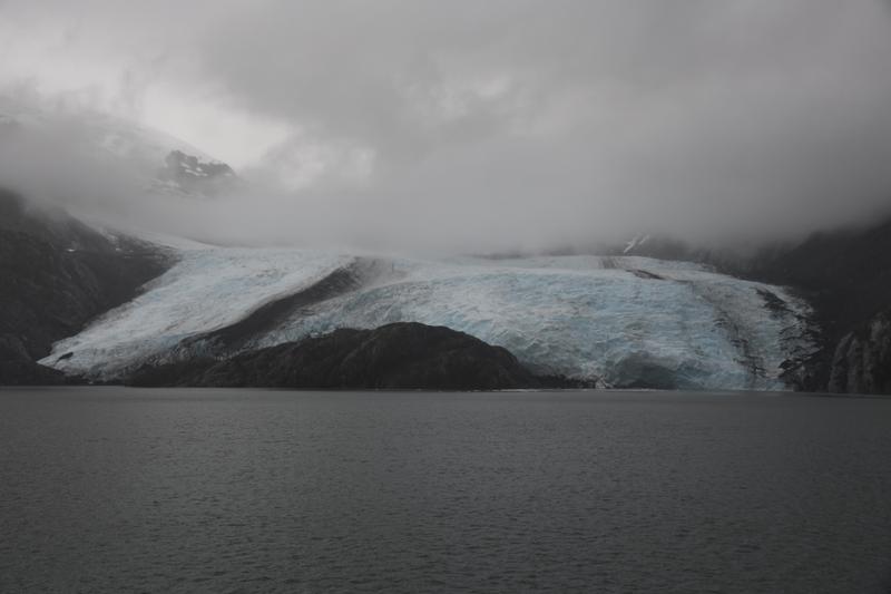 Portage Bay Glacier |
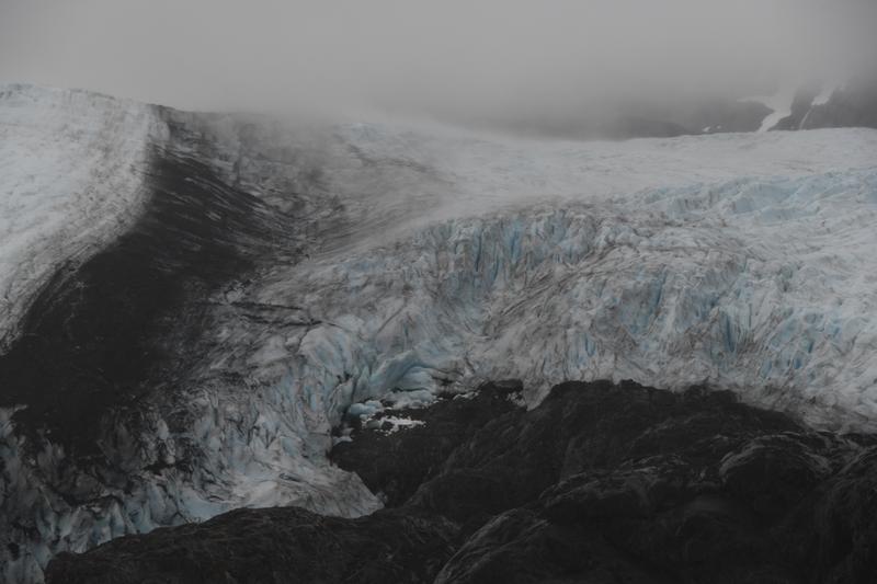 Swirling ice as it cascades down the mountain. |
 Blue ice under the snow and rocks. |
 Wave of ice entering the lake. |
 Glacier sweeps across the rock. |
 |
 Ice grinding the rock. |
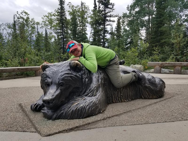
 Riding on the Chicken! |
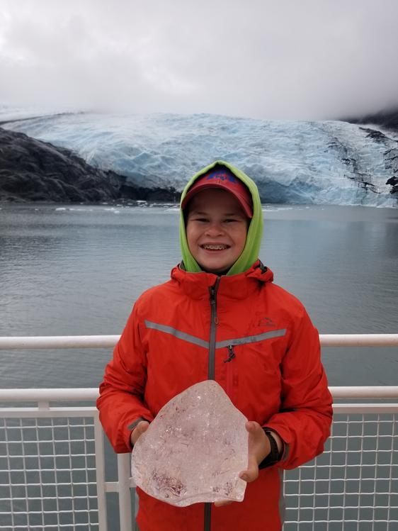 Holding an iceberg. |
 |
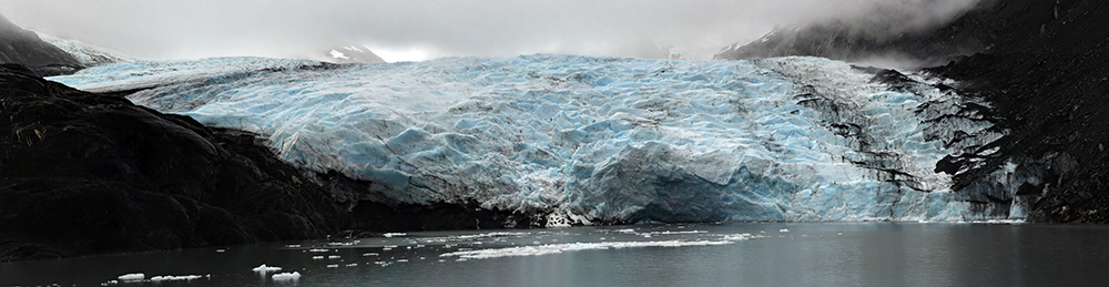 Panorama of the Portage Glacier. |
 Full view of glacier winding down the mountain. |
 More glaciers in the mountains. |
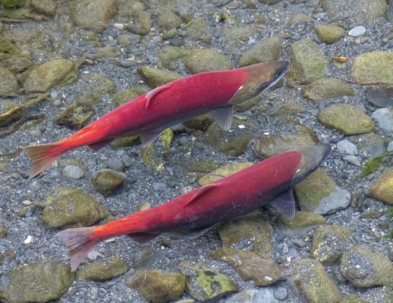 Sockeye salmon! |
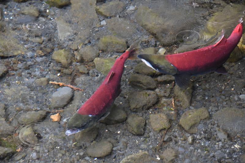 Transformed and ready for spawning. |
 Our last dinner of the trip! |